Parowan in Iron County, Utah — The American Mountains (Southwest)
Southern Utah Expedition of 1849
Photographed by Jeremy Snow, May 31, 2025
1. Southern Utah Expedition of 1849 Marker
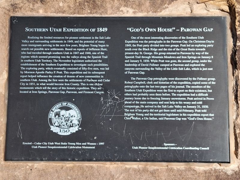
Southern Utah Expedition of 1849
Realizing the limited resources for pioneer settlement in the Salt Lake Valley and surrounding settlements in 1849, and the potential of many more immigrants arriving in the next few years, Brigham Young began to search out possible new settlements. Based on reports of Jefferson Hunt, who had traveled through southern Utah in 1847 and 1848, one of the regions which seemed promising was the valleys along the Spanish Trail in southern Utah Territory. The November legislature authorized the establishment of the Southern Expedition to investigate such possibilities. The exploring party, which eventually consisted of fifty-five men, was led by Mormon Apostle Parley P. Pratt. This expedition and its subsequent report helped influence the creation of dozens of new communities in southern Utah. Among the first were the settlements of Parowan and Cedar City in 1851, in what would become Iron County. This is one of four monuments which tell the story of this historic expedition. They are located at Iron Springs, Parowan Gap, Parowan, and Fremont Canyon.
Erected-Cedar City Utah West Stake Young
this page online
Utah Pioneer Sesquicentennial Celebration Monument
”God's Own House” - Parowan Gap
One of the most interesting discoveries of the Southern Utah Expedition was the petroglyphs in the Parowan Gap. On Christmas Day in 1849, the Pratt party divided into two groups. Pratt led an exploring party south over the Black Ridge and the rim of the Great Basin towards present-day St. George. His group returned to Parowan by way of the Spanish Trail through Mountain Meadows and Iron Springs on January 8 and January 9, 1850. While Pratt was gone, the second group, under the leadership of David Fullmer camped at Parowan and explored the canyons surrounding the Valley of the Little Salt Lake, which is just east of Parowan Gap.
The Parowan Gap petroglyphs were discovered by the Fullmer group. Robert Campbell, clerk and historian of the expedition, copied some of the petroglyphs onto the last two pages of his journal. The members of the Southern Utah Expedition were the first to report on their existence, but others had probably seen them before. The expedition had a difficult journey home due to freezing January snowstorms.
Photographed by Jeremy Snow, May 31, 2025
2. Southern Utah Expedition of 1849 Marker
Sponsors-Utah Pioneer Sesquicentennial Celebration Coordinating Council
Erected 1997 by Cedar City Utah West Stake Young Men and Women.
Topics. This historical marker is listed in these topic lists: Exploration • Indigenous Peoples and Communities • Settlements & Settlers. A significant historical year for this entry is 1849.
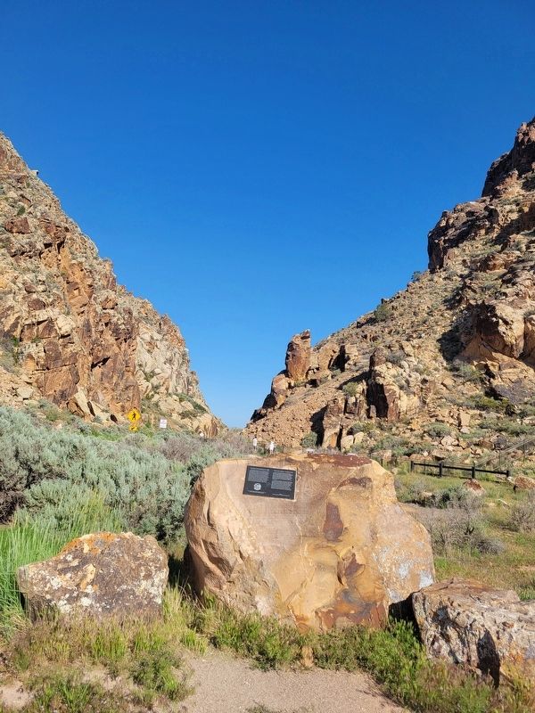
Location. 37° 54.553′ N, 112° 59.066′ W. Marker is in Parowan, Utah, in Iron County. It is on West Gap Road, on the right when traveling west. Touch for map. Marker is at or near this postal address: W Gap Rd, Parowan UT 84761, United States of America. Touch for directions.

Regionally, this marker is in Utah’s Color Country. It is also in the American Mountain West and on the Colorado Plateau. Globally, it is in North America, the Rocky Mountains, the Western Hemisphere, the Western World, and the Anglosphere. Historically, it finds itself in what was once New Spain and also Mexico’s Alta California.
Other nearby markers. At least 8 other markers are within 8 miles of this marker, measured as the crow flies: Long-Ago Artisans (a few steps from this marker); Paiute Perspective (within shouting distance of this marker); The Great Migration (within shouting distance of this marker); Parowan Gap Petroglyphs (within shouting distance of this marker); Hopi Perspective (within shouting distance of this marker); Art or Language? / How These Images Were Made (about 300 feet away, measured in a direct line); Settlement of Parowan Valley (about 500 feet away); Old Spanish National Historic Trail (approx. 7.8 miles away). Touch for a list and map of all markers in Parowan.
Also see . . . Parowan Gap Petroglyphs (Atlas Obscura). Excerpt:
Just a few miles west of the small town of Parowan, and just at the edge of the dry "Little Salt Lake," lies a natural gap in the mountains, covered with hundreds of petroglyphs. They have been there for over a thousand years.(Submitted on June 1, 2025.)
Archaeologists have argued that the petroglyphs are in fact a complex calendar system. Hopi and Paiute peoples have a variety of interpretations for the rock art as well, which includes representations of humans as well as depictions of animals and geometric shapes.
Credits. This page was last revised on June 1, 2025. It was originally submitted on May 31, 2025, by Jeremy Snow of Cedar City, Utah. This page has been viewed 395 times since then and 33 times this year. Photos: 1, 2. submitted on May 31, 2025, by Jeremy Snow of Cedar City, Utah. • Andrew Ruppenstein was the editor who published this page.
