
Shamrock in Wheeler County, Texas — The American South (West South Central)
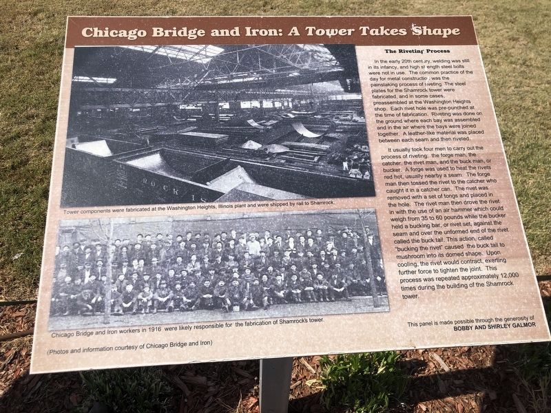
Chicago Bridge and Iron: A Tower Takes Shape
Photographed by Duane and Tracy Marsteller, April 12, 2025
1. Chicago Bridge and Iron: A Tower Takes Shape Marker
It usually took four men to carry out the process of riveting: the forge man, the catcher, the rivet man, and the buck man, or bucker. A forge was used to heat the rivets red hot, usually nearby a seam. The forge man then tossed the rivet to the catcher who caught it in a catcher can. The rivet was removed with a set of tongs and placed in the hole. The rivet man then drove the rivet in with the use of an air hammer which could weigh from 35 to 60 pounds while the bucker held a bucking bar, or rivet set, against the seam and over the unformed
this page online
Captions (top to bottom)
• Tower components were fabricated at the Washington Heights, Illinois plant and were shipped by rail to Shamrock.
• Chicago Bridge and Iron workers in 1916 were likely responsible for the fabrication of Shamrock's tower.
(Photos and information courtesy of Chicago Bridge and Iron)
This panel is made possible through the generosity of Bobby and Shirley Galmor
Topics. This historical marker is listed in this topic list: Man-Made Features. A significant historical year for this entry is 1916.
Location. 35° 12.86′ N, 100° 14.962′ W. Marker is in Shamrock, Texas, in Wheeler County. It can be reached from the intersection of North Main Street (U.S. 83) and Railroad Avenue, on the left when traveling north. Marker is in Tower Plaza. Touch for map. Marker is at or near this postal address: 210 N Main
Photographed by Duane and Tracy Marsteller, April 12, 2025
2. Chicago Bridge and Iron: A Tower Takes Shape Marker
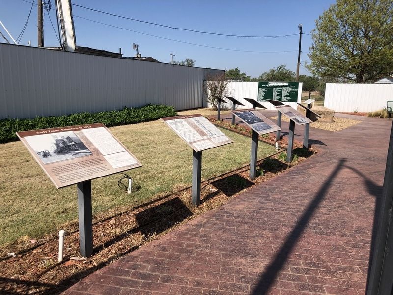
This marker is third from left.

Regionally, this marker is on the Texas Panhandle. It is also on the American Great Plains and specifically on the Southern Plains. Globally, it is in North America, a Gulf of Mexico state, the Western Hemisphere, the Western World, and the Anglosphere. Historically, it finds itself in what was once New Spain, the Comanchería, the Dust Bowl, the Republic of Texas, and one of the Confederate States of America.
Other nearby markers. At least 8 other markers are within walking distance of this marker: The Raising of Shamrock's Tower (here, next to this marker); Construction Planning (here, next to this marker); Enoch Carlson: A Company Legend / “The Bridge” (here, next to this marker); Early Years: Shamrock in 1912 (here, next to this marker); Water Tower Innovations (here, next to this marker); A Tower's Influence (here, next to this marker); A Community Icon (here, next to this marker); The Shamrock Tower (here, next to this marker). Touch for a list and map of all markers in Shamrock.
Related markers. Click here for a list of markers that are related to this marker.
Credits. This page was last revised on June 4, 2025. It was originally submitted on June 2, 2025, by Duane and Tracy Marsteller of Murfreesboro, Tennessee. This page has been viewed 158 times since then and 29 times this year. Photos: 1, 2. submitted on June 2, 2025, by Duane and Tracy Marsteller of Murfreesboro, Tennessee.
