
St Ives in Cornwall, England, United Kingdom — Northwestern Europe (the British Isles)
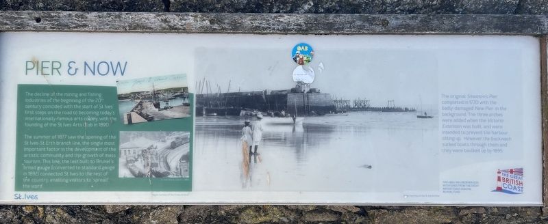
Pier & Now
Photographed by Ray Gurganus, April 7, 2025
1. Pier & Now Marker
The summer of 1877 saw the opening of the St Ives-St Erth branch line, the single most important factor in the development of the artistic community and the growth of mass tourism. This line, the last built to Brunel's broad gauge (converted to standard gauge in 1892) connected St. Ives to the rest of the country, enabling visitors to 'spread the word'.
The original Smeaton's Pier, completed in 1770 with the badly damaged New Pier in the background. The three arches were added when the Victoria Extension was built, and were intended to prevent the harbour silting up. However the backwash sucked boats through them and they were baulked up by 1895.
Topics. This historical marker is listed in these topic lists: Arts, Letters, Music • Waterways & Vessels. A significant historical year for this entry is 1890.
Location. 50° 12.925′ N, 5° 28.58′ W. Marker is in St Ives,
this page online

Regionally, this marker is in South West England. Globally, it is on the Atlantic Ocean, in the North Atlantic Region, on the Atlantic Arc, in Europe, on the Celtic Fringe, in Atlantic Europe, on one of the British Isles, in the Western World, and in the Anglosphere. Historically, it finds itself in what was once the Roman Empire.
Other nearby markers. At least 8 other markers are within 11 kilometers of this marker, measured as the crow flies: Shared Viewpoints (here, next to this marker); The Coastal Community (here, next to this marker); The Island or St. Ives Head (about 210 meters away, measured in a direct line); St Nicholas Chapel (approx. 0.3 kilometers away); St Ives War Memorial (approx. 0.4 kilometers away); King Edward Landing (approx. 10.3 kilometers away); Victoria & Albert Visit (approx. 10.7 kilometers away); Footprints of HM the Queen (approx. 10.8 kilometers away). Touch for a list and map of all markers in St Ives.
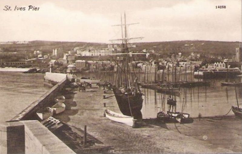
circa 1900
2. St Ives Pier
Credits. This page was last revised on June 2, 2025. It was originally submitted on June 2, 2025, by Ray Gurganus of Washington, District of Columbia. This page has been viewed 123 times since then and 27 times this year. Photos: 1. submitted on June 2, 2025, by Ray Gurganus of Washington, District of Columbia. 2. submitted on June 2, 2025. • Andrew Ruppenstein was the editor who published this page.
Editor’s want-list for this marker. photo of the marker within its surroundings • Can you help?
