Lyons in Wayne County, New York — The American Northeast (Mid-Atlantic)
Honoring Those Who Worked on the Erie Canal
Photographed by Susan A. Dalaba, April 20, 2025
1. Honoring Those Who Worked on the Erie Canal Marker
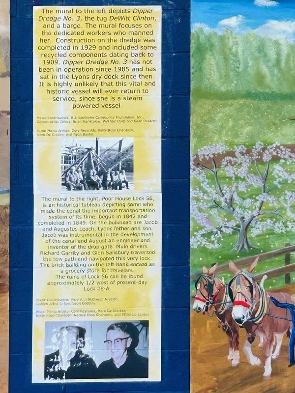
The mural to the left depicts Dipper Dredge No. 3, the tug Dewitt Clinton, and a barge. The mural focuses on the dedicated workers who manned her. Construction on the dredge was completed in 1929 and included some recycled components dating back to 1909. Dipper Dredge No. 3 has not been in operation since 1985 and has sat in the Lyons dry dock since then. It is highly unlikely that this vital and historic vessel will ever return to service, since she is a steam vessel.
The mural to the right, Poor House Lock 56, is a historical tableau, depicting some who made the canal the important transportation system of its time, begun in 1842 and completed in 1849. On the bulkhead are Jacob and Augustus Leach, Lyons father and son. Jacob was instrumental in the development of the canal and August an engineer and inventor of the drop gate. Mule drivers Richard Garrity and Glen Salisbury traversed the tow path and navigated this very lock. The brick building on the left bank served as a grocery store for travelers.
The ruins of Lock 56 can be found approximately 1/2 mile west of present-day Lock 28-A.
Topics. This historical
this page online
Location. 43° 3.775′ N, 77° 1.052′ W. Marker is in Lyons, New York, in Wayne County. It is at the intersection of Old Lyons Road - Empire State Trail and Gansz Road, on the right when traveling east on Old Lyons Road - Empire State Trail. Touch for map. Marker is at or near this postal address: 7665 Dry Dock Road, Lyons NY 14489, United States of America. Touch for directions.

Regionally, this marker is in Upstate New York, specifically in Western New York, in the Finger Lakes, and in the Rochester Metropolitan Area. It is also in the American Northeast and in the Mid-Atlantic. Globally, it is in North America, on the Great Lakes, in the Western Hemisphere, in the Western World, and in the Anglosphere. Historically, it finds itself in what was once the Haudenosaunee (Iroquois) Confederacy, New Netherland, and one of the original Thirteen Colonies.
Other nearby markers. At least 8 other markers are within one mile of this marker, measured as the crow flies: The Lyons Drydock (approx. 0.2 miles away); The Poor House Lock

Photographed by Susan A. Dalaba, June 3, 2025
2. Honoring Those Who Worked on the Erie Canal Marker
Also see . . . Erie Canal (Wikipedia). (Submitted on June 6, 2025, by Michael Herrick of Southbury, Connecticut.)

Photographed by Susan A. Dalaba, April 20, 2025
3. Honoring Those Who Worked on the Erie Canal Marker

Photographed by Susan A. Dalaba, April 20, 2025
4. Honoring Those Who Worked on the Erie Canal Marker

Photographed by Susan A. Dalaba, June 3, 2025
5. Dipper Dredge No. 3
Credits. This page was last revised on June 6, 2025. It was originally submitted on June 3, 2025, by Susan A. Dalaba of Cortland, New York. This page has been viewed 129 times since then and 30 times this year. Photos: 1, 2, 3, 4, 5. submitted on June 3, 2025, by Susan A. Dalaba of Cortland, New York. • Michael Herrick was the editor who published this page.
