
Niagara-on-the-Lake in Niagara Region, Ontario — Central Canada (North America)
In Their Footsteps
⎯⎯⎯
Sur Leurs Traces

Photographed by Kevin Westell, June 2, 2025
1. In Their Footsteps Marker

In Their Footsteps
When you cross this bridge, you are walking on one of the oldest bridges in Nagara-on-the-Lake.
This bridge has already outlived most, if not all the skilled young men who built it. Some of these soldiers who joined the Canadian Expeditionary Force during the First World War (1914-1918) were wounded or killed in the line of duty.
These men were also proud members of the "Royal Canadian Engineers." Officially formed as a professional military branch in 1903, the RCE was part of a long line of professional military builders, engineers, and draughtsmen. Their contributions can still be felt in many of the buildings, the street planning, and even the Board of Ordnance markers that identity original key boundaries in Niagara-on-the-Lake.
Quand vous franchissez cette structure, vous posez pied sur l'un des plus vieux ponts de Niagara-on-the-Lake. De fait, ce dernier a survécu à quasiment tous les vaillants jeunes hommes qui l'ont construit. Certains de ces soldats, qui ont joint les rangs du Corps expéditionnaire canadien pendant la Première Guerre
this page online
Ces hommes étaient aussi de fiers membres du Corps royal du génie canadien. Officiellement institué en 1903 comme une branche des militaires de carrière, ce corps s'inscrivait dans une longue tradition de bâtisseurs, d'ingénieurs et de dessinateurs militaires professionnels. Les fruits de leurs travaux sont encore visibles au niveau de nombreux bâtiments et plans de rues ainsi que sur les marqueurs du Board of Ordnance qui délimitaient les premières frontières de Niagara-on-the-Lake.
Erected by Parks Canada.
Topics. This historical marker is listed in these topic lists: Bridges & Viaducts • Military. A significant historical year for this entry is 1903.
Location. 43° 14.971′ N, 79° 4.116′ W. Marker is in Niagara-on-the-Lake, Ontario, in Niagara Region. It can be reached from Wellington Street. This marker is within the Parks Canada land called "The Commons", adjacent to a path named "Otter Trail". It is - 400 metres north-east of the Butler's Barracks parking lot at the end of Mary Street - 150 metres south-east of Queens Parade.
Photographed by Kevin Westell, June 2, 2025
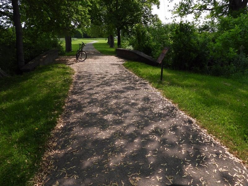
2. Otter Trail at Engineer's Bridge, looking north-east
The low bridge crosses a small seasonal creek.

Regionally, this marker is on Ontario’s Golden Horseshoe and in Niagara Canada. It is also in Central Canada. Globally, it is in North America, on the Great Lakes, in the Western Hemisphere, in the Western World, and in the Anglosphere. Historically, it finds itself in what was once a British colony, the Viceroyalty of New France, the Haudenosaunee (Iroquois) Confederacy, and Rupert’s Land.
Other nearby markers. At least 8 other markers are within walking distance of this marker: Indian Council House At Niagara (within shouting distance of this marker); The Site Of The Military Hospital And Indian Council House (about 90 meters away, measured in a direct line); Finding Common Ground (about 90 meters away); The Canada Constellation (approx. 0.4 kilometers away); Even before Canada was an independent nation (approx. 0.4 kilometers away); Janet Carnochan 1839 - 1926 (approx. 0.4 kilometers away); Courting International Tennis (approx. 0.4 kilometers away); Memorial Hall, 1906 (approx. 0.4 kilometers away). Touch for a list and map of all markers in Niagara-on-the-Lake.
Credits. This page was last revised on June 4, 2025. It was originally submitted on June 3, 2025, by Kevin Westell of St. Catharines, Ontario. This page has been viewed 68 times since then and 12 times this year. Photos: 1. submitted on June 3, 2025, by Kevin Westell of St. Catharines, Ontario. 2. submitted on June 4, 2025, by Kevin Westell of St. Catharines, Ontario. • Andrew Ruppenstein was the editor who published this page.
