Fonthill in Thorold in Niagara Region, Ontario — Central Canada (North America)
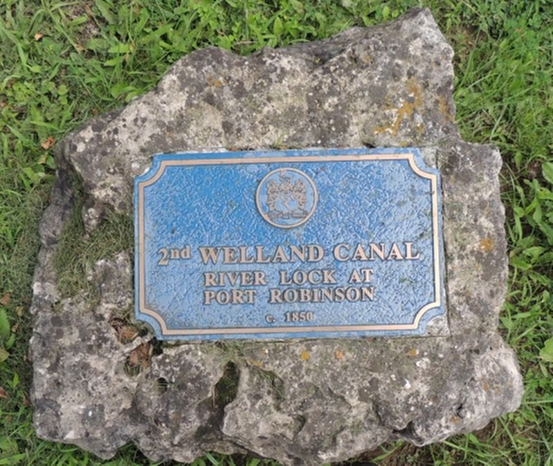
2nd Welland Canal River Lock At Port Robinson
Photographed by Kevin Westell, August 3, 2021
1. 2nd Welland Canal River Lock At Port Robinson - Marker
River Lock At Port Robinson
c. 1850
Erected by City Of Thorold.
Topics and series. This historical marker is listed in this topic list: Waterways & Vessels. In addition, it is included in the The Welland Canals series list. A significant historical year for this entry is 1850.
Location. 43° 2.393′ N, 79° 12.538′ W. Marker is in Thorold, Ontario, in Niagara Region. It is in Fonthill. It can be reached from River Street 0.1 kilometers north of Bridge St. E, on the right when traveling north. The marker is 30 metres east of River Road, on the north wall of the former river lock. Touch for map. Marker is at or near this postal address: 2 River St, Thorold ON L0S 1A0, Canada. Touch for directions.

Regionally, this marker is on Ontario’s Golden Horseshoe and in Niagara Canada. It is also in Central Canada. Globally, it is in North America, on the Great Lakes, in the Western Hemisphere, in the Western World, and in the Anglosphere. Historically, it finds itself in what was once a British colony, the Viceroyalty of New France, the Haudenosaunee (Iroquois) Confederacy, and Rupert’s
this page online
Other nearby markers. At least 8 other markers are within walking distance of this marker: A different marker also named 2nd Welland Canal River Lock At Port Robinson (within shouting distance of this marker); Founding Of Port Robinson (within shouting distance of this marker); Beckett's Reserve-McFarland House c. 1840 / Stephen Beatty House 1879 (about 120 meters away, measured in a direct line); Allanburg Firehouse First World War Memorial (about 120 meters away); The Pew House c. 1871 (about 180 meters away); The Pew House (about 210 meters away); Camp House (approx. 0.3 kilometers away); Robert Ross House (approx. 0.4 kilometers away). Touch for a list and map of all markers in Thorold.
Regarding 2nd Welland Canal River Lock At Port Robinson. The two river locks were used at the time of the 1st and 2nd Welland Canals. The various versions of Welland Canals permitted (and continue to permit) 2-way ship traffic between Lake Ontario and Lake Erie. At Port Robinson, they all followed/follow roughly the same north-south path. The two river locks at this location formed a junction on the canal, to permit 2-way ship traffic
Photographed by Kevin Westell, August 3, 2021
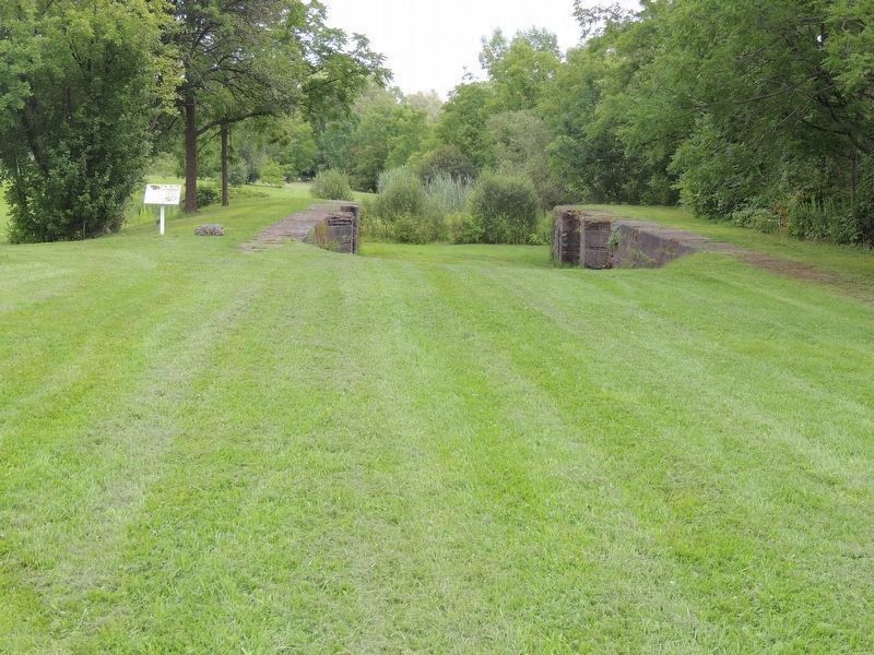
2. 2nd Welland Canal River Lock - viewed from River Street
This plaque is on the rock on the left (northern) lock wall, beside the white sign. This river lock's total length is 45 m - 150 feet; most of it is still buried. Exposed is a short length of the lock chamber; the recesses for the wooden lock gate doors; and the rounded end of the lock.
The 1st river lock, built of wood, was in use during 1829 - c. 1850. The larger 2nd river lock was built of stone, soon after the 2nd Welland Canal; and operated to c. 1880.
Today, the paths of both river locks are a grassy park. The 1st river lock is still buried, and certainly nothing remains of its wooden structure. The 2nd river lock has been partially excavated.
Some dates:
1829 - 1845 - 1st Welland Canal operated, using the 1st river lock.
1829 - 1833 - Initially, this river lock was the southern terminus of the Welland Canal. In fact, this is how the Welland Canal got its name - it was the canal from Lake Ontario to the Welland River. And, this is how this landlocked village got its name, Port Robinson.
1833 - the 1st Welland Canal was extended south to Lake Erie.
1845 - 1880s - 2nd Welland Canal operated.
c. 1850 - the 2nd river lock replaced the 1st river lock.
c. 1880 - the 3rd Welland Canal's water level was lower than the 2nd Canals; and when the water level was dropped, the river lock was no longer usable.
Photographed by Kevin Westell, August 3, 2021
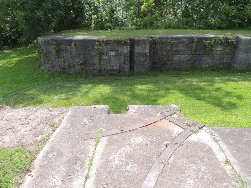
3. 2nd Welland Canal River Lock - recesses for lock gate doors
On the far lock-wall, the hinge for the lock gate door was on the left. In the foreground is the steel support (recessed into the stone) for the hinge. The matching vertical slots just left (downstream) of the lock gate doors may have been for "stop logs", to block the flow so that water could be pumped out of the lock chamber (useful in certain maintenance emergencies).
Photographed by Kevin Westell, August 3, 2021
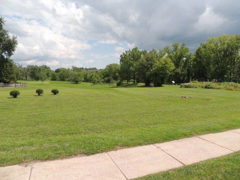
4. Location of 1st River Lock, viewed from River St
The white sign and rock for this marker show the location of the 2nd river lock. The 1st river lock lay here, left of the 2nd river lock; not quite parallel, but angled southward of the 2nd river lock. So when the 2nd river lock was constructed, it utilized the existing downstream infrastructure.
Credits. This page was last revised on March 16, 2026. It was originally submitted on June 4, 2025, by Kevin Westell of St. Catharines, Ontario. This page has been viewed 152 times since then and 27 times this year. Photos: 1. submitted on June 4, 2025, by Kevin Westell of St. Catharines, Ontario. 2, 3, 4. submitted on June 9, 2025, by Kevin Westell of St. Catharines, Ontario. • Bill Pfingsten was the editor who published this page.
