Clear Brook in Frederick County, Virginia — The American South (Mid-Atlantic)
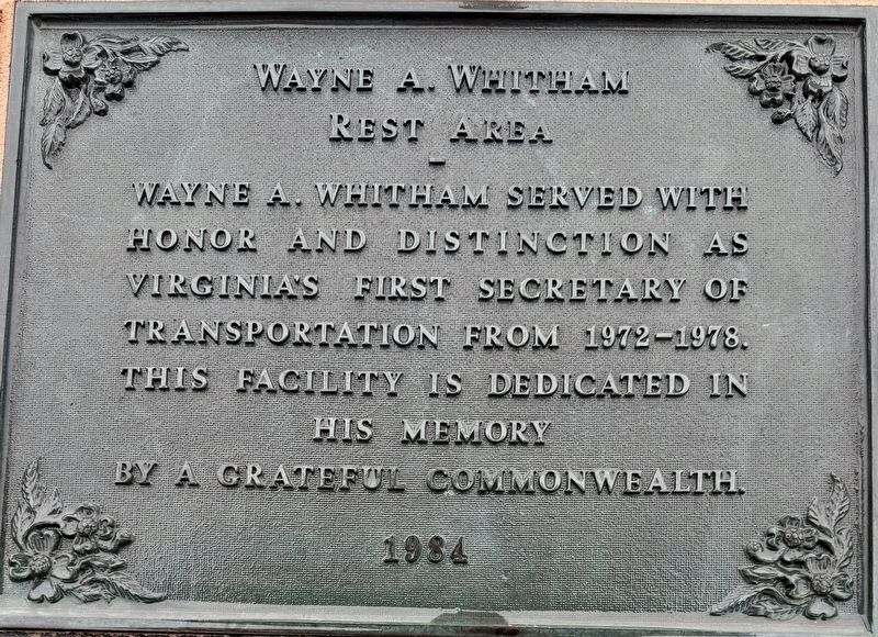
Wayne A. Whitham Rest Area
Photographed by Brandon D Cross, May 27, 2025
1. Wayne A. Whitham Rest Area Marker
honor and distinction as
Virginia’s first Secretary of
Transportation from 1972-1978.
This facility is dedicated in
his memory
by a grateful Commonwealth.
1984
Erected 1984 by Virginia Department of Transportation.
Topics. This historical marker is listed in these topic lists: Government & Politics • Roads & Vehicles. A significant historical year for this entry is 1972.
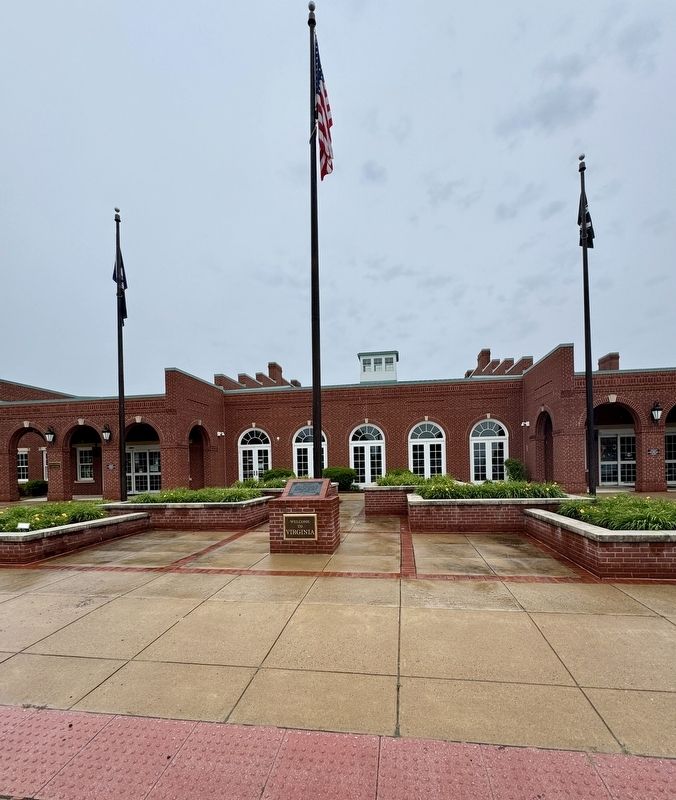
Location. 39° 14.567′ N, 78° 6.947′ W. Marker is in Clear Brook, Virginia, in Frederick County. It is on Interstate 81 (at milepost 320) near Martinsburg Pike (U.S. 11), on the right when traveling south. The marker is located in front of the Clear Brook Visitor Welcome Center. Touch for map. Marker is in this post office area: Clear Brook VA 22624, United States of America. Touch for directions.

Regionally, this marker is in Virginia’s Shenandoah Valley. It is also in the American South, specifically in the Upper South, and in the Mid-Atlantic. Globally, it is in North America, the Western Hemisphere, the Western World, and the Anglosphere. Historically, it finds itself in what was
this page online
Other nearby markers. At least 8 other markers are within 2 miles of this marker, measured as the crow flies: Triceratops (within shouting distance of this marker); Lake Anhinga (within shouting distance of this marker); 1st Maryland Battery (CSA) Memorial (approx. half a mile away); Action at Stephenson’s Depot (approx. half a mile away); Roots Of Methodism In Frederick County Milburn Chapel (approx. 1.3 miles away); a different marker also named Roots Of Methodism In Frederick County Milburn Chapel (approx. 1.3 miles away); Hopewell Friends Meeting House (approx. 1.4 miles away); Interrupted by War (approx. 1.7 miles away).
Other markers no longer nearby. Third Battle of Winchester (was approx. 0.9 miles away but has been permanently removed); Stephenson Depot (was approx. one mile away but has been confirmed missing); Rutherford's Farm (was approx. 1.7 miles away but has been replaced with another marker now near it); Battle of Rutherford's Farm (was approx. 1.7
Photographed by Brandon D Cross, May 27, 2025
2. Wayne A. Whitham Rest Area Marker
Credits. This page was last revised on June 12, 2025. It was originally submitted on June 5, 2025, by Brandon D Cross of Flagler Beach, Florida. This page has been viewed 158 times since then and 23 times this year. Photos: 1, 2. submitted on June 5, 2025, by Brandon D Cross of Flagler Beach, Florida. • Andrew Ruppenstein was the editor who published this page.
