
Gloucester in Essex County, Massachusetts — The American Northeast (New England)
Samuel de Champlain
1630 - 1930
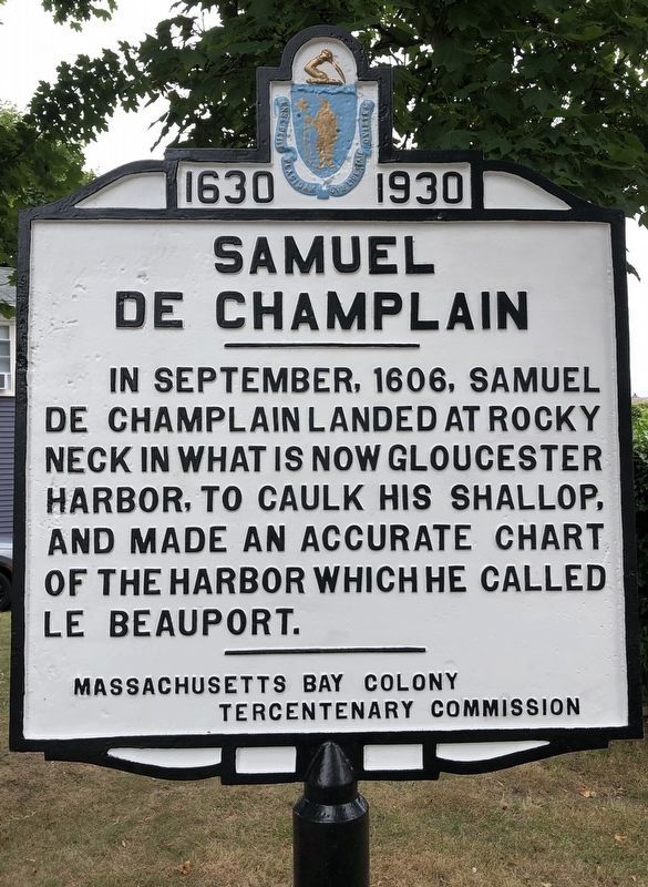
Photographed by Susan Morreale, May 19, 2025
1. Samuel de Champlain Marker
Erected 1930 by Massachusetts Bay Colony Tercentenary Commission.
Topics and series. This historical marker is listed in these topic lists: Colonial Era • Exploration. In addition, it is included in the Massachusetts Bay Colony—Tercentenary Commission Markers series list. A significant historical month for this entry is September 1606.
Location. 42° 36.222′ N, 70° 39.279′ W. Marker is in Gloucester, Massachusetts, in Essex County. It is at the intersection of Rocky Neck Avenue and East Main Street, on the right when traveling west on Rocky Neck Avenue. Touch for map. Marker is at or near this postal address: 1 Rocky Neck Ave, Gloucester MA 01930, United States of America. Touch for directions.

Regionally, this marker is on Massachusetts’ Cape Ann, on the North Shore, in Greater Boston, and in the Merrimack Valley. It is also in the American Northeast, in New England, and on the Eastern Seaboard. Globally, it is in the
this page online
Other nearby markers. At least 8 other markers are within walking distance of this marker: Solomon Jacobs Landing & Park (approx. 0.6 miles away); Dogtown & Babson Builders (approx. 0.6 miles away); Battle of Gloucester 1775 (approx. 0.6 miles away); Charles Heberle (approx. 0.7 miles away); Porter Anchor (approx. 0.7 miles away); Rocky Neck (approx. 0.7 miles away); Captain Alfred (Centennial) Johnson (approx. 0.7 miles away); Captain Howard Blackburn (approx. 0.7 miles away). Touch for a list and map of all markers in Gloucester.
Also see . . . Historical Markers Erected by Massachusetts Bay Colony Tercentenary Commission (1930). Original 1930 publication by the Commonwealth of Massachusetts of Tercentenary Commission Markers, commemorating the three hundredth anniversary of the Massachusetts Bay Colony. (Submitted on August 9, 2011, by Russell Chaffee Bixby of Bernardston, Massachusetts.)
Photographed by Russell C. Bixby, October 21, 2011
2. Marker’s Condition in 2011
Credits. This page was last revised on June 26, 2025. It was originally submitted on August 9, 2011, by Russell Chaffee Bixby of Bernardston, Massachusetts. This page has been viewed 1,991 times since then and 92 times this year. Last updated on June 6, 2025, by Susan Morreale of Gloucester, Massachusetts. Photos: 1. submitted on June 6, 2025, by Susan Morreale of Gloucester, Massachusetts. 2. submitted on October 22, 2011, by Russell Chaffee Bixby of Bernardston, Massachusetts. • Devry Becker Jones was the editor who published this page.
