Parowan in Iron County, Utah — The American Mountains (Southwest)
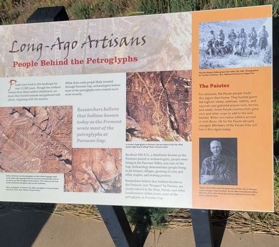
Long-Ago Artisans
People Behind the Petroglyphs
Photographed by Jeremy Snow, May 31, 2025
1. Long-Ago Artisans Marker
While these early people likely traveled through Parowan Gap, archaeologists believe most of the petroglyphs were created much more recently.
Researchers believe that Indians known today as the Fremont wrote most of the petroglyphs at Parowan Gap.
By about 500 A.D., a timeframe known as the Fremont period to archaeologists, people were living in the Parowan Valley, just east of the Gap. Archaeology demonstrates people living in pit-houses, villages, growing of corn and other staples, and making pottery.
Researchers believe that Indians known as the Fremont, but "Nungwu" by Paiutes, are closely related to the Hopi, Palute, and other Southwestern tribes, wrote most of the petroglyphs at Parowan Gap.
(photo caption) Native Americans say that petroglyphs are their written language based on the Indian sign lanugage which was universal amoung all tribes and can be read by any tribe throughout North America. This is why you see many symbol similarities throughout Utah and the southwest.
(photo caption) Above, petroglyphs at Parowan Gap. Right, petroglyphs at Fremont Indian State Park, Sevier, Utah. Photos: Francois Gohier
(photo caption) A number of petroglyphs at Parowan Gap are unique to this site. What stories might they be telling? Photo: Francois Gohier
The Paiutes
For
this page online
(photo caption) Pah-Ute (Paiute) Indian group near Cedar City, Utah. Photographed by Timothy O'Sullivan, 1872, NAtional Archives at College Park.
(photo caption) Today, Paiute elders pass along the story of their ties to Parowan Gap to younger tribal members. Paiute elder and historian Arthur Richards of the Cedar Band also shares traditional Paiute skills. Photo: Michael Plyler.
Topics. This historical marker is listed in this topic list: Indigenous Peoples and Communities. A significant historical year for this entry is 500 CE.
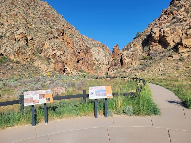
Location. 37° 54.562′ N, 112° 59.059′ W. Marker is in Parowan, Utah, in Iron County. It can be reached from West Gap Road. Markers just east of the Parowan Gap parking lot. Touch for map. Marker is at or near this postal
Photographed by Jeremy Snow, May 31, 2025
2. Long-Ago Artisans Marker
Marker is on the left.

Regionally, this marker is in Utah’s Color Country. It is also in the American Mountain West and on the Colorado Plateau. Globally, it is in North America, the Rocky Mountains, the Western Hemisphere, the Western World, and the Anglosphere. Historically, it finds itself in what was once New Spain and also Mexico’s Alta California.
Other nearby markers. At least 8 other markers are within 8 miles of this marker, measured as the crow flies: Southern Utah Expedition of 1849 (a few steps from this marker); Paiute Perspective (within shouting distance of this marker); The Great Migration (within shouting distance of this marker); Parowan Gap Petroglyphs (within shouting distance of this marker); Hopi Perspective (within shouting distance of this marker); Art or Language? / How These Images Were Made (about 300 feet away, measured in a direct line); Settlement of Parowan Valley (about 600 feet away); Old Spanish National Historic Trail (approx. 7.8 miles away). Touch for a list and map of all markers in Parowan.
Credits. This page was last revised on June 9, 2025. It was originally submitted on June 9, 2025, by Jeremy Snow of Cedar City, Utah. This page has been viewed 107 times since then and 28 times this year. Photos: 1, 2. submitted on June 9, 2025, by Jeremy Snow of Cedar City, Utah. • Andrew Ruppenstein was the editor who published this page.
