Niagara Falls in Niagara Region, Ontario — Central Canada (North America)
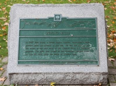
Burch’s Mills
Photographed by J. J. Prats, October 15, 2014
1. Burch’s Mills Marker
Erected by The Niagara Parks Commission.
Topics. This historical marker is listed in these topic lists: Industry & Commerce • Settlements & Settlers • War of 1812 • Waterways & Vessels. A significant historical year for this entry is 1786.
Location. 43° 4.268′ N, 79° 4.367′ W. Marker is in Niagara Falls, Ontario, in Niagara Region. It is on Niagara Parkway just north of Dufferin Isle Drive, on the right when traveling north. It is on the Niagara River Recreation Trail just south of the abandoned Toronto Power plant. Touch for map. Marker is at or near this postal address: 7230 Niagara Parkway, Niagara Falls ON L0S 1A0, Canada. Touch for directions.

Regionally, this marker is on Ontario’s Golden Horseshoe and in Niagara Canada. It is also in Central Canada. Globally, it is in North
this page online
Other nearby markers. At least 8 other markers are within walking distance of this marker: The Stranded Scow (about 90 meters away, measured in a direct line); Toronto Power Generating Station (about 150 meters away); Gate House (approx. 0.3 kilometers away); Niagara Park Greenhouses (approx. 0.4 kilometers away); Ontario Power Screen House (approx. 0.4 kilometers away); Bridgewater Mills (approx. half a kilometer away); William Birch Rankine Hydro-Electric Power Station (approx. 0.7 kilometers away); Wm. B. Rankine (approx. 0.7 kilometers away). Touch for a list and map of all markers in Niagara Falls.
Another marker is no longer nearby. Stranded Scow (was about 90 meters away but has been replaced with another marker now near it).
Regarding Burch’s Mills. John Burch lived 1741–1797. He moved from Britain to New York 1772; from New York to Upper Canada in
Photographed by J. J. Prats, October 15, 2014
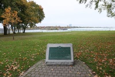
2. Burch’s Mills Marker
Related marker. Click here for another marker that is related to this marker. It mentions the Battle of Lundy’s Lane.
Also see . . . Entry in Dictionary of Canadian Biography for Burch, John. “In 1783, at the end of the war, he and his wife settled on land on the west bank of the Niagara River. Burch received several lots in what became Stamford Township and established his home at the mouth of Chippawa Creek. A few miles to the north, beside the Niagara rapids, he constructed a grist- and sawmill in 1785–86. Its workmanship and the ingenious log flume were admired by travellers of the period.” (Submitted on December 20, 2014.)
Credits. This page was last revised on June 25, 2025. It was originally submitted on December 20, 2014, by J. J. Prats of Powell, Ohio. This page has been viewed 958 times since then and 44 times this year. Last updated on June 9, 2025, by Kevin Westell of St. Catharines, Ontario. Photos: 1, 2. submitted on December 20, 2014, by J. J. Prats of Powell, Ohio. • Devry Becker Jones was the editor who published this page.
