Disputanta in Rockcastle County, Kentucky — The American South (East South Central)
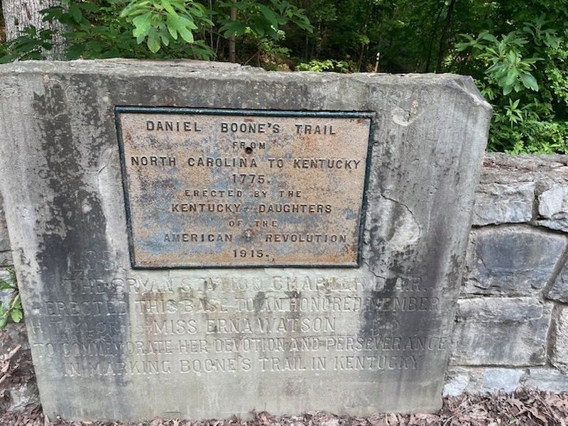
Daniel Boone's Trail
Photographed by Ted Wayne Smith
1. Daniel Boone's Trail Marker
Erected 1915 by Kentucky Daughters of the American Revolution.
Topics. This historical marker is listed in these topic lists: Colonial Era • Exploration • Landmarks • Settlements & Settlers. A significant historical year for this entry is 1775.
Location. 37° 31.678′ N, 84° 18.808′ W. Marker is in Disputanta, Kentucky, in Rockcastle County. It is at the intersection of U.S. 25 and Old US 25 on U.S. 25. The marker is located at the Boone Gap Historical Overlook. Touch for map. Marker is at or near this postal address: 13084 N Wilderness Rd, Berea KY 40403, United States of America. Touch for directions.

Regionally, this marker is in Kentucky’s The Knobs. It is also in the American South, specifically in the Upper South, in Appalachia, and specifically in Southern Appalachia. Globally, it is in North America, the Western Hemisphere, the Western World, and the Anglosphere. Historically, it finds itself in what was once the territory of the Mississippian Culture and also the Antebellum South.
Other nearby markers. At least 8
this page online
Other markers no longer nearby. For Mountain Youth (was approx. 3.3 miles away but has been replaced with another marker now near it); Berea – A Birthplace of the Handicraft Revival (was approx. 4.7 miles away but has been confirmed missing); Kentucky's Earliest Artforms (was approx. 4.7 miles away but has been confirmed missing).
Credits. This page was last revised on June 16, 2025. It was originally submitted on June 9, 2025, by Ted Wayne Smith of Nicholasville, Kentucky. This page has been viewed 148 times since then and 32 times this year. Photo 1. submitted on June 9, 2025, by Ted Wayne Smith of Nicholasville, Kentucky. • James Hulse was the editor who published this page.
Editor’s want-list for this marker. A wide view photo of the marker and the surrounding area together in context. • Can you help?
