
Millerton in McCurtain County, Oklahoma — The American South (West South Central)
Wheelock Mission
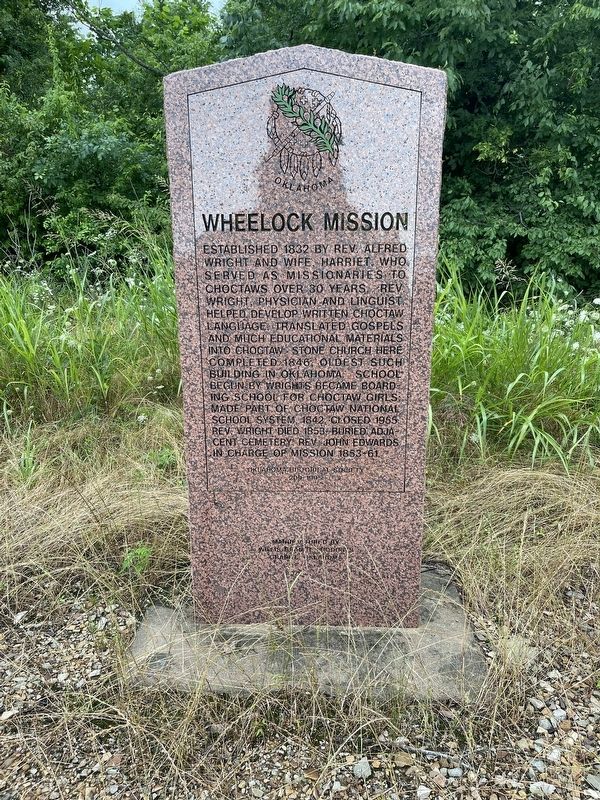
Photographed by Billy A. Honey, June 7, 2025
1. Wheelock Mission Marker
Established 1832 by Rev. Alfred Wright and wife, Harriet, who served as missionaries to Choctaws over 30 years. Rev. Wright, physician and linguist, helped develop written Choctaw language, translated gospels and much educational materials into Choctaw. Stone church here completed 1846, oldest such building in Oklahoma. School begun by Wrights became boarding school for Choctaw girls, made part of Choctaw National School system, 1842. Closed 1955. Rev. Wright died 1853, buried adjacent cemetery, Rev. John Edwards in charge of mission 1853-61.
Erected 1995 by Oklahoma Historical Society. (Marker Number 209-1995.)
Topics and series. This historical marker is listed in these topic lists: Indigenous Peoples and Communities • Religion & Religious Structures. In addition, it is included in the Oklahoma Historical Society series list. A significant historical year for this entry is 1832.
Location. 33° 58.488′ N, 94° 59.628′ W. Marker is in Millerton, Oklahoma, in McCurtain County. It is on U.S. 70, on the right when traveling east. Touch for map. Marker is at or near this postal address: 13891 US-70, Millerton
this page online

Regionally, this marker is in Oklahoma’s Choctaw Nation. It is also in the American South, specifically in the Piney Woods, on the prairies, and on the Southern Plains. Globally, it is in North America, the Western Hemisphere, the Western World, and the Anglosphere. Historically, it finds itself in what was once New Spain, the territory of the Mississippian Culture, and the Louisiana Purchase.
Other nearby markers. At least 8 other markers are within 9 miles of this marker, measured as the crow flies: The Choctaw Nation of Oklahoma (approx. 1½ miles away); Waterhole Cemetery (approx. 5.3 miles away); Isaac Levi Garvin (approx. 5.3 miles away); Clear Creek Water Mill (approx. 7½ miles away); Elliott Academy (approx. 7½ miles away); Arnold E. A. Roitsch Archeological Site (approx. 8.4 miles away in Texas); Jesse B. Bowman (approx. 9 miles away in Texas); Jonesboro (approx. 9 miles away in Texas).
Credits. This page was last revised on June 28, 2025. It was originally submitted on June 9, 2025, by Billy A. Honey of Garvin, Oklahoma. This page has been viewed 426 times since then and 33 times this year. Photo 1. submitted on June 9, 2025, by Billy A. Honey of Garvin, Oklahoma. • J. Makali Bruton was the editor who published this page.
Editor’s want-list for this marker. A wide view photo of the marker and the surrounding area together in context. • Can you help?
