
Port Weller West in St. Catharines in Niagara Region, Ontario — Central Canada (North America)
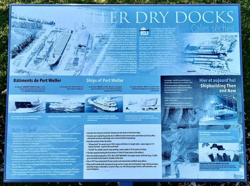
Port Weller Dry Docks
Photographed by Tim Boyd, November 7, 2024
1. Port Weller Dry Docks Marker

Depuis le debút du 19° siècle, la construction et la réparation rue intégrante de la riche histoire maritime de navires fait partie intégrante de la riche histoire maritime de la region de Niagara. Entre 1913 et 1932, lors de la construction du 4º (et actuel) canal Welland, le gouvernement Canadien établit une cale sèche rudimentaire, en amont de l’Écluse 1, pour y entreposer des portes d'écluse et pour y d'effectuer des travaux de réparation et de maintenance sur les pièces d'équipement de flottaison. En avril 1946, Charles Ansell, acquiert l'installation et fonde les cales sèches de Port Weller.
À titre de président et jusqu'à son décès en 1957, Mr. Ansell entreprît de moderniser les installations et instaura un programme de constructions nouvelles et de réparation de navires. En 2010, les cales sèches de Port Weller se spécialisaient en services de remise en état de navires, de manufacture industrielle et d'installation de dispositif d'auto déchargement. Les méthodes de travail, en constante évolution, intègrent les nouvelles technologies. Les cales sèches de Port Weller se classent parmi les meilleures
this page online
Serving as its President until his passing in November 1957, Mr. Ansell quickly turned the dock into a modern facility producing new vessels and repairing existing ships. In 2010, Port Weller Dry Docks specialized in mid-life refits, self-unloading conversions and industrial manufacturing. New technology was added to maintain its world-class position.
• Détient les deux seules cales sèches pouvant accommoder les bâtiments ayant les dimensions maximales pour la navigation sur la voie maritime des Grands lacs.
• Dispose d'une cale unique, qui se remplit et se vide sous l'action de la gravité grâce aux variations du niveau de l'eau en amont et en aval de l'Écluse 1
Photographed by Tim Boyd, October 7, 2024
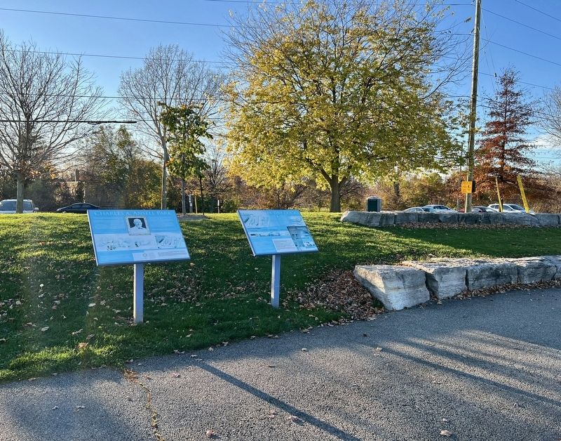
2. Port Weller Dry Docks Marker (centre of photo)
• Comprend deux cales sèches en état de fonctionner:
- une profonde de 7.9 mètres (26 pi. - égale à la profondeur du canal) pour les bâtiments jusqu'à 198.3 mètres (650 pieds) en longueur;
- et une peu profonde, de 4.26 mètres (14 pi.) pour les plus petits bâtiments.
• 18 bâtiments ont été réparés lors du premier hiver 1946-47 (valeur de six millions de dollars)
• Première construction nouvelle en 1951, le M.V. SCOTT MISENER, le plus grand vraquier construit au Canada à cette date, avec 654 pieds en longueur et 13,080 tonnes de brute.
• Depuis 1951, 58 nouveaux bâtiments ont été construits et plusieurs autres ont été considérablement modifiés.
• Parmi les spécialités: vraquiers, cargos, grands et petits pétroliers, remorqueurs, chalutiers de pêche, péniches, brise-glace, bateaux de recherches, traversiers pour passagers, véhicules routiers et ferroviaires, vraquiers à déchargement automatique, vraquiers océaniques.
• Includes the only two maximum Seaway-size dry docks on the Great Lakes.
• Flooded and emptied by gravity due to different water levels
Photographed by Tim Boyd, November 7, 2024
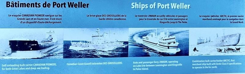
3. Port Weller Dry Docks marker photo detail
Ships of Port Weller
• Actually consists of two dry docks:
-"A Deep Dock" for vessels up to 198.2 meters (650 feet ) in length with a water depth of 7.9 metres (26 feet) - equal to the canal itself.
-"A Shelf" for smaller vessels only needing a water depth of 4.26 metres (14 feet).
• 18 ships repaired during the first winter of 1946-47 (total value of $6 million.)
• First new build produced in 1951, M.V. SCOTT MISENER- the largest vessel (654 foot long, 13,080 gross ton bulk carrier) built in Canada to that date.
• Since 1951 has constructed 58 new vessels and extensively modified many others.
• Ships built include bulk and general cargo carriers; large and small tankers; tugs; fishing trawlers; specialty barges; icebreakers; research ships; car, rail and passenger ferries; self-unloaders; and ocean freighters.
Erected by The Rotary Club of St. Catharines.
Topics and series. This historical marker is listed in these topic lists: Industry & Commerce • Waterways & Vessels. In addition, it is included in the Rotary International, and the
Photographed by Tim Boyd, November 7, 2024
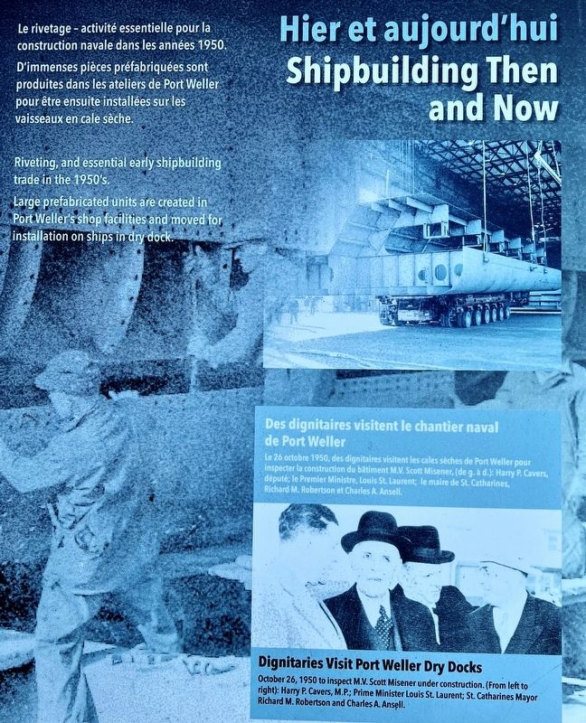
4. Port Weller Dry Docks marker photos detail
Shipbuiding Then and Now
Location. 43° 12.853′ N, 79° 12.768′ W. Marker is in St. Catharines, Ontario, in Niagara Region. It is in Port Weller West. It can be reached from Bunting Road, on the right when traveling north. The marker is in Charles A. Ansell Park, near Bunting Road and Parnell Road. Touch for map. Marker is at or near this postal address: Bunting Road, St Catharines ON L0S 1T0, Canada. Touch for directions.

Regionally, this marker is on Ontario’s Golden Horseshoe and in Niagara Canada. It is also in Central Canada. Globally, it is in North America, on the Great Lakes, in the Western Hemisphere, in the Western World, and in the Anglosphere. Historically, it finds itself in what was once a British colony, the Viceroyalty of New France, the Haudenosaunee (Iroquois) Confederacy, and Rupert’s Land.
Other nearby markers. At least 8 other markers are within walking distance of this marker: Charles A. Ansell Park (here, next to this marker); The Battle of Vimy Ridge/The History of Vimy Oak Trees (a few steps from this marker); Hélice John O. McKellar Propeller
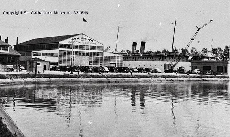
5. Port Weller Dry Docks, 1940s
Source: St. Catharines Museum (public domain)
Regarding Port Weller Dry Docks. Port Weller Dry Docks formerly occupied the land across the canal from here. Since it stopped building new ships in the early 1990s, ownership has changed a few times, but the drydocks are still used for ship maintenance and repairs. In addition, part of the property (further back from the water) is now used by other businesses unrelated to shipping.
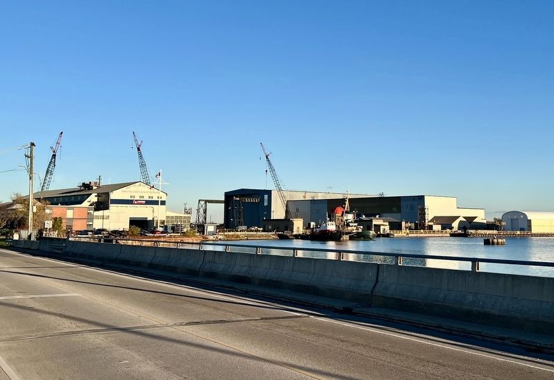
Photographed by Tim Boyd, November 7, 2024
6. Port Weller Dry Docks, 2024
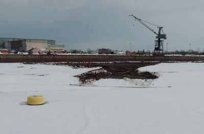
Photographed by Kevin Westell, February 9, 2022
7. Port Weller Dry Docks: Past and Future
1. The vintage whirley crane is no longer used. It is on tracks, so it could move anywhere along the "fitting out wall" (visible, facing the camera), and along the side of one of the two dry docks (left of frame).
2. Someone is investing money deepening the basin, so the dry docks have a bright future! This 2022 photo captures excavation of the basin in front of the dry docks, during the winter canal closure. (One orange excavator and one tracked dump-truck are partially visible left of centre.)
2. Someone is investing money deepening the basin, so the dry docks have a bright future! This 2022 photo captures excavation of the basin in front of the dry docks, during the winter canal closure. (One orange excavator and one tracked dump-truck are partially visible left of centre.)
Credits. This page was last revised on June 16, 2025. It was originally submitted on November 13, 2024, by Tim Boyd of Hamilton, Ontario. This page has been viewed 409 times since then and 96 times this year. Last updated on June 10, 2025, by Kevin Westell of St. Catharines, Ontario. Photos: 1, 2, 3, 4, 5, 6. submitted on November 13, 2024, by Tim Boyd of Hamilton, Ontario. 7. submitted on June 11, 2025, by Kevin Westell of St. Catharines, Ontario. • Devry Becker Jones was the editor who published this page.
