Port Hope in Northumberland County, Ontario — Central Canada (North America)
Aboriginal Settlement

Photographed by Tim Boyd, June 7, 2025
1. Aboriginal Settlement Marker
First known inhabitants of Port Hope - from about 900 A.D. - were ancient Iroquois who had hunting and fishing grounds north to Rice Lake. In 1668 the Cayuga people living here were visited by Sulpician missionaries, and by 1750 the Cayuga were displaced by the Mississauga nation who called this area one of the Cochingomings, or 'carrying places'. It became an English trading post by the 1770's and since 1819 has been called Port Hope.
Topics. This historical marker is listed in this topic list: Indigenous Peoples and Communities. A significant historical year for this entry is 1819.
Location. 43° 57.066′ N, 78° 17.518′ W. Marker is in Port Hope, Ontario, in Northumberland County. It is at the intersection of Walton Street and Mill Street North, on the right when traveling west on Walton Street. Touch for map. Marker is at or near this postal address: 2 Walton St, Port Hope ON L1A 2T1,
this page online

Regionally, this marker is in the Kawarthas Northumberland Area and in Eastern Ontario. It is also in Central Canada. Globally, it is in North America, on the Great Lakes, in the Western Hemisphere, in the Western World, and in the Anglosphere. Historically, it finds itself in what was once a British colony, the Viceroyalty of New France, the Haudenosaunee (Iroquois) Confederacy, and Rupert’s Land.
Other nearby markers. At least 8 other markers are within walking distance of this marker: The Great Farini (here, next to this marker); Port Hope Early Settlement (here, next to this marker); Signor Farini (William Leonard Hunt) 1838-1929 (a few steps from this marker); Port Hope Capitol Theatre / Le Théâtre Capitol de Port Hope (about 90 meters away, measured in a direct line); St. Mark’s Church 1822 (about 150 meters away); Farley Mowat (about 150 meters away); Myndert Harris 1748-1823 (about 150 meters away); History of the Ganaraska Watershed (about 150 meters away). Touch for a list and map of all markers in Port Hope.
Also see . . . Indigenous History of the Port Hope Area.
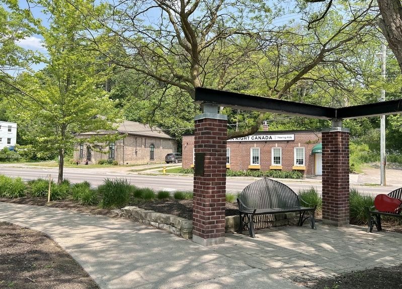
Photographed by Tim Boyd, June 7, 2025
2. Aboriginal Settlement Marker
The traditional homelands of the Michi Saagiig (Mississauga Anishinaabeg) encompass a vast area of what is now known as southern Ontario. The Michi Saagiig are known as “the people of the big river mouths” and were also known as the “Salmon People” who occupied and fished the north shore of Lake Ontario where the various tributaries emptied into the lake. Their territories extended north into and beyond the Kawarthas as winter hunting grounds on which they would break off into smaller social groups for the season, hunting and trapping on these lands, then returning to the lakeshore in spring for the summer months.(Submitted on June 10, 2025, by Tim Boyd of Hamilton, Ontario.)
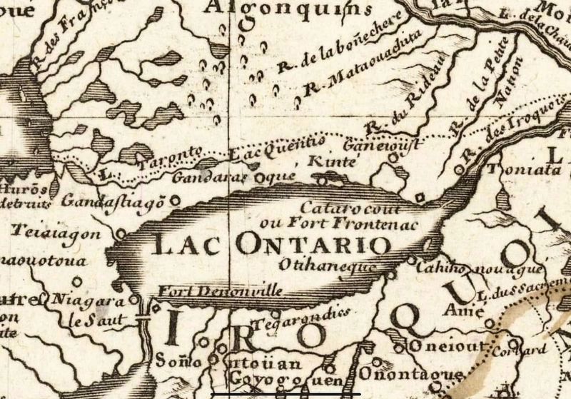
3. Map of New France, 1708, showing ‘Gandarasqué’ (centre), the location of Port Hope
Source: Library and Archives Canada (public domain)
Credits. This page was last revised on June 10, 2025. It was originally submitted on June 10, 2025, by Tim Boyd of Hamilton, Ontario. This page has been viewed 179 times since then and 24 times this year. Photos: 1, 2, 3. submitted on June 10, 2025, by Tim Boyd of Hamilton, Ontario. • Andrew Ruppenstein was the editor who published this page.
