Port Hope in Northumberland County, Ontario — Central Canada (North America)
Thomas Curtis Clarke 1827-1901
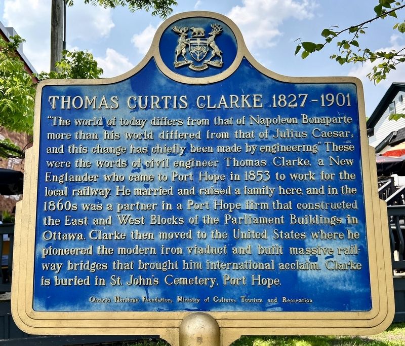
Photographed by Tim Boyd, June 7, 2025
1. Thomas Curtis Clarke 1827-1901 Marker

this page online
Erected by Ontario Heritage Foundation.
Topics and series. This historical marker is listed in these topic lists: Bridges & Viaducts • Railroads & Streetcars • Science & Medicine. In addition, it is included in the Canada, Ontario Heritage Trust series list. A significant historical year for this entry is 1853.
Location. 43° 57.021′ N, 78° 17.664′ W. Marker is in Port Hope, Ontario, in Northumberland County. It is on Elias Street 0.1 kilometers Augusta Street, on the left when traveling north. Touch for map. Marker is at or near this postal address: 30 Queen Street, Port Hope ON L1A 3V4, Canada. Touch for directions.

Regionally, this marker is in the Kawarthas Northumberland Area and in Eastern Ontario. It is also in Central Canada. Globally, it is in North America, on the Great Lakes, in the Western Hemisphere, in the Western
![Thomas Curtis Clarke 1827-1901 Marker [français] image. Click for full size.](Photos8/871/Photo871994.jpg?6102025100600PM "Thomas Curtis Clarke 1827-1901 Marker [français]. Click for full size.")
Photographed by Tim Boyd, June 7, 2025
2. Thomas Curtis Clarke 1827-1901 Marker [français]
Other nearby markers. At least 8 other markers are within walking distance of this marker: The Little Station House (within shouting distance of this marker); Port Hope Capitol Theatre / Le Théâtre Capitol de Port Hope (about 120 meters away, measured in a direct line); Cenotaph Plaque (about 120 meters away); Port Hope Cenotaph (about 120 meters away); Arthur T.H. Williams MP (about 180 meters away); 77mm German Field Gun (about 180 meters away); Founding of Port Hope (about 180 meters away); Rotary Foot Bridge (about 180 meters away). Touch for a list and map of all markers in Port Hope.
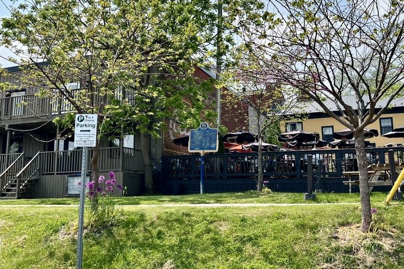
Photographed by Tim Boyd, June 7, 2025
3. Thomas Curtis Clarke 1827-1901 Marker

1896
4. Thomas Curtis Clarke in 1896
Source: Wikipedia (public domain)

5. East Block of the Parliament Buildings in Ottawa ca 1877-80
Clarke was a partner in the company that constructed this and the West Block.
Source: Library and Archives Canada (public domain)
Credits. This page was last revised on June 10, 2025. It was originally submitted on June 10, 2025, by Tim Boyd of Hamilton, Ontario. This page has been viewed 136 times since then and 29 times this year. Photos: 1, 2, 3, 4, 5. submitted on June 10, 2025, by Tim Boyd of Hamilton, Ontario. • Andrew Ruppenstein was the editor who published this page.
