
Foxhurst in the Bronx in Bronx County, New York — The American Northeast (Mid-Atlantic)
Lyons Square Playground
1.322 acres
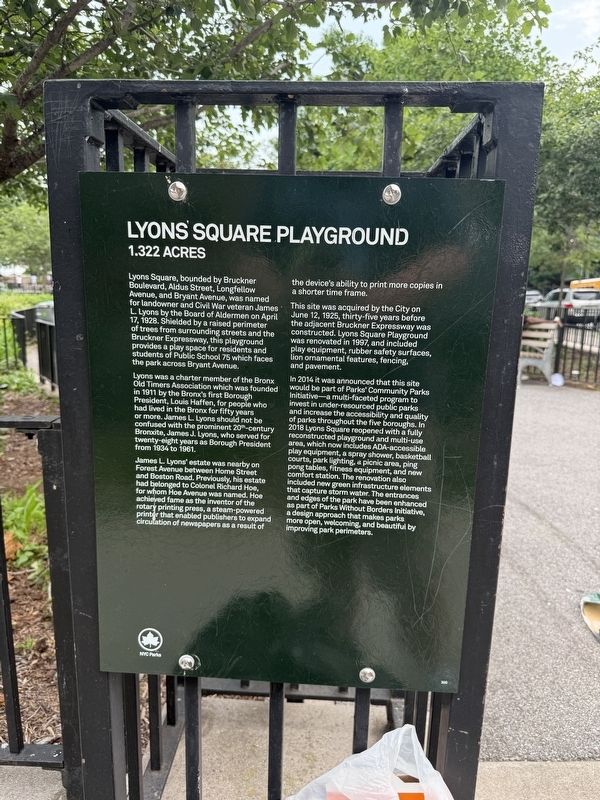
Lyons Square, bounded by Bruckner Boulevard, Aldus Street, Longfellow Avenue, and Bryant Avenue, was named for landowner and Civil War veteran James L. Lyons by the Board of Aldermen on April 17, 1928. Shielded by a raised perimeter of trees from surrounding streets and the Bruckner Expressway, this playground provides a play space for residents and students of Public School 75 which faces the park across Bryant Avenue.
Lyons was a charter member of the Bronx Old Timers Association which was founded in 1911 by the Bronx's first Borough President, Louis Haffen, for people who had lived in the Bronx for fifty years or more. James L. Lyons should not be confused with the prominent 20th-century Bronxite, James J. Lyons, who served for twenty-eight years as Borough President from 1934 to 1961.
James L. Lyons' estate was nearby on Forest Avenue between Home Street and Boston Road. Previously, his estate had belonged to Colonel Richard Hoe, for whom Hoe Avenue was named. Hoe achieved fame as the inventor of the rotary printing press, a steam-powered printer that enabled publishers to expand circulation of newspapers as
this page online
This site was acquired by the City on June 12, 1925, thirty-five years before the adjacent Bruckner Expressway was constructed. Lyons Square Playground was renovated in 1997, and included play equipment, rubber safety surfaces, lion ornamental features, fencing and pavement.
In 2014 it was announced that this site would be part of Parks' Community Parks Initiative—a multi-faceted program to invest in under-resourced public parks and increase the accessibility and quality of parks throughout the five boroughs. In 2018 Lyons Square reopened with a fully reconstructed playground and multi-use area, which now includes ADA-accessible play equipment, a spray shower, basketball courts, park lighting, a picnic area, ping pong tables, fitness equipment, and new comfort station. The renovation also included new green infrastructure elements that capture storm water. The entrances and edges of the park have been enhanced as part of Parks Without Borders Initiative, a design approach that makes parks more open, welcoming, and beautiful by improving park perimeters.
Erected by NYC
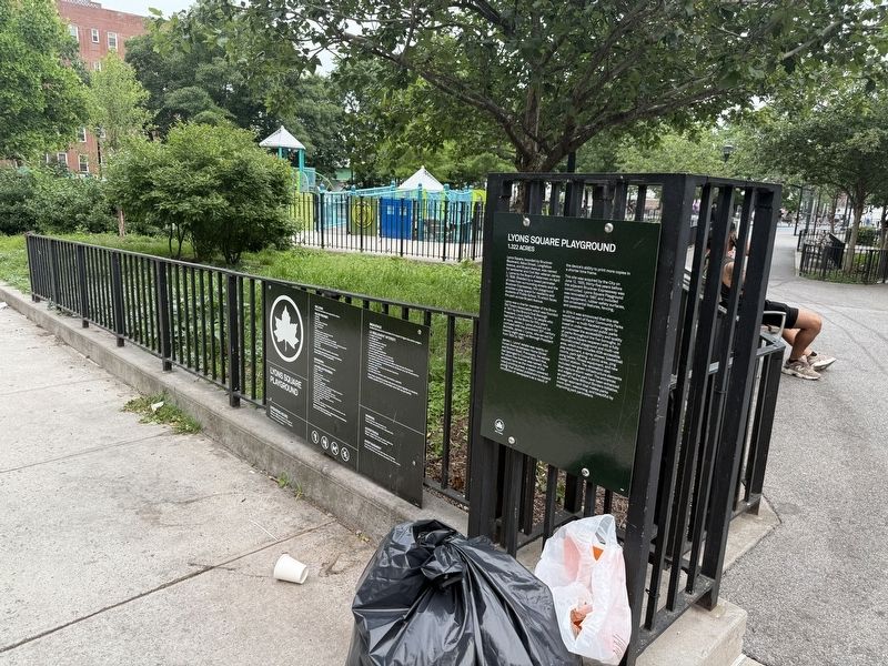
Topics and series. This historical marker is listed in these topic lists: Communications • Fraternal or Sororal Organizations • Industry & Commerce • Parks & Recreational Areas. In addition, it is included in the NYC Parks series list. A significant historical date for this entry is April 17, 1928.
Location. 40° 49.392′ N, 73° 53.308′ W. Marker is in Bronx, New York, in Bronx County. It is in Foxhurst. It is at the intersection of Aldus Street and Bryant Avenue, on the right when traveling east on Aldus Street. Touch for map. Marker is at or near this postal address: 1011 Aldus St, Bronx NY 10459, United States of America. Touch for directions.

Regionally, this marker is in New York City. It is also in the American Northeast, in the Mid-Atlantic, and on the Eastern Seaboard. Globally, it is in the North Atlantic Region, North America, the Western Hemisphere, the Western World, and the Anglosphere. Historically, it finds itself in what was once New Netherland and also one of the original Thirteen Colonies.
Other nearby markers. At least 8 other markers are within walking distance of this marker: A different marker also named Lyons Square Playground (within shouting distance of this marker); a different marker also named Lyons Square Playground (about 400 feet away, measured in a direct line); Printers Park (about 600 feet away); a different marker also named Printers Park (about 700 feet away); Longfellow Playground (approx. 0.2 miles away); The Bronx (approx. 0.2 miles away); Bryant Triangle (approx. ¼ mile away); Edible Food Forest (approx. 0.3 miles away). Touch for a list and map of all markers in Bronx.
Credits. This page was last revised on June 11, 2025. It was originally submitted on June 11, 2025, by Devry Becker Jones of Washington, District of Columbia. This page has been viewed 130 times since then and 19 times this year. Photos: 1, 2. submitted on June 11, 2025, by Devry Becker Jones of Washington, District of Columbia.
