
Woodsdale in Butler County, Ohio — The American Midwest (Great Lakes)
Chrisholm
⎯⎯⎯
Woodsdale
Photographed by Rev. Ronald Irick, August 21, 2018
1. Chrisholm Marker
Chrisholm
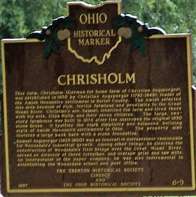
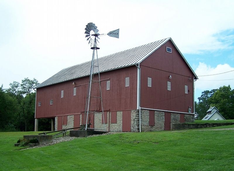
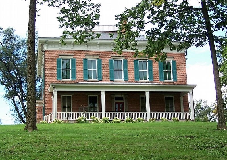
This farm, Chrisholm (German for home farm of Christian Augspurger), was established in 1830 by Christian Augspurger (1782-1848), leader of the Amish Mennonite settlement in Butler County. The Amish selected this area because of rich, fertile farmland and proximity to the Great Miami River. Christian's son, Samuel, inherited the farm and lived there with his wife, Eliza Holly, and their seven children. The large, two-story farmhouse was built in 1874 after fire destroyed the original 1830 stone house. It typifies the stark simplicity and balanced building style of Amish Mennonite settlements in Ohio. The property also features a large bank barn with a stone foundation. Samuel Augspurger (1825-1900) was an innovative entrepreneur responsible for Woodsdale's industrial growth. Among other things, he directed the construction of Woodsdale's first bridge over the Great Miami River, served as director of three turnpikes, and oversaw grist and saw mills. An incorporator of the paper company, he was also instrumental in establishing the Woodsdale school and post office.
Samuel Augspurger (1825-1900) was an innovative
this page online
Woodsdale
This hamlet, located one mile southwest from here, was never platted, but was named after William Woods. president of the three-story brick Woodsdale paper mill constructed in 1867. Flanking the mill were the company office and store and several workers' houses. Previous to this, the area flourished from the presence of two grist mills on the Great Miami River and from the Miami & Erie Canal. Additional enter prises such as a stone quarry, ice cutting company, and grain elevator operated here during the late 19th and early 20th centuries. Woodsdale was also known for the Woodsdale Island Amusement Park and the LC&D Railroad depot. The park, established on an island between the Miami & Erie Canal and the Great Miami River in 1891, was the site of picnics, political rallies,

Photographed by Rev. Ronald Irick, August 21, 2018
2. Woodsdale Marker
Erected 1997 by Trenton Historical Society, CINERGY, and The Ohio Historical Society. (Marker Number 6-9.)
Topics and series. This historical marker is listed in these topic lists: Agriculture • Settlements & Settlers. In addition, it is included in the Ohio Historical Society / The Ohio History Connection series list.
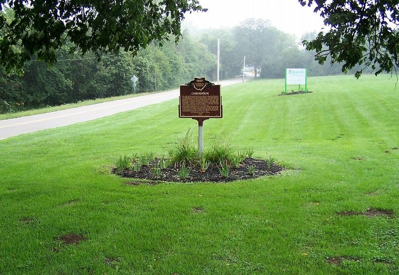
Location. 39° 26.599′ N, 84° 27.65′ W. Marker is in Woodsdale, Ohio, in Butler County. It is on Woodsdale Road (County Route 150), on the right when traveling west. Marker is at the front entrance to Chrisholm MetroPark Farmstead. Touch for map. Marker is at or near this postal address: 2070 Woodsdale Road, Trenton OH 45067, United States of America. Touch for directions.

Regionally, this marker is in Greater Cincinnati and in the Miami Valley. It is also in the American Midwest. Globally, it is in North America, the Western Hemisphere, the Western World, and the Anglosphere. Historically, it finds itself in what was once
Photographed by Rev. Ronald Irick, August 21, 2018
3. Chrisholm / Woodsdale Marker
Other nearby markers. At least 8 other markers are within walking distance of this marker: The Amish Mennonite Settlement (about 400 feet away, measured in a direct line); Chrisholm Cellar (about 500 feet away); Sanitary Outhouse (about 500 feet away); John Augspurger Portable Fences (about 500 feet away); Butler County's First Green Restroom (about 500 feet away); Alsdorf Windmill (about 500 feet away); Chrisholm Native Pollinator Garden (about 500 feet away); Chrisholm Summer Kitchen (about 500 feet away). Touch for a list and map of all markers in Woodsdale.
Photographed by Rev. Ronald Irick, August 21, 2018
4. Chrisholm Marker
the barn, with windmill
Photographed by Rev. Ronald Irick, August 21, 2018
5. Chrisholm Marker
the house
Credits. This page was last revised on June 19, 2025. It was originally submitted on August 25, 2018, by Rev. Ronald Irick of West Liberty, Ohio. This page has been viewed 665 times since then and 102 times this year. Last updated on June 11, 2025, by Craig Doda of Napoleon, Ohio. Photos: 1, 2, 3, 4, 5. submitted on August 25, 2018, by Rev. Ronald Irick of West Liberty, Ohio. • Devry Becker Jones was the editor who published this page.
