
St. Catharines in Niagara Region, Ontario — Central Canada (North America)
Major-General Sir Isaac Brock, K.B. 1769-1812

Photographed by Kevin Westell, June 11, 2025
1. Major-General Sir Isaac Brock, K.B. 1769-1812 Marker
Major-General
Sir Isaac Brock, K.B.
1769-1812
Erected 2015.
Topics. This memorial is listed in these topic lists: Colonial Era • War of 1812.
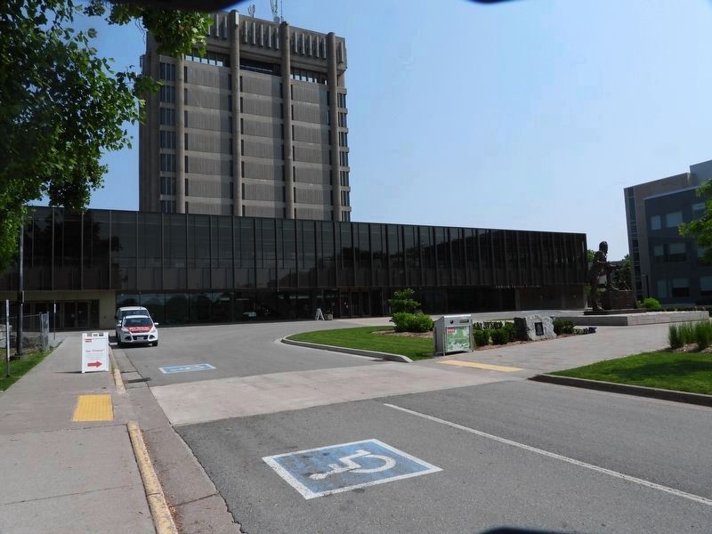
Location. 43° 7.142′ N, 79° 14.946′ W. Memorial is in St. Catharines, Ontario, in Niagara Region. It is at the intersection of Isaac Brock Boulevard E and Isaac Brock Boulevard W on Isaac Brock Boulevard E. The marker is within the Brock University main campus, on the drop-off loop (where Isaac Brock Blvd E and Isaac Brock Blvd W meet) immediately south of the Schmonn Tower (the 10-storey cube building), 10 metres west of the statue of Isaac Brock. Touch for map. Memorial is at or near this postal address: Isaac Brock Boulevard E, St Catharines ON L2S 3A1, Canada. Touch for directions.

Regionally, this memorial is on Ontario’s Golden Horseshoe and in Niagara Canada. It is also in Central Canada. Globally, it is in North America, the Western Hemisphere, the Western World, and the Anglosphere. Historically, it finds itself in what was once a British colony, the Viceroyalty of New France, the Haudenosaunee
this page online
Other nearby markers. At least 8 other markers are within walking distance of this marker: Brock University (within shouting distance of this marker); Niagara Peninsula Conservation Authority (approx. 0.3 kilometers away); Niagara Region 9/11 Memorial (approx. 0.7 kilometers away); About the Glenridge Quarry Naturalization Site (approx. 0.8 kilometers away); History of the Niagara Escarpment (approx. 0.8 kilometers away); History of the Site - Use as a Quarry and a Landfill (approx. 0.8 kilometers away); Land Acknowledgement (approx. 0.8 kilometers away); Weather Station: Stormy Weather (approx. 0.8 kilometers away). Touch for a list and map of all markers in St. Catharines.
Photographed by Kevin Westell, June 11, 2025
2. Major-General Sir Isaac Brock, K.B. 1769-1812 - Marker in context
Photo faces north and north-east. The marker is centre-right in picture - mounted on a south-facing rock, on the west part of the walkway across the island in the centre of the drop-off loop, just west of the statue it marks.
Photographed by Kevin Westell, June 11, 2025
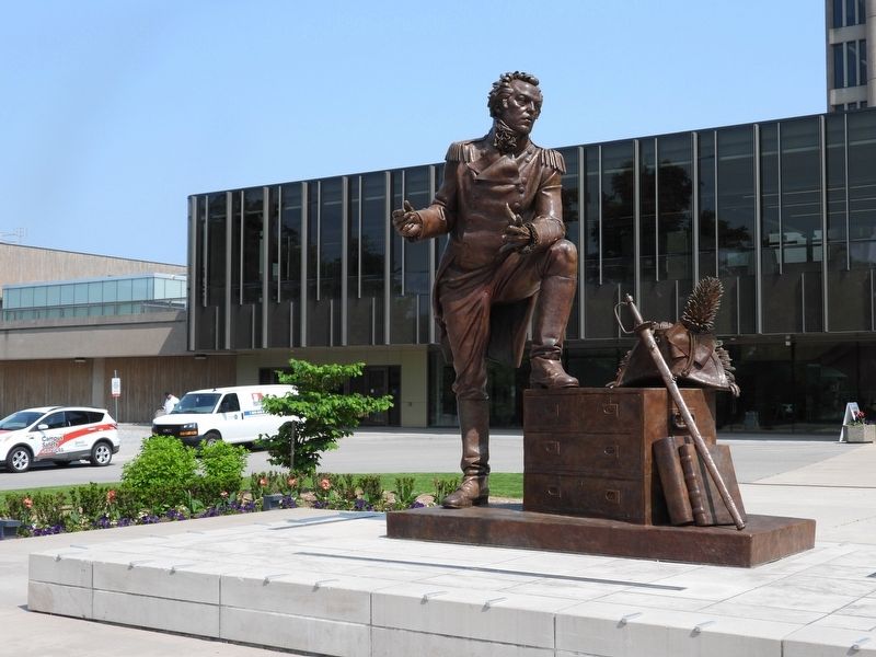
3. Isaac Brock statue
Credits. This page was last revised on June 25, 2025. It was originally submitted on June 12, 2025, by Kevin Westell of St. Catharines, Ontario. This page has been viewed 105 times since then and 10 times this year. Photos: 1, 2, 3. submitted on June 12, 2025, by Kevin Westell of St. Catharines, Ontario. • Andrew Ruppenstein was the editor who published this page.
