Providence Township near Grand Rapids in Lucas County, Ohio — The American Midwest (Great Lakes)
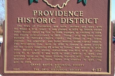
Providence Historical District
Photographed by Dale K. Benington, March 6, 2010
1. Providence Historical District Marker
Erected 1980 by Grand Rapids Historical Society and The Ohio Historical Society. (Marker Number 4-87.)
Topics and series. This historical marker is listed in these topic lists: Settlements & Settlers • Waterways & Vessels. In addition, it is included in the Ohio Historical Society / The Ohio History Connection, and the The Miami & Erie Canal series lists. A significant historical year for this entry is 1835.
Location. 41° 25.098′ N,
this page online

Regionally, this marker is on the Lake Erie Shore and in the Toledo Metropolitan Area. It is also in the American Midwest and in the Corn Belt. Globally, it is in North America, on the Great Lakes, in the Western Hemisphere, in the Western World, and in the Anglosphere. Historically, it finds itself in what was once the Viceroyalty of New France, the Haudenosaunee (Iroquois) Confederacy, the territory of the Mississippian Culture, and the Northwest Territory.
Other nearby markers. At least 8 other markers are within walking distance of this marker: St. Patrick Church
Photographed by Dale K. Benington, March 6, 2010
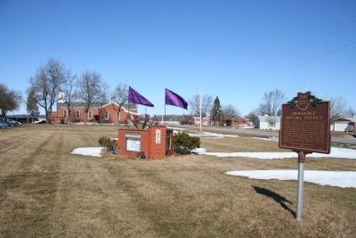
2. Providence Historical District Marker
View of historical marker in the front yard of St. Patrick's Church.
Photographed by Dale K. Benington, March 6, 2010
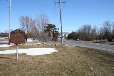
3. Providence Historical District Marker
View looking northeast of the historical marker in the left foreground and to the right of River Road (US 24) heading towards Waterville, Maumee, and Toledo.
Photographed by Dale K. Benington, March 6, 2010
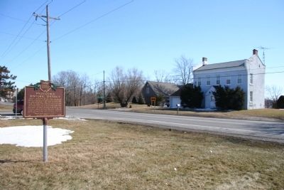
4. Providence Historical District Marker
View looking across the street (River Road) from the historical marker at the Peter Manor house, which is situated on the high ridge overlooking the Maumee River.
Photographed by Dale K. Benington, March 6, 2010
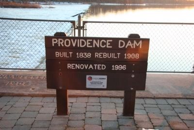
5. Providence Dam
View of the nearby Providence Dam that was built to supply the canal with the water needed for its operations from Providence all the way to the end of the line in Toledo.
Photographed by Dale K. Benington, March 6, 2010
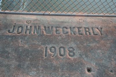
6. Providence Dam
View of the name of the contractor, John Weckerly, written in the dam's cement 1908 renovation, on the west side of the Maumee River.
Photographed by Dale K. Benington, March 6, 2010
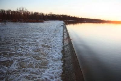
7. Providence Dam
View from the western bank of the Maumee River of the Providence Dam that was originally built in 1838 as part of the canal system.
Credits. This page was last revised on June 27, 2025. It was originally submitted on March 9, 2010, by Dale K. Benington of Toledo, Ohio. This page has been viewed 2,123 times since then and 95 times this year. Last updated on June 13, 2025, by Craig Doda of Napoleon, Ohio. Photos: 1, 2, 3, 4. submitted on March 9, 2010, by Dale K. Benington of Toledo, Ohio. 5, 6, 7. submitted on May 2, 2010, by Dale K. Benington of Toledo, Ohio. • Devry Becker Jones was the editor who published this page.
