Burnet in Burnet County, Texas — The American South (West South Central)
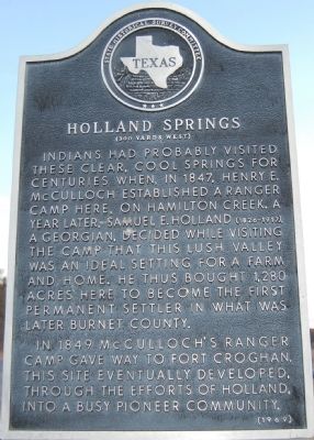
Holland Springs
— (300 Yards West) —
In 1849 McCulloch's Ranger camp gave way to Fort Croghan. This site eventually developed, through the efforts of Holland, into a busy pioneer community.
Erected 1969 by the State Historical Survey Committee. (Marker Number 9719.)
Topics. This historical marker is listed in these topic lists: Forts and Castles • Native Americans • Settlements & Settlers. A significant historical year for this entry is 1847.
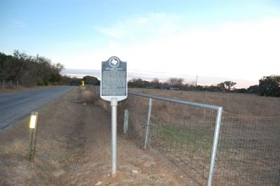
Location. 30° 43.232′ N, 98° 13.355′ W. Marker is in Burnet, Texas, in Burnet County. Marker is on CR-340, 0.1 miles south of 340A, on the right when traveling south. Touch for map. Marker is in this post office area: Burnet TX 78611, United States of America. Touch for directions.
Other nearby markers. At least 8 other markers are within 3 miles of this marker, measured as the crow flies. Magill Family Cemetery (approx. 1.6 miles away); George Whitaker Home (approx. 2.2 miles away); Rocky Rest (approx. 2.4 miles away); Oldest Commercial Building in Burnet (approx. 2.4 miles away); The Galloway House (approx. 2˝ miles away); The Burnet Bulletin (approx. 2˝ miles away); Airy Mount Barn (approx. 2˝ miles away); The Badger Building (approx. 2˝ miles away). Touch for a list and map of all markers in Burnet.
Credits. This page was last revised on August 27, 2020. It was originally submitted on February 14, 2010, by Keith Peterson of Cedar Park, Texas. This page has been viewed 871 times since then and 17 times this year. Photos: 1, 2. submitted on February 14, 2010, by Keith Peterson of Cedar Park, Texas. • Bill Pfingsten was the editor who published this page.

