Fishers Hill in Shenandoah County, Virginia — The American South (Mid-Atlantic)
Fisher's Hill Battlefield
Veteran's Picnic Grounds
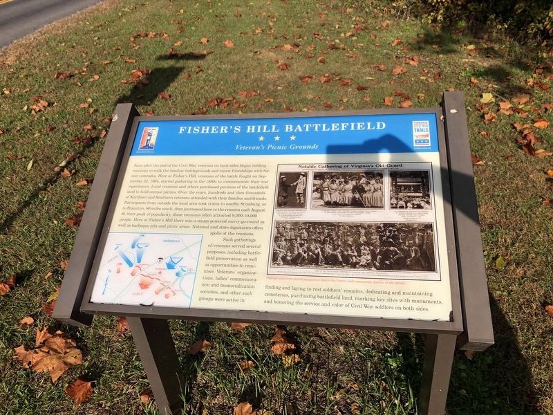
Soon after the end of the Civil War, veterans on both sides began holding reunions to walk the familiar battlegrounds and renew friendships with former comrades. Here at Fisher's Hill, veterans of the battle fought on September 22, 1864, started gathering in the 1880s to commemorate their war experiences. Local veterans and others purchased portions of the battlefield land to hold annual picnics. Over the years, hundreds and then thousands of Northern and Southern veterans attended with their families and friends. Participants from outside the local area took trains to nearby Strasburg, or to Staunton, 80 miles south, then journeyed here to the reunion each August. At their peak of popularity, these reunions often attracted 9,000-10,000 people. Here at Fisher's Hill there was a steam-powered merry-go-round as well as barbeque pits and picnic areas. National and state dignitaries often spoke at the reunions.
Such gatherings of veterans served several purposes, including battlefield preservation as well as opportunities to reminisce. Veteran's organizations, ladies' commemoration and memorialization societies, and other
this page online
(caption) Photographs from period magazines depict the festive and community nature of the picnic.
Erected by Virginia Civil War Trails.
Topics and series. This historical marker is listed in this topic list: War, US Civil. In addition, it is included in the Virginia Civil War Trails series list. A significant historical date for this entry is September 22, 1864.
Location. This marker has been replaced by another marker nearby. It was located near 38° 59.038′ N, 78° 23.809′ W. Marker was in Fishers Hill, Virginia, in Shenandoah County. It was at the intersection of Battlefield Road (County Route 601) and Tripplet Road (County Route 821), on the right when traveling west on Battlefield Road. Located just to the east of the Norfolk Southern Railroad overpass. Touch for map. Marker was in this post office area: Fishers Hill VA 22626, United States of America. Touch for directions.

Regionally, this marker
Photographed by Craig Swain, December 1, 2007
2. Battle Map
Battle of Fisher's Hill Virtual Tour by Markers:
Eight HMDb marker entries that document the battle of Fisher's Hill, September 20-21, 1864.
Click for more information.
Click for more information.
Other nearby markers. At least 8 other markers are within one mile of this location, measured as the crow flies: Battle of Fisher's Hill (here, next to this marker); Stoner-Keller House & Mill (approx. 0.2 miles away); Creative Women of Fishers Hill (approx. ¼ mile away); Valley Pike (approx. half a mile away); a different marker also named The Battle of Fishers Hill (approx. 0.6 miles away); a different marker also named Battle of Fisher's Hill (approx. 0.7 miles away); a different marker also named Battle of Fisher's Hill (approx. 0.8 miles away); Ramseur's Hill (approx. one mile away). Touch for a list and map of all markers in Fishers Hill.
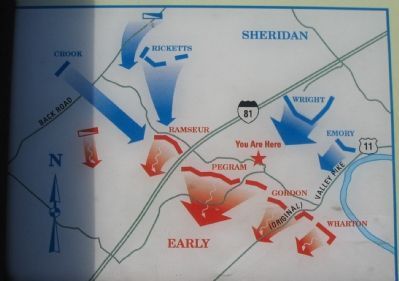
More about this marker. On the lower left is a map of the
Photographed by Craig Swain, December 1, 2007
3. Fisher's Hill Battlefield Marker
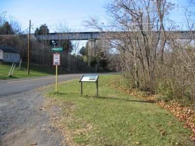
Regarding Fisher's Hill Battlefield. This is one of several markers interpreting the Battle of Fisher's Hill. See the links at the Battle Map above.
Related marker. Click here for another marker that is related to this marker. New CWT Marker At This Location titled "Battle of Fisher's Hill".
Also see . . . Battle of Fisher's Hill. Wikipedia entry (Submitted on June 4, 2022, by Larry Gertner of New York, New York.)
Photographed by Craig Swain, December 1, 2007
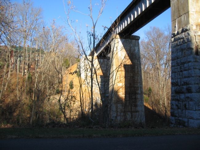
5. Norfolk Southern Railroad Bridge
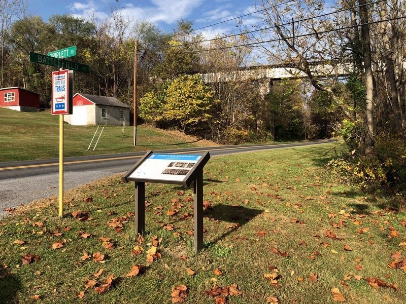
At the time of the battle the Manassas Gap Railroad ran across a span here. Out of operation due to the passing of the warring armies, the railroad line bisected the Confederate defenses at this point, at the point that Gordon's and Pegram's divisions were deployed.
Credits. This page was last revised on June 16, 2025. It was originally submitted on December 11, 2007, by Craig Swain of Leesburg, Virginia. This page has been viewed 3,907 times since then and 78 times this year. Last updated on June 14, 2025, by Mike McKeown of Baltimore, Maryland. Photos: 1. submitted on October 24, 2020, by Devry Becker Jones of Washington, District of Columbia. 2, 3. submitted on December 11, 2007, by Craig Swain of Leesburg, Virginia. 4. submitted on October 24, 2020, by Devry Becker Jones of Washington, District of Columbia. 5. submitted on December 16, 2007, by Craig Swain of Leesburg, Virginia. • Bernard Fisher was the editor who published this page.
