Near Oakland in Garrett County, Maryland — The American Northeast (Mid-Atlantic)
Deep Creek Hydroelectric Station
Deep Creek Lake 100 Years
| — | 1925 • 2025 | — |
Photographed by Bradley Owen, June 12, 2025
1. Deep Creek Hydroelectric Station Marker
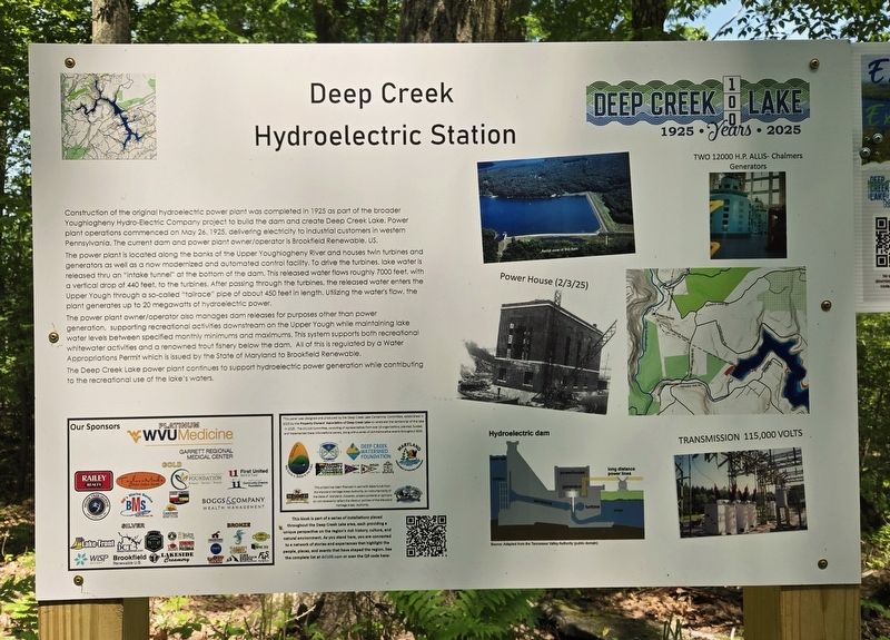
Construction of the original hydroelectric power plant was completed in 1925 as part of the broader Youghiogheny Hydro-Electric Company project to build the dam and create Deep Creek Lake. Power plant operations commenced on May 26, 1925, delivering electricity to industrial customers in western Pennsylvania. The current dam and power plant owner/operator is Brookfield Renewable, US.
The power plant is located along the banks of the Upper Youghiogheny River and houses twin turbines and generators as well as a now modernized and automated control facility. To drive the turbines, lake water is released thru an “intake tunnel” at the bottom of the dam. This released water flows roughly 7000 feet, with a vertical drop of 440 feet, to the turbines. After passing through the turbines, the released water enters the Upper Yough through a so-called “tailrace” pipe of about 450 feet in length. Utilizing the water's flow, the plant generates up to 20 megawatts of hydroelectric power.
The power plant owner/operator also manages dam releases for purposes other than power generation, supporting recreational activities downstream
this page online
The Deep Creek Lake power plant continues to support hydroelectric power generation while contributing to the recreational use of the lake’s waters.
Erected 2025 by Deep Creek Lake Centennial Committee.
Topics. This historical marker is listed in these topic lists: Industry & Commerce • Waterways & Vessels. A significant historical date for this entry is May 26, 1925.
Location. 39° 30.501′ N, 79° 23.215′ W. Marker is near Oakland, Maryland, in Garrett County. It is on Mayhew Inn Road just north of Wild Turkey Lane, on the left when traveling east. Touch for map. Marker is at or near this postal address: 1253 Mayhew Inn Road, Oakland MD 21550, United States of America. Touch for directions.

Regionally, this marker is in Western Maryland. It is also in the American Mid-Atlantic, in Appalachia, and specifically
Photographed by Bradley Owen, June 12, 2025
2. Deep Creek Hydroelectric Station Marker
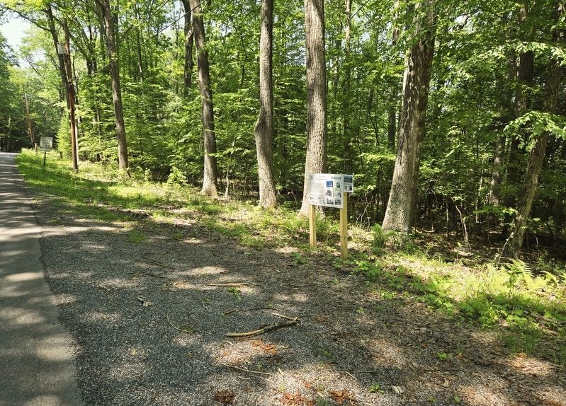
View is looking southwest along Mayhew Inn Road.
Other nearby markers. At least 8 other markers are within 4 miles of this marker, measured as the crow flies: Campsite (approx. 1.7 miles away); Youghiogheny Grove (approx. 1.8 miles away); Swallow Falls vs. Hurricane Sandy (approx. 1.8 miles away); Civilian Conservation Corps (approx. 1.8 miles away); The Bridges of Deep Creek Lake (approx. 2.6 miles away); Einstein's Visit to Deep Creek Lake (approx. 3 miles away); Deep Creek Lake (approx. 3.2 miles away); The Creation of Deep Creek Lake (approx. 3.2 miles away). Touch for a list and map of all markers in Oakland.
Another marker is no longer nearby. Thayer Game Refuge (was approx. 2.7 miles away but has been confirmed missing).
Credits. This page was last revised on June 14, 2025. It was originally submitted on June 14, 2025, by Bradley Owen of Morgantown, West Virginia. This page has been viewed 216 times since then and 83 times this year. Photos: 1, 2. submitted on June 14, 2025, by Bradley Owen of Morgantown, West Virginia.
