Murray in Carrying Place in Hastings County, Ontario — Central Canada (North America)
Murray Canal
⎯⎯⎯
Le canal Murray
Photographed by Tim Boyd, June 8, 2025
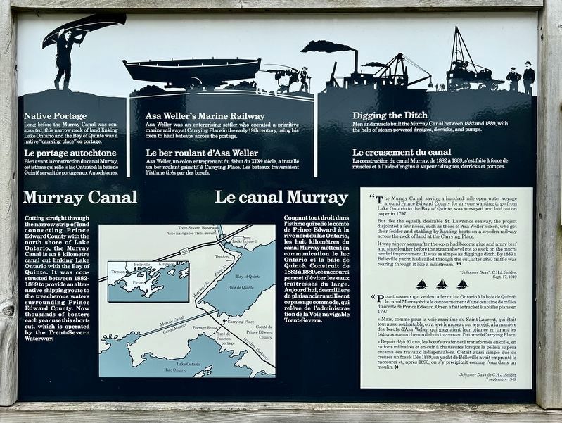
1. Murray Canal Marker (left panel)

Murray Canal
Cutting straight through the narrow strip of land connecting Prince Edward County with the north shore of Lake Ontario, the Murray Canal is an 8 kilometre canal cut linking Lake Ontario with the Bay of Quinte. It was constructed between 1882-1889 to provide an alternative shipping route to the treacherous waters surrounding Prince Edward County. Now thousands of boaters each year use this short-cut, which is operated by the Trent-Severn Waterway.
Native Portage
Long before the Murray Canal was con-structed, this narrow neck of land linking Lake Ontario and the Bay of Quinte was a native "carrying place" or portage.
Asa Weller's Marine Railway
Asa Weller was an enterprising settler who operated a primitive marine railway at Carrying Place in the early 19th century, using his oxen to haul bateaux across the portage.
Digging the Ditch
Men and muscle built the Murray Canal between 1882 and 1889, with the help of steam-powered dredges, derricks, and pumps.
”The Murray Canal, saving a hundred mile open water voyage around Prince Edward County for anyone wanting to go from Lake
this page online
But like the equally desirable St. Lawrence seaway, the project disjointed a few noses, such as those of Asa Weller's oxen, who got their fodder and stabling by hauling boats on a wooden railway across the neck of land at the Carrying Place.
It was ninety years after the oxen had become glue and army beef and shoe leather before the steam shovel got to work on the much-needed improvement. It was as simple as digging a ditch. By 1889 a Belleville yacht had sailed through the cut, after 1890 traffic was roaring through it like a millstream. 99 "Schooner Days", C.H.J. Snider, Sept. 17, 1949
Le canal Murray
Coupant tout droit dans l'isthme qui relie le comté de Prince Edward à la rive nord du lac Ontario, les huit kilomètres du canal Murray mettent en communication le lac Ontario et la baie de Quinté. Construit de 1882 à 1889, ce raccourci permet d'éviter les eaux traitresses du large. Aujourd'hui, des milliers de plaisanciers utilisent ce passage commode, qui relève de l'administration de la Voie navigable Trent-Severn.
Le portage autochtone
Bien
Photographed by Tim Boyd, June 8, 2025
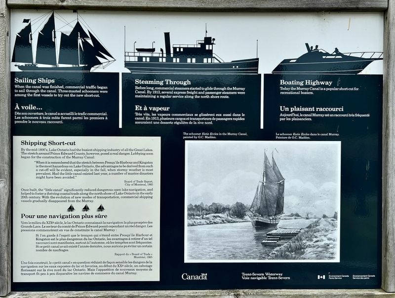
2. Murray Canal/ Le canal Murray Marker (right panel)
Le ber roulant d'Asa Weller
Asa Weller, un colon entreprenant du début du XIXe siècle, a installé un ber roulant primitif à Carrying Place. Les bateaux traversaient l'isthme tirés par des bœufs.
Le creusement du canal
La construction du canal Murray, de 1882 à 1889, s'est faite à force de muscles et à l'aide d'engins à vapeur: dragues, derricks et pompes.
«Pour tous ceux qui veulent aller du lac Ontario à la baie de Quinté, le canal Murray évite le contournement d'une centaine de milles du comté de Prince Edward. On en a fait le tracé et établi les plans en 1797.
« Mais, comme pour la voie maritime du Saint-Laurent, qui était tout aussi souhaitable, on a levé le museau sur le projet, à la manière des bœufs d'Asa Weller, qui gagnaient leur pitance en tirant les bateaux sur un chemin de bois traversant l'isthme à Carrying Place.
« Depuis déjà 90 ans, les bœufs avaient été transformés en colle, en rations militaires et en cuir à chaussures lorsque la pelle à vapeur entama ces travaux indispensables.
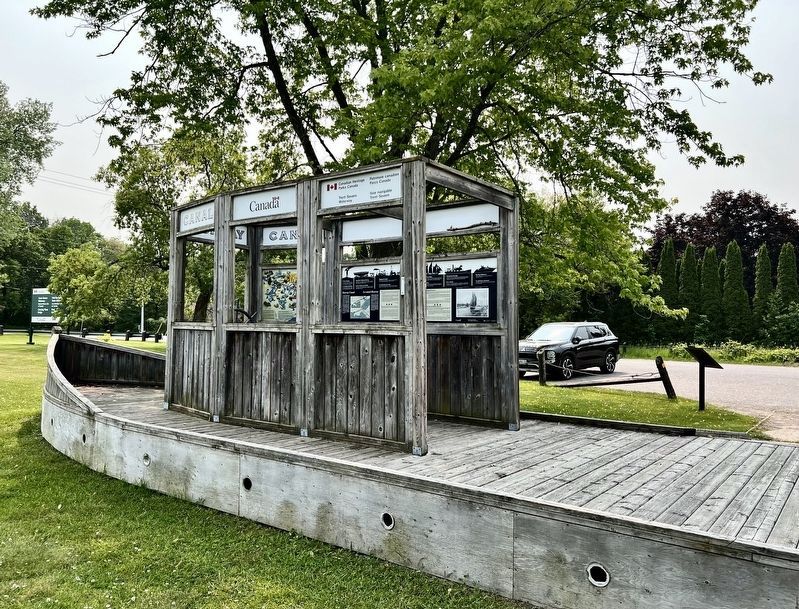
Photographed by Tim Boyd, June 8, 2025
3. Murray Canal/ Le canal Murray Marker
Panels are in the ship play structure
Schooner Days de C.H.J. Snider
17 septembre 1949
Sailing Ships
When the canal was finished, commercial traffic began to sail through the canal. Three-masted schooners were among the first vessels to try out the new short-cut.
Steaming Through
Before long, commercial steamers started to glide through the Murray Canal. By 1913, several express freight and passenger steamers were maintaining a regular service along the north shore route.
Boating Highway
Today the Murray Canal is a popular short-cut for recreational boaters.
Shipping Short-cut
By the mid-1800's, Lake Ontario had the busiest shipping industry of all the Great Lakes. The stretch around Prince Edward County, however, posed a real danger. Lobbying soon began for the construction of the Murray Canal:
"When it is remembered that the stretch between Presqu'ile Harbour and Kingston is the most hazardous on Lake Ontario, the advantages to be derived from such a cut-off will beBoard of Trade Reportevident, especially in the fall, when stormy weather is most prevalent. Had the little canal existed last year, a number of marine disasters might have been avoided."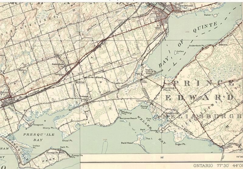 4. 1932 topographic map showing the Murray Canal
City of Montreal, 1865
Once built, the "little canal" significantly reduced dangerous open lake navigation, and helped to foster a thriving coastal trade along the north shore of Lake Ontario in the early 20th century. With the evolution of new modes of transportation, commercial shipping vessels gradually disappeared from the Murray.
À voile...
Dès son overture, le canal a accueilli le trafic commercial. Les schooners à trois mâts furent parmi les premiers à prendre le nouveau raccourci.
Et à vapeur
Très vite, les vapeurs commerciaux se glissèrent eux aussi dans le canal. En 1913, plusieurs cargos et transporteurs de passagers rapides assuraient une desserte régulière de la rive nord.
Un plaisant raccourci
Aujourd'hui, le canal Murray est un raccourci très fréquenté par les plaisanciers.
Pour une navigation plus sûre
Vers le milieu du XIXe siècle, le lac Ontario connaissait la navigation la plus prospère des Grands
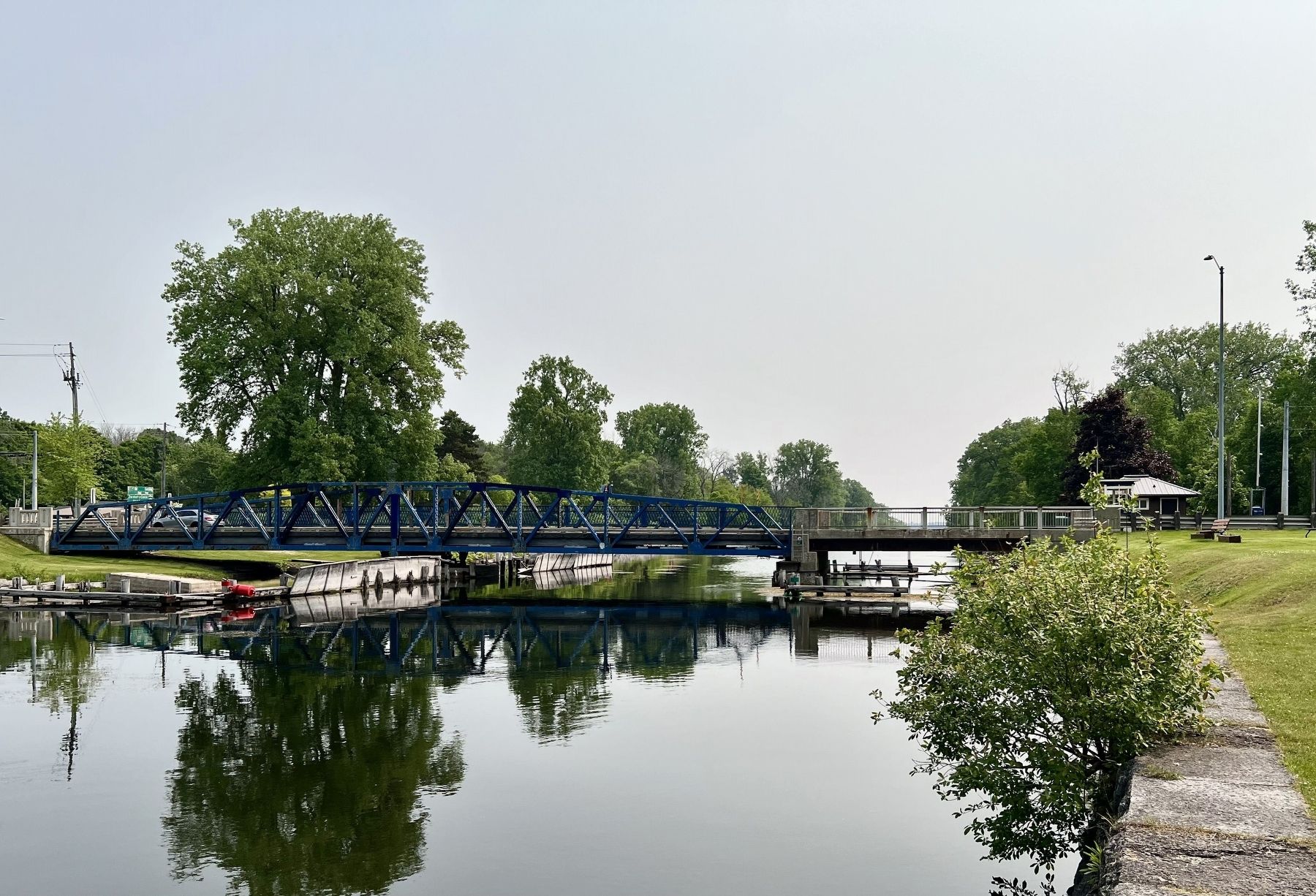
Photographed by Tim Boyd, June 8, 2025
5. The Murray Canal at Carrying Place, 2025
Si l'on garde à l'esprit que le tronçon qui s'étend entre Presqu'ile Harbour et Kingston est le plus dangereux du lac Ontario, les avantages à retirer d'un tel raccourci sont manifestes, surtout à l'automne, où les tempêtes sont fréquentes. Si ce petit canal avait existé l'année dernière, nous aurions pu éviter un certain nombre de naufrages.Rapport du «Board of Trade»
Montréal, 1865
Une fois construit, le «petit canal» en question réduisit de façon sensible les dangers de la navigation sur les eaux exposées du lac et favorisa, au début du XXe siècle, un cabotage florissant sur la rive nor du lac Ontario. Mais l'apparition de nouveaux moyens de transport fit peu à peu disparaitre les navires de commerce du canal Murray.
Erected by Trent Severn Waterway/Environment Canada- Parks Canada.
Topics. This historical marker is listed in this topic list: Waterways & Vessels. A significant historical year for this entry is 1889.
Location. 44° 3.341′ N, 77° 35.853′ W. Marker is in Carrying Place, Ontario, in Hastings County. It is in Murray. It is at the intersection of Shore Road and Loyalist Parkway, on the right when traveling west on Shore Road. Touch for map. Marker is at or near this postal address: 22014 Loyalist Pkwy, Carrying Place ON K0K 1L0, Canada. Touch for directions.

Regionally, this marker is in Eastern Ontario and specifically in Southeastern Ontario. It is also in Central Canada. Globally, it is in North America, on the Great Lakes, in the Western Hemisphere, in the Western World, and in the Anglosphere. Historically, it finds itself in what was once a British colony, the Viceroyalty of New France, the Haudenosaunee (Iroquois) Confederacy, and Rupert’s Land.
Other nearby markers. At least 8 other markers are within 6 kilometers of this marker, measured as the crow flies: The Important Connection / Un lien important (here, next to this marker); Bay of Quinte Carrying Place / Le Portage de la Baie de Quinte (approx. 1.5 kilometers away); Site of Trenton Cooperage Mills (approx. 5.1 kilometers away); Hugh O'Neil Friendship Garden (approx. 5.1 kilometers away); Champlain's War Party, 1615 (approx. 5.2 kilometers away); O. G. "Buster" Alyea Memorial Park (approx. 5.2 kilometers away); Liberation of Holland 45th Anniversary (approx. 5.3 kilometers away); War Memorial Cenotaph (approx. 5.3 kilometers away). Touch for a list and map of all markers in Carrying Place.
More about this marker. The marker consists of two adjacent panels
Credits. This page was last revised on July 1, 2025. It was originally submitted on June 15, 2025, by Tim Boyd of Hamilton, Ontario. This page has been viewed 249 times since then and 72 times this year. Photos: 1, 2, 3, 4, 5. submitted on June 15, 2025, by Tim Boyd of Hamilton, Ontario. • Andrew Ruppenstein was the editor who published this page.
