Carolina Beach in New Hanover County, North Carolina — The American South (South Atlantic)
Such parts of the Sugar Loaf line...
!["Such parts of the [Sugar Loaf] line as I saw from the top of an old house...." Marker image. Click for full size.](Photos8/873/Photo873094.jpg?615202530000PM "\"Such parts of the [Sugar Loaf] line as I saw from the top of an old house....\" Marker. Click for full size.")
Photographed by Evan Dwyer, January 24, 2025
1. "Such parts of the [Sugar Loaf] line as I saw from the top of an old house...." Marker
"Such parts of the [Sugar Loaf] line as I saw from the top of an old house appeared to be well manned." Bvt. Brig. Gen. Joseph C. Abbott, 24th US Army Corps, 20 Jan 1865
James Burriss (below right), a Cape Fear River pilot, waterman, and farmer owned the property on Federal Point where engineers, using mostly enslaved Black laborers, constructed this portion of the Sugar Loaf defenses. He and his family lived in a two story clapboard house that stood about 250 yards south of the earthworks seen in the background of this photograph taken in the 1870s.
On January 19, 1865, U.S. Army troops, under covering fire from Union warships on the ocean-side to the east, made a reconnaissance in force along the Sugar Loaf lines in an attempt to overrun them.
With a tangled swamp blocking his view, Bvt. Brig. Gen. Joseph C. Abbott, who led one of the Union brigades in the advance, climbed to the top of James Burriss's house to get a good look at the Confederate defenses. From there he observed that General Bragg's fieldworks were strong, well manned, and probably could not be taken by a frontal assault. Brigadier General Charles
this page online
As January 1865 drew to a close, the Union and Confederate forces that faced each other at Sugar Loaf settled into a stalemate. The Federals adopted a strategy of intimidation, while gray uniformed soldiers dug in deeper. General Bragg seemingly was content to prevent an enemy advance on Wilmington instead of trying to recapture Fort Fisher as the government in Richmond had instructed. The campaign devolved into a routine in which pickets on the front lines traded pot-shots, while Union gunboats daily fired their cannons against the Sugar Loaf lines. The harassment continued for weeks.
Erected 2021 by Brunswick Civil War Roundtable, Town of Carolina Beach.
Topics. This historical marker is listed in this topic list: War, US Civil. A significant historical date for this entry is January 19, 1865.
Location. 34° 2.743′ N, 77° 53.826′ W. Marker is in Carolina Beach, North Carolina, in New Hanover County. It can be reached from North
Photographed by Evan Dwyer, January 24, 2025
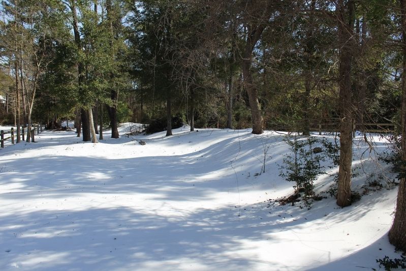
2. View of the Sugar Loaf Line
Viewed from the location of the marker. This is the interior of the defensive line.

Regionally, this marker is in the Coastal Plain and on the Cape Fear Coast. It is also in the American South, specifically in the Upper South, in the Tidewater, and on the Eastern Seaboard. Globally, it is in the North Atlantic Region, North America, the Western Hemisphere, the Western World, and the Anglosphere. Historically, it finds itself in what was once the territory of the Mississippian Culture, one of the original Thirteen Colonies, one of the Confederate States of America, and the Antebellum South.
Other nearby markers. At least 8 other markers are within walking distance of this marker: To close the port of Wilmington... (a few steps from this marker); We are strongly entrenched here... (within shouting distance of this marker); I hope we can hold Wilmington (within
Photographed by Evan Dwyer, January 24, 2025
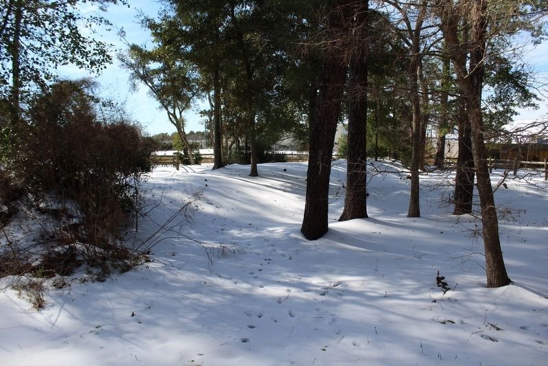
3. Sugar Loaf Line Earthworks
Facing in the opposite direction of the previous image. The marker is just out of frame to the right, adjacent to the grouping of trees. The western end of the earthworks is in the distance, where the path loops around from the left.
Credits. This page was last revised on June 16, 2025. It was originally submitted on June 15, 2025, by Evan Dwyer of Richmond, Virginia. This page has been viewed 183 times since then and 22 times this year. Photos: 1, 2, 3. submitted on June 15, 2025, by Evan Dwyer of Richmond, Virginia. • Bernard Fisher was the editor who published this page.
