Near Oakland in Garrett County, Maryland — The American Northeast (Mid-Atlantic)
The Bridges of Deep Creek Lake
Deep Creek Lake 100 Years
| — | 1925 • 2025 | — |
Photographed by Bradley Owen, June 12, 2025
1. The Bridges of Deep Creek Lake Marker
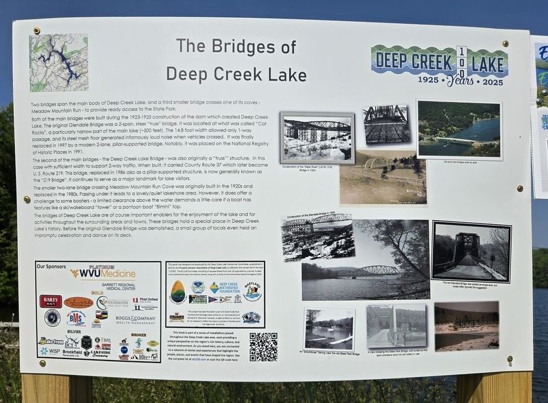
Two bridges span the main body of Deep Creek Lake, and a third smaller bridge crosses one of its coves - Meadow Mountain Run - to provide ready access to the State Park.
Both of the main bridges were built during the 1923-1925 construction of the dam which created Deep Creek Lake. The original Glendale Bridge was a 2-span, steel “truss” bridge. It was located at what was called “Cat Rocks”, a particularly narrow part of the main lake (~500 feet). The 14.8 foot width allowed only 1-way passage, and its steel mesh floor generated infamously loud noise when vehicles crossed. It was finally replaced in 1997 by a modern 2-lane, pillar-supported bridge. Notably, it was placed on the National Registry of Historic Places in 1991.
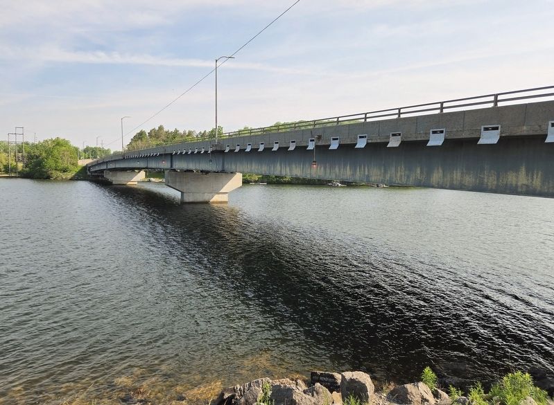
The second of the main bridges - the Deep Creek Lake Bridge - was also originally a “truss’” structure, in this case with sufficient width to support 2-way traffic. When built, it carried County Route 37 which later became U. S. Route 219. This bridge, replaced in 1986 also as a pillar-supported structure, is now generally known as the “219 Bridge”. It continues to serve as a major landmark for
this page online
The smaller two-lane bridge crossing Meadow Mountain Run Cove was originally built in the 1920s and replaced in the 1980s. Passing under it leads to a lovely/quiet lakeshore area. However. it does offer a challenge to some boaters - a limited clearance above the water demands a little care if a boat has features like a ski/wakeboard “tower” or a pontoon boat “Bimini” top.
The bridges of Deep Creek Lake are of course important enablers for the enjoyment of the lake and for activities throughout the surrounding areas and towns. These bridges hold a special place in Deep Creek Lake’s history. Before the original Glendale Bridge was demolished, a small group of locals even held an impromptu celebration and dance on its deck.
(Captions):
Construction of the "State Road" (US Rt. 219) Bridge in 1924
Old and new bridges side-by-side
Construction of the Glendale Bridge in 1924
The old Glendale Bridge was posted as single-lane, but locals offen ignored the suggestion
An "amphbicar" fishing near the old State Park Bridge
A view crossing the State Park Bridge, with evidence that spell-checkers were not yet widely in use
Erected 2025
Photographed by Bradley Owen, June 12, 2025
2. The Bridges of Deep Creek Lake Marker
Topics. This historical marker is listed in these topic lists: Bridges & Viaducts • Waterways & Vessels. A significant historical year for this entry is 1997.
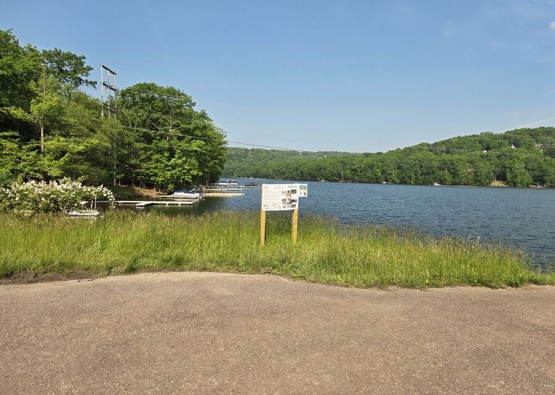
Location. 39° 31.619′ N, 79° 20.659′ W. Marker is near Oakland, Maryland, in Garrett County. It is on Lake Shore Drive west of Garrett Highway (U.S. 219), on the right when traveling west. Marker is located on the left side of a paved dead end road that heads north towards the lake. Touch for map. Marker is at or near this postal address: 3582 Lake Shore Drive, Oakland MD 21550, United States of America. Touch for directions.

Regionally, this marker is in Western Maryland. It is also in the American Mid-Atlantic, in Appalachia, and specifically in Northern Appalachia. Globally, it is in North America, the Western Hemisphere, the Western World, and the Anglosphere. Historically, it finds itself in what was once one of the original Thirteen Colonies.
Other nearby markers. At least 8 other markers are within 2 miles of this marker, measured as the crow flies: Einstein's Visit to Deep Creek Lake (approx. 0.6 miles away); Deep Creek Lake
Photographed by Bradley Owen, June 12, 2025
3. The “219 Bridge”
View of the bridge from the marker location.
Other markers no longer nearby. Thayer Game Refuge (was approx. ¼ mile away but has been confirmed missing); Col. James McHenry of Baltimore (was approx. 1.4 miles away but has been confirmed missing).
Credits. This page was last revised on June 15, 2025. It was originally submitted on June 15, 2025, by Bradley Owen of Morgantown, West Virginia. This page has been viewed 636 times since then and 264 times this year. Photos: 1, 2, 3. submitted on June 15, 2025, by Bradley Owen of Morgantown, West Virginia.
