Strokestown in County Roscommon, Connacht, Ireland — Irish West ((Éire) North Atlantic Ocean)
Strokestown Brewery
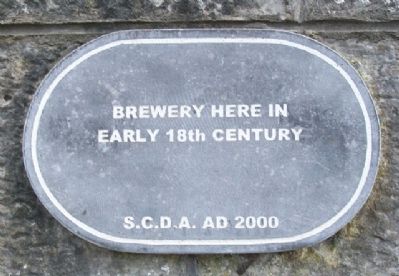
Photographed by William Fischer, Jr., September 23, 2009
1. Strokestown Brewery Marker
early 18th century
Erected 2000 by Strokestown Community Development Association.
Topics. This historical marker is listed in these topic lists: Colonial Era • Industry & Commerce.
Location. 53° 46.611′ N, 8° 6.128′ W. Marker is in Strokestown, Connacht, in County Roscommon. It is on Bawn Street, on the right when traveling east. Marker is about 50 meters WSW of the entrance to Strokestown Park House and The Famine Museum. Touch for map. Touch for directions.

Regionally, this marker is in the Hidden Heartlands. Globally, it is on the Atlantic Ocean, in the North Atlantic Region, on the Atlantic Arc, in Europe, on the Island of Ireland, on the Celtic Fringe, in the European Union, in Atlantic Europe, on one of the British Isles, in the Western World, and in the Anglosphere.
Other nearby markers. At least 6 other markers are within 14 kilometers of this marker, measured as the crow flies: Mahon Dower House (within shouting distance of this marker); Dr. Dudley Forde House (within shouting distance of this marker); The Sharkey Sisters
this page online
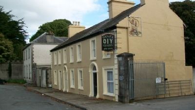
Photographed by William Fischer, Jr., September 23, 2009
2. Strokestown Brewery Marker
Wall along entrance to the Strokestown Park House Estate is at left distance.
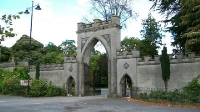
Photographed by William Fischer, Jr.
3. Entrance to Strokestown Park House and Estate
Credits. This page was last revised on July 12, 2019. It was originally submitted on February 15, 2010, by William Fischer, Jr. of Reynoldsburg, Ohio. This page has been viewed 1,277 times since then and 25 times this year. Photos: 1, 2, 3. submitted on February 15, 2010, by William Fischer, Jr. of Reynoldsburg, Ohio.
