Near McHenry in Garrett County, Maryland — The American Northeast (Mid-Atlantic)
Deep Creek Lake
Photographed by Bradley Owen, June 12, 2025
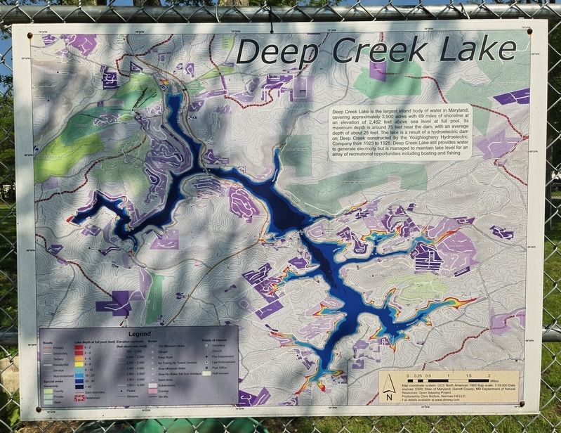
1. Deep Creek Lake Marker
Deep Creek Lake is the largest inland body of water in Maryland, covering approximately 3,900 acres with 69 miles of shoreline at an elevation of 2,462 feet above sea level at full pool. Its maximum depth is around 75 feet near the dam, with an average depth of about 25 feet. The lake is a result of a hydroelectric dam on Deep Creek constructed by the Youghiogheny Hydroelectric Company from 1923 to 1925. Deep Creek Lake still provides water to generate electricity but is managed to maintain lake level for an array of recreational opportunities including boating and fishing.
Erected 2019 by Chris Nichols, Founder, Narrows Hill LLC.
Topics. This historical marker is listed in these topic lists: Industry & Commerce • Waterways & Vessels. A significant historical year for this entry is 1923.
Location. 39° 34.387′ N, 79° 20.13′ W. Marker is near McHenry, Maryland, in Garrett County. It can be reached from Bumble Bee Road 1.3 miles north of Mosser Road, on the left when traveling north. Marker is located in Deep Creek Lions Club Park. Touch for map. Marker is at or near this postal address: 1249 Bumble Bee Road, Mc
this page online

Regionally, this marker is in Western Maryland. It is also in the American Mid-Atlantic, in Appalachia, and specifically in Northern Appalachia. Globally, it is in North America, the Western Hemisphere, the Western World, and the Anglosphere. Historically, it finds itself in what was once one of the original Thirteen Colonies.
Other nearby markers. At least 8 other markers are within walking distance of this marker: Doing Good at Deep Creek Lake (here, next to this marker); It takes a community... to build a community park (a few steps from this marker); Blind Campers Given the Joy of Outdoors Fun With the Deep Creek Lake Lions Club (a few steps from this marker); Deep Creek Lake Lions Give Sight-Challenged Students the Adventure of a Lifetime (a few steps from this marker); Meshach Browning surveys a mountain sunset (about 300 feet away, measured in a direct line); Meshach Browning Trail System (about 300 feet away); Life in Western Maryland during the Pioneer Era (about 300 feet away); Mary Browning and her Tree of Life (about 300 feet away). Touch for a list and map
Photographed by Bradley Owen, June 12, 2025
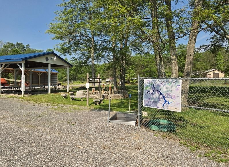
2. Deep Creek Lake Marker
Credits. This page was last revised on June 18, 2025. It was originally submitted on June 16, 2025, by Bradley Owen of Morgantown, West Virginia. This page has been viewed 132 times since then and 25 times this year. Photos: 1, 2. submitted on June 16, 2025, by Bradley Owen of Morgantown, West Virginia.
