Cross Keys in Rockingham County, Virginia — The American South (Mid-Atlantic)
The Armies Brace for Battle
"A Position of Uncommon Strength"
| — | The Battle of Cross Keys (June 8, 1862) | — |
Photographed by Jay Richardson, June 14, 2025
1. The Armies Brace for Battle Marker
Early Morning
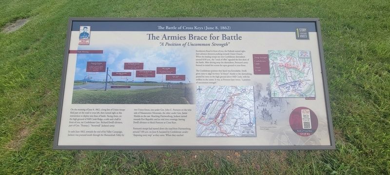
On the morning of June 8, 1862, a long line of Union troops filed past on the road to your left, turned right at this intersection to deploy into lines of battle. Facing them, on the high ground of Mill Creek Ridge, a mile and a half in front of you, sat Confederate Gen. Richard Ewell's division, part of Gen. Thomas J. "Stonewall" Jackson's army.
In early June 1862, towards the end of his Valley Campaign, Jackson was pursued south through the Shenandoah Valley by two Union forces, one under Gen. John C. Fremont on the west side of Massanutten Mountain, the other under Gen. James Shields on the east. Reaching Harrisonburg, Jackson turned towards Port Republic and its vital river crossings, leaving Ewell's division to block Fremont at Cross Keys.
Fremont's troops had started down the road from Harrisonburg around 7:00 a.m. on June 8, harassed by Confederate cavalry "disputing every step" as they came. When they reached Keezletown Road in front of you, the Federals turned right, their advance elements pushing towards Union Church. When the leading troops ran into Confederate skirmishers around 8:30 a.m.,
this page online
The Confederate position they faced was formidable. Ewell, given time to align his force "at leisure" thanks to the skirmishing, posted his men on the high ground above Mill Creek, with his artillery in the center. It was, as Fremont later wrote, "a position of uncommon strength."
Troop Strength:
Confederates: 5,800
Union: 11,500
(caption) Fremont's army in pursuit of Jackson. Library of Congress.
Erected 2025 by Shenandoah Valley Battlefields Foundation. (Marker Number Stop #3.)
Topics. This historical marker is listed in this topic list: War, US Civil. A significant historical date for this entry is June 8, 1862.
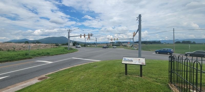
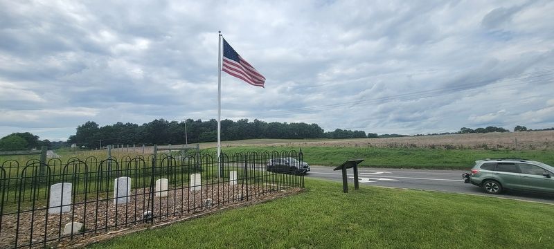
Location. Marker is missing. It was located near 38° 22.037′ N, 78° 49.966′ W. Marker was in Cross Keys, Virginia, in Rockingham County. It was at the intersection of Cross Keys Road (Virginia Route 276) and Port Republic Road ( Route 253), on the right when traveling south on Cross Keys Road. Located next to a small graveyard and an American
Photographed by Jay Richardson, June 14, 2025
2. Cross Keys Road and Port Republic Road

Regionally, this marker was in the Shenandoah Valley. It was also in the American South and specifically in the Upper South. Globally, it was in North America, the Western Hemisphere, the Western World, and the Anglosphere. Historically, it found itself in what was once the territory of the Mississippian Culture, one of the original Thirteen Colonies, one of the Confederate States of America, and the Antebellum South.
Other nearby markers. At least 8 other markers are within walking distance of this location: Battle of Cross Keys (approx. half a mile away); Kyles Mill House (approx. half a mile away); Cross Keys Cemetery (approx. 0.8 miles away); Union Church (approx. 0.8 miles away); Fighting in the Cemetery (approx. 0.8 miles away); Cross Keys Battlefield (approx. 0.8 miles away); a different marker also named Battle of Cross Keys (approx. 0.8 miles away); Milroy Moves Forward (approx. 0.8 miles away). Touch for a list and map of all markers in Cross Keys.
Other markers no longer
Photographed by Jay Richardson, June 14, 2025
3. Flag and graveyard next to marker - Port Republic Road

Photographed by Bradley Owen, July 21, 2025
4. The Armies Brace for Battle Marker
Marker is missing. The post holes remain.
Credits. This page was last revised on July 27, 2025. It was originally submitted on June 17, 2025, by Jay Richardson of Winchester, Virginia. This page has been viewed 204 times since then and 22 times this year. Photos: 1, 2, 3. submitted on June 17, 2025, by Jay Richardson of Winchester, Virginia. 4. submitted on July 27, 2025, by Bradley Owen of Morgantown, West Virginia. • Bernard Fisher was the editor who published this page.
