Kanosh in Millard County, Utah — The American Mountains (Southwest)
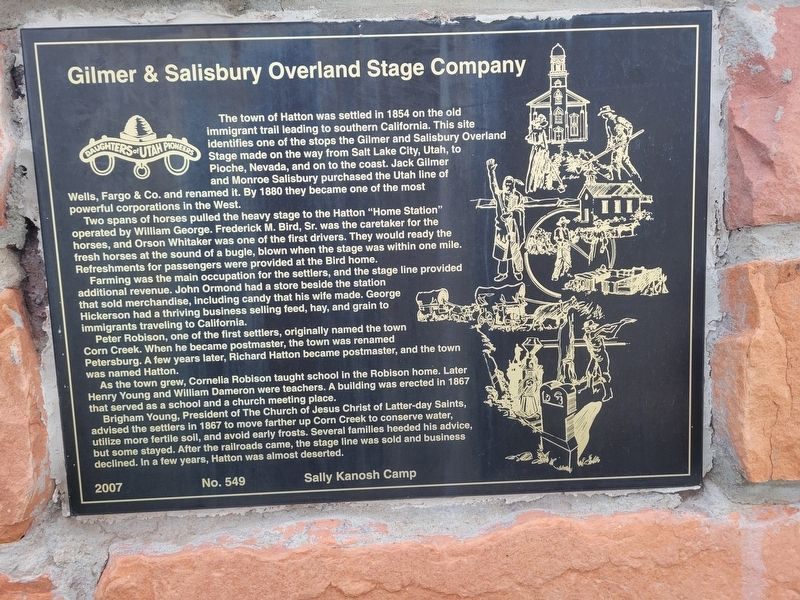
Gilmer & Salisbury Overland Stage Company
Photographed by Jeremy Snow, June 16, 2025
1. Gilmer & Salisbury Overland Stage Company Marker
Two spans of horses pulled the heavy stage to the Hatton "Home Station" operated by William George. Frederick M. Bird, Sr. was the caretaker for the horses, and Orson Whitaker was one of the first drivers. They would ready the fresh horses at the sound of a bugle, blown when the stage was within one mile. Refreshments for passengers were provided at the Bird home.
Farming was the main occupation for the settlers, and the stage line provided additional revenue. John Ormond had a store beside the station that sold merchandise, Including candy that his wife made. George Hickerson had a thriving business selling feed, hay, and grain to immigrants traveling to California.
Peter Robison, one of the
this page online
As the town grew, Cornelia Robison taught school in the Robison home. Later Henry Young and William Dameron were teachers. A building was erected in 1867 that served as a school and a church meeting place.
Brigham Young, President of The Church of Jesus Christ of Latter-day Saints, advised the settlers in 1867 to move farther up Corn Creek to conserve water, utilize more fertile soil, and avoid early frosts. Several families heeded his advice, but some stayed. After the railroads came, the stage line was sold and business declined. In a few years, Hatton was almost deserted.
Erected 2007 by Daughters of Utah Pioneers. (Marker Number 549.)
Topics. This historical marker is listed in these topic lists: Industry & Commerce • Roads & Vehicles • Settlements & Settlers. A significant historical year for this entry is 1854.
Location. 38° 50.395′ N, 112° 27.085′ W. Marker is in Kanosh, Utah, in Millard County. It is on West Hatton

Photographed by Jeremy Snow, June 16, 2025
2. Gilmer & Salisbury Overland Stage Company Marker

Regionally, this marker is in the Central Utah Valleys and in the West Desert. It is also in the American Mountain West and on the Colorado Plateau. Globally, it is in North America, the Western Hemisphere, the Western World, and the Anglosphere. Historically, it finds itself in what was once New Spain and also Mexico’s Alta California.
Other nearby markers. At least 8 other markers are within 11 miles of this marker, measured as the crow flies: 1867 Chief Kanosh Memorial 1976 (approx. 2.7 miles away); Kanosh (approx. 2.7 miles away); a different marker also named Kanosh (approx. 3.7 miles away); Taysom Cabin (approx. 3.7 miles away); Settlement of Meadow (approx. 3.9 miles away); Chief Walkara (approx. 4.2 miles away); Edward Partridge, Jr. House (approx. 11.1 miles away); Little Rock Schoolhouse (approx. 11.1 miles away). Touch for a list and map of all markers in Kanosh.
Credits. This page was last revised on June 17, 2025. It was originally submitted on June 17, 2025, by Jeremy Snow of Cedar City, Utah. This page has been viewed 407 times since then and 41 times this year. Photos: 1, 2. submitted on June 17, 2025, by Jeremy Snow of Cedar City, Utah. • Andrew Ruppenstein was the editor who published this page.
