Speckmannshof in Amberg, Bavaria, Germany — Central Europe
Bahnhof/ Railway Station
Amberg
Photographed by James Hulse, May 30, 2025
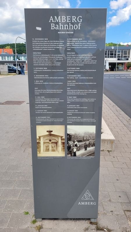
1. Bahnhof/ Railway Station Marker

12. Dezember 1859
Einfahrt des ersten Zuges der Linie Nürnberg-Schwandorf-Regensburg-München in den Amberger Bahnhof, der nach den Plänen des Direktions-Architekten der Ostbahn-Gesellschaft Heinrich von Hügel im „Maximilianstil“ erbaut worden war.
1859/1860
Zur besseren Anbindung der Stadt an den Bahnhof kam es zur weiträumigen Öffnung der Stadtmauer und dem Abbruch einiger Häuser am Platz „Auf der Wart“, darunter das „Türkenwirtshaus“. Teile der kurz zuvor geschaffenen Grünanlagen mussten ebenfalls wieder aufgegeben werden.
5. Oktober 1898
Eröffnung der Lokalbahnlinie Amberg-Schnaittenbach.
5. Dezember 1903
Inbetriebnahme der Strecke Amberg-Kastl-Lauterhofen.
1. Μai 1910
Eröffnung der Lokalbahn Amberg-Schmidmühlen.
1937
Planungen für einen Bahnhofsneubau durch Oberbahnrat Dorn, die kriegsbedingt nicht realisiert wurden.
17. Μai 1960
Vorstellung der Planungen zum Neubau des Amberger Bahnhofs, dessen Hauptteil eine zentrale Empfangs- und Schalterhalle bilden sollte.
11. Januar 1961
Beginn des Bahnhofsumbaus.
5. August 1961
Richtfest des neuen Bahnhofs-Empfangsgebäudes.
8. September 1962
Einweihung des jetzigen Bahnhofs in Anwesenheit von Bundesverkehrsminister Dr. Hans-Christoph Seebohm.
Bildunterschriften
(Foto #1) Eingangsbereich des „alten", im „Maximiliansstil" erbauten Bahnhofs um 1900 (Stadtarchiv Amberg Fotosammlung 102-061-001).
(Foto #2) Zum Abschied winkende Soldaten des 6. Infanterie-Regiments bei ihrer Abfahrt an die Front am 7. August 1914 (Stadtarchiv Amberg Fotosammlung 601-030-009).
12 December 1859
The first train on the Nuremberg-Schwandorf-Regensburg-Munich line enters Amberg station, built in "Maximilian Style" to plans of the Eastern Train Company director's architect, Heinrich von Hügel.
1859/1860
So
this page online
5 October 1898
The local line between Amberg and Schnaittenbach was opened.
5 December 1903
The Amberg-Kastl-Lauterhofen line started.
1 May 1910
The local train from Amberg to Schmidmühlen went into operation.
1937
Plans drawn up by Oberbahnrat Dorn, a high-ranking railway official, to build a new station were not implemented because of the ensuing war.
17 May 1960
Plans were introduced for building a new station in Amberg with a central reception lobby and ticket office.
11 January 1961
Conversion of the station was started.
5 August 1961
Topping out ceremony for the new station reception building.
8 September 1962
The present-day station was inaugurated in the presence of Federal Transport Minister Dr. Hans-Christoph Seebohm.
Captions
(Photo #1) Entrance area of the "old" train station, built in the "Maximilian style" around 1900 (Amberg City Archives Photo Collection 102-061-001).
(Photo #2) Soldiers of the 6th Infantry Regiment waving farewell as they depart for the front on August 7, 1914 (Amberg City Archives Photo Collection 601-030-009).
Erected by Amberg
Photographed by James Hulse, May 30, 2025
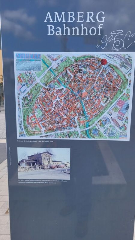
2. Reverse of the Railway Station Marker
Topics. This historical marker is listed in this topic list: Railroads & Streetcars. A significant historical date for this entry is January 11, 1961.
Location. 49° 26.82′ N, 11° 51.707′ E. Marker is in Amberg, Bayern (Bavaria). It is in Speckmannshof. It is at the intersection of Bahnhofstraße and Batteriegasse, on the right when traveling west on Bahnhofstraße. The marker is located along the street. Touch for map. Marker is at or near this postal address: Bahnhofstraße 21, Amberg BY 92224, Germany. Touch for directions.

Regionally, it is in Europe, the European Union, Atlantic Europe, Central Europe, the Schengen Area, Western Europe, and the Western World. Historically, it finds itself in what was once the Holy Roman Empire and also the former West Germany.
Other nearby markers. At least 8 other markers are within walking distance of this marker: Spitalkirche / Infirmary Church (about 150 meters away, measured in a direct line); Nabburger Tores / Nabburger Gate (about 180 meters away); Karl and Erika Giehrl (about 240 meters away); Morawitzky-Palais / Morawitzky Residence (about 240 meters away); Nabburgertor / Nabburg Gate (approx. 0.3 kilometers away); Nabburger Tor / Nabburg Gate (approx. 0.3 kilometers away); Ziegeltor / Ziegel Gate (approx. 0.3 kilometers away); a different marker also named Nabburger Tor / Nabburg Gate (approx. 0.3 kilometers away). Touch for a list and map of all markers in Amberg.
Photographed by James Hulse, May 30, 2025
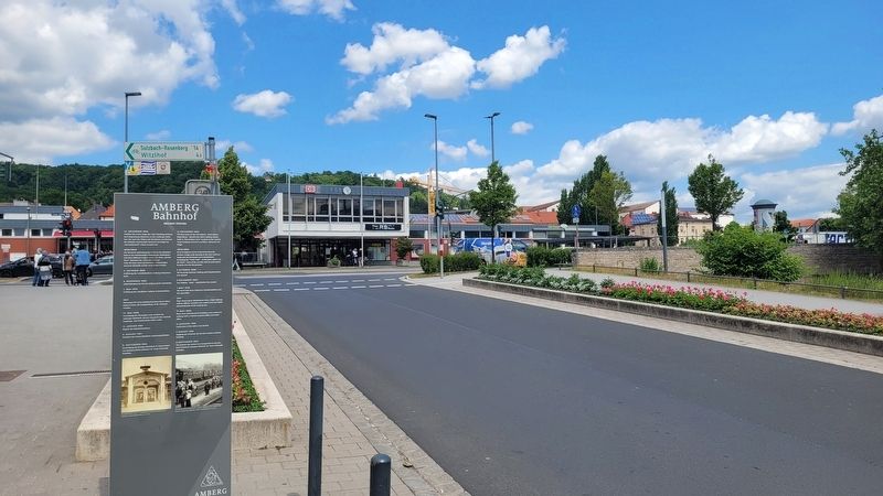
3. Bahnhof/ Railway Station Marker
Photographed by James Hulse, May 30, 2025
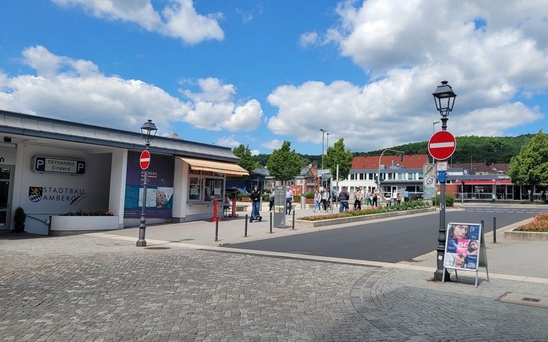
4. The view of the Railway Station Marker from across the street
Credits. This page was last revised on June 18, 2025. It was originally submitted on June 17, 2025, by James Hulse of Medina, Texas. This page has been viewed 111 times since then and 14 times this year. Photos: 1, 2, 3, 4. submitted on June 18, 2025, by James Hulse of Medina, Texas.
