Ohioville in Beaver County, Pennsylvania — The American Northeast (Mid-Atlantic)
Ohioville

Photographed by Mike Wintermantel, May 9, 2015
1. Ohioville Marker
Nearness to Ohio River
Founded
1805
Erected by Pennsylvania Department of Highways.
Topics and series. This historical marker is listed in these topic lists: Settlements & Settlers • Waterways & Vessels. In addition, it is included in the Pennsylvania Keystone Markers series list. A significant historical year for this entry is 1805.
Location. 40° 40.715′ N, 80° 29.671′ W. Marker is in Ohioville, Pennsylvania, in Beaver County. It is on Smith Ferry Road 0.1 miles south of Tuscarawas Road, on the right when traveling north. Touch for map. Touch for directions.

Regionally, this marker is in Greater Pittsburgh. It is also in the American Northeast, in the Mid-Atlantic, and in the Ohio River Valley. Globally, it is in North America, the Western Hemisphere, the Western World, and the Anglosphere. Historically, it finds itself in what was once the Haudenosaunee (Iroquois) Confederacy and also one of the original Thirteen Colonies.
Other nearby markers. At least 8 other markers are within 3 miles of this marker, measured as the crow flies: Fairview (approx. 1.3 miles away); a different
this page online
Another marker is no longer nearby. First Paper Mill / Little Beaver Creek Bridge (was approx. 2½ miles away in Ohio but has been confirmed missing).

Photographed by Mike Wintermantel, May 9, 2015
2. Ohioville Marker
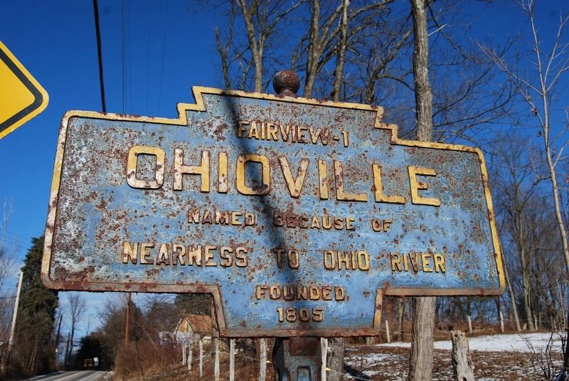
Photographed by Mike Wintermantel, December 27, 2013
3. Ohioville Marker
Before being repainted by KMT Board Member Mike Wintermantel.
Credits. This page was last revised on June 17, 2025. It was originally submitted on June 17, 2025, by Mike Wintermantel of Pittsburgh, Pennsylvania. This page has been viewed 127 times since then and 35 times this year. Photos: 1, 2, 3. submitted on June 17, 2025, by Mike Wintermantel of Pittsburgh, Pennsylvania.
