Piqua in Miami County, Ohio — The American Midwest (Great Lakes)
Lock Nine
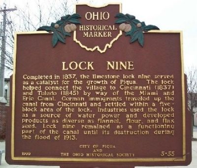
Photographed by William Fischer, Jr., March 6, 2009
1. Lock Nine Marker
Erected 1999 by City of Piqua and The Ohio Historical Society. (Marker Number 5-55.)
Topics and series. This historical marker is listed in these topic lists: Disasters • Industry & Commerce • Settlements & Settlers • Waterways & Vessels. In addition, it is included in the Ohio Historical Society / The Ohio History Connection, and the The Miami & Erie Canal series lists. A significant historical year for this entry is 1837.
Location. Marker has been reported missing. It was located near 40° 8.837′ N, 84° 14.289′ W. Marker was in Piqua, Ohio, in Miami County. It was at the intersection
this page online

Regionally, this marker was in the Dayton Metro, in the Miami Valley, and in the Till Plains. It was also in the American Midwest and in the Corn Belt. Globally, it was in North America, the Western Hemisphere, the Western World, and the Anglosphere. Historically, it found itself in what was once the Haudenosaunee (Iroquois) Confederacy, the territory of the Mississippian Culture, and the Northwest Territory.
Other nearby markers. At least 8 other markers are within walking distance of this location: Lock Nine Riverfront Park (a few steps from this marker); Shawnee Bridge (about 300 feet away, measured in a direct line); Main Street (about 400 feet away); Public Square (about 500 feet away); Capt. Don Gentile (about 600 feet away); a different marker also named Shawnee Bridge
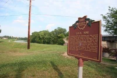
Photographed by Dale K. Benington, July 11, 2010
2. Lock Nine Marker
View of historical marker looking east along the north bank of the Great Miami River.
Another marker is no longer nearby. The 1913 Flood (was within shouting distance of this marker but has been permanently removed).
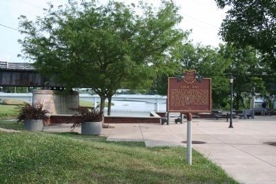
Photographed by Dale K. Benington, July 11, 2010
3. Lock Nine Marker
View looking south of the historical marker at Lock Nine Park, with a view in the background of the Great Miami River and a bridge spanning the river.
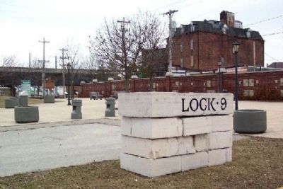
Photographed by William Fischer, Jr., March 6, 2009
4. Lock Nine Riverfront Park and Marker
Photographed by Dale K. Benington, July 11, 2010
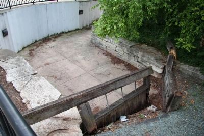
5. Lock Nine
View looking south of the original site of the canal lock 9, and the south entrance to the lock.
Photographed by Dale K. Benington, July 11, 2010
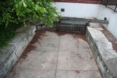
6. Lock Nine
View at Lock 9 Park, looking north at the partially reconstructed canal Lock 9.
Credits. This page was last revised on June 27, 2025. It was originally submitted on March 22, 2009, by William Fischer, Jr. of Reynoldsburg, Ohio. This page has been viewed 2,482 times since then and 175 times this year. Last updated on June 17, 2025, by Craig Doda of Napoleon, Ohio. Photos: 1. submitted on March 22, 2009, by William Fischer, Jr. of Reynoldsburg, Ohio. 2. submitted on January 23, 2011, by Dale K. Benington of Toledo, Ohio. 3. submitted on January 22, 2011, by Dale K. Benington of Toledo, Ohio. 4. submitted on March 22, 2009, by William Fischer, Jr. of Reynoldsburg, Ohio. 5, 6. submitted on January 23, 2011, by Dale K. Benington of Toledo, Ohio. • Devry Becker Jones was the editor who published this page.
