
Pelham Bay Park in the Bronx in Bronx County, New York — The American Northeast (Mid-Atlantic)
Glover's Rock
Pelham Bay Park
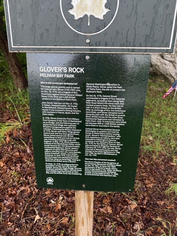
Who is this monument dedicated to?
This large, glacial granite rock is named for Colonel John Glover (1732-1797) who, on Oct. 18, 1776, led a brigade of 843 Americans against British General William Howe (1720-1814) and 4,000 British soldiers in the Battle on Pell's Point.
John Glover was born on Nov. 5, 1732, in Salem, Massachusetts. He moved to Marblehead, Massachusetts, for a career in the successful fishing industry, with markets in France, Spain, and the West Indies.
In 1759, Glover joined the Third Military Foot Company in the Town of Marblehead as an Ensign, and the following year he joined the local Whigs who opposed Britain's transgressions against the colonies. Following the Boston Massacre of 1770, Glover and fellow Whigs gained control over the Tory town government. Glover joined several anti-British committees to limit and subvert British rule including prohibiting trade with England. In May 1775, Glover became a Colonel of the Marblehead Militia, which would become the 14th Massachusetts Continental Regiment. Glover raised a regiment of about 500 fishermen and sailors, including men who were Spanish,
this page online
On Sept. 13, 1776, he safeguarded the evacuation of New York City through Harlem, across the King's Bridge, and into the Bronx and White Plains. General Howe and a British fleet had landed on Kip's Bay, and the British Army was threatening General Washington's position in White Plains. Glover spied the fleet off Pell's point, the site of present-day Rodman's Neck.
On Oct. 18, 1776, Colonel Glover commanded a brigade of four separate regiments, spreading them along Split Rock Road behind the stone walls that marked property lines. He then led 40 men in a direct attack on the British. After an exchange of fire, two Americans were killed, and Glover retreated north along the path with the British in pursuit. Soon, British forces hit the other three Continental Regiments and retreated to Pell's Point. Only 12 Americans were killed, yet between 800 to 1,000 British soldiers were killed or wounded in the battle.
Colonel Glover thus enabled General
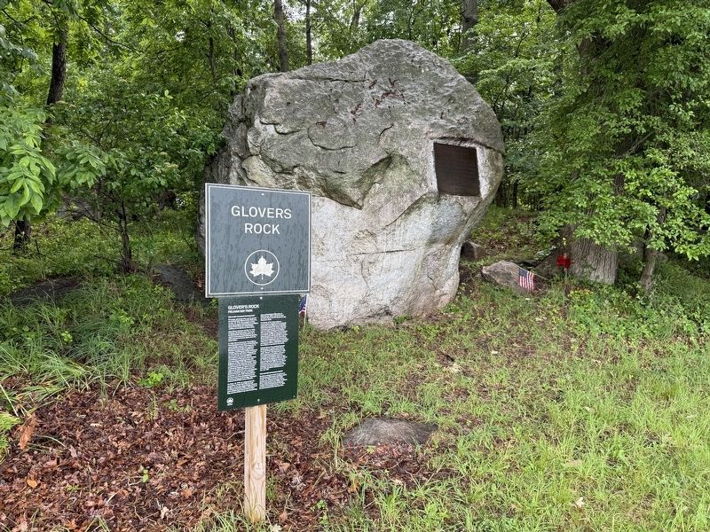
How was this monument created?
The Bronx Chapter of the Daughters of the American Revolution erected a tablet on Oct. 18, 1901, to honor the 125th anniversary of Glover's heroic victory. After it was stolen in the 1930s, the Bronx County Historical Society dedicated another bronze tablet on Nov. 11, 1960, to commemorate this important site.
Erected by NYC Parks. (Marker Number 301.)
Topics and series. This historical marker is listed in these topic lists: Industry & Commerce • Patriots & Patriotism • War, US Revolutionary • Waterways & Vessels. In addition, it is included in the NYC Parks series list. A significant historical date for this entry is February 23, 1777.
Location. 40° 51.906′ N, 73° 48.181′ W. Marker is in Bronx, New York, in Bronx County. It is in Pelham Bay Park. It is on Orchard Beach Road west of Park Drive, on the right when traveling east. Touch for map. Marker is at or near this postal address: 1 Orchard Beach Rd, Bronx NY 10464, United States of America. Touch for directions.

Regionally, this marker is in New York City. It is also in the American Northeast, in the Mid-Atlantic, and on the Eastern Seaboard. Globally, it is in the North Atlantic Region, North America, the Western Hemisphere, the Western World, and the Anglosphere. Historically, it finds itself in what was once New Netherland and also one of the original Thirteen Colonies.
Other nearby markers. At least 8 other markers are within walking distance of this marker: A different marker also named Glover’s Rock (a few steps from this marker); Bartow-Pell Mansion (approx. half a mile away); Bartow-Pell Mansion Museum (approx. half a mile away); Col. Lawrence G. Lane (approx. 0.9 miles away); World War II Memorial (approx. 0.9 miles away); Vietnam War Veterans (approx. 0.9 miles away); Korean War Veterans (approx. 0.9 miles away); St. Mary Star of the Sea 9/11 Memorial (approx. one mile away). Touch for a list and map of all markers in Bronx.
Other markers no longer nearby. Glover’s Rock (was here, next to this marker but has been replaced with another marker now near it); Pell’s Treaty Oak (was approx. 0.6 miles away but has been confirmed missing).
Related marker. Click here for another marker that is related to this marker. This marker has replaced the linked marker.
Credits. This page was last revised on June 18, 2025. It was originally submitted on June 18, 2025, by Devry Becker Jones of Washington, District of Columbia. This page has been viewed 209 times since then and 70 times this year. Photos: 1, 2. submitted on June 18, 2025, by Devry Becker Jones of Washington, District of Columbia.
