
Falaise in Calvados, Normandy, France — Western Europe
La Vie Dans L'enceinte
⎯⎯⎯
Life Inside the Enclosure
Photographed by James Hulse, June 2, 2025
1. La Vie Dans L'enceinte Marker - French Text

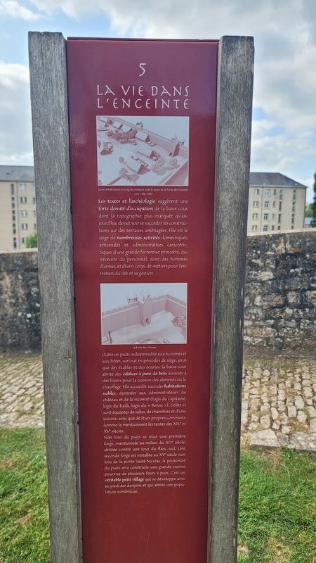
Les textes et l'archéologie suggèrent une forte densité d'occupation de la basse cour, dont la topographie plus marquée qu'aujourd'hui devait voir se succéder les constructions sur des terrasses aménagées. Elle est le siège de nombreuses activités domestiques, artisanales et administratives caractéristiques d'une grande forteresse princière, qui nécessite du personnel, dont des hommes d'armes, et divers corps de métiers pour l'entretien du site et sa gestion.
Outre un puits indispensable aux hommes et aux bêtes, surtout en périodes de siège, ainsi que des étables et des écuries, la basse cour abrite des édifices à pans de bois associés à des foyers pour la cuisson des aliments ou le chauffage. Elle accueille aussi des habitations nobles, destinées aux administrateurs du château et de la vicomté (logis du capitaine, logis du bailli, logis du «Barou»). Celles-ci sont équipées de salles, de chambres et d'une cuisine, ainsi que de leurs propres communs, comme le mentionnent les textes des XIVe et XVe siècles.
Non loin du puits se situe une première forge, mentionnée au milieu du XIVe siècle, abritée contre une tour du flanc sud. Une seconde forge est installée au XVe siècle non loin de la porte Saint-Nicolas. À proximité du puits sera construite une grande cuisine pourvue de plusieurs fours à pain. C'est un véritable petit village qui se développe ainsi au pied des donjons et qui abrite une population nombreuse.
Légendes
(Photo #1) Zone d'habitation le long du rempart sud, le puits et la Porte des Champs vers 1160-1200.
(Photo #2) La Porte des Champs.
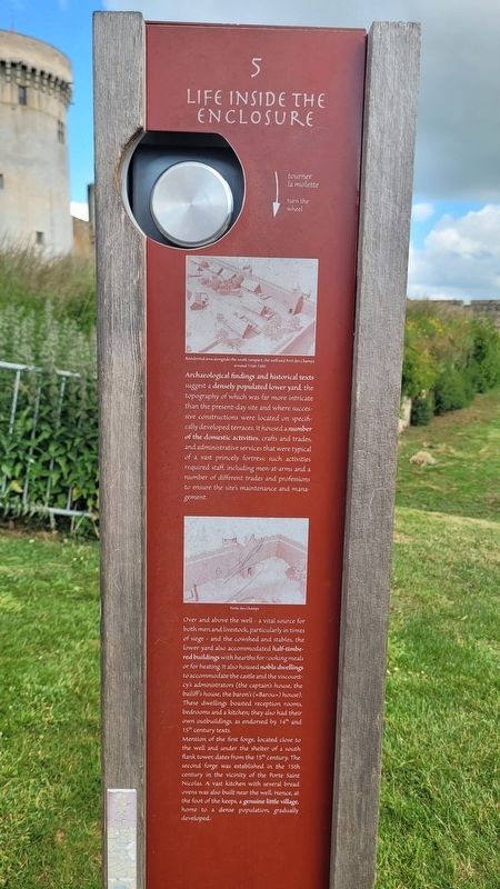
Archaeological findings and historical texts suggest a densely populated lower yard, the topography of which was far more intricate than the present-day site and where successive constructions were located on specifically developed terraces. It housed a number of the domestic activities, crafts and trades, and administrative services that were typical of a vast princely fortress; such activities required staff, including men-at-arms and a number of different trades and professions to ensure the site's maintenance and management.
Over and above the well - a vital source for both men and livestock, particularly in times of siege - and the cowshed and stables, the lower yard also accommodated half-timbered buildings with hearths for cooking meals or for heating. It also housed noble dwellings to accommodate the castle and the viscountcy's administrators (the captain's house, the bailiff's house, the baron's («Barou») house). These dwellings boasted reception rooms, bedrooms and a kitchen; they also had their own outbuildings, as endorsed by 14th and 15th century texts.
Mention of the first forge, located close to the well and under the shelter of a south flank tower, dates from the 15th century. The second forge was established in the 15th century in the vicinity of the Porte Saint Nicolas. A vast kitchen with several bread ovens was also built near the well. Hence, at the foot of the keeps, a genuine little village, home to a dense population, gradually developed.
Captions
(Photo #1) Residential area alongside the south rampart, the well and Port des Champs around 1160-1200.
(Photo #2) Porte des Champs.
Erected by Conseil
this page online
Topics. This historical marker is listed in these topic lists: Anthropology & Archaeology • Forts and Castles • Settlements & Settlers.
Location. 48° 53.57′ N, 0° 12.261′ W. Marker is in Falaise, Normandie (Normandy), in Calvados. It is at the intersection of Pl. Guillaume le Conquérant and Rue Blacher on Pl. Guillaume le Conquérant. The marker is located on the grounds of the Château Guillaume-le-Conquérant. Touch for map. Marker is in this post office area: Falaise, Normandie 14700, France. Touch for directions.

Regionally, it is in the North Atlantic Region, Europe, the European Union, Atlantic Europe, the Schengen Area, Western Europe, a coastal Mediterranean country, and the Western World. Historically, it finds itself in what was once a French colony and also the Roman Empire.
Other nearby markers. At least 8 other markers are within walking distance of this marker: La Haute Cour et les Donjons / The Upper Yard and the Keeps (within shouting distance of this marker);
Photographed by James Hulse, June 2, 2025
2. Life Inside the Enclosure Marker - English Text
Also see . . . History. Chateau Guillaume-le-Conquerant
The site of Falaise, situated on the edge of the first foothills of the Armorican massif, has been occupied by man since at least the Mesolithic Age (around 7000 BC). Different types of settlement succeeded one another over the centuries, and it seems that a fortification already exists on the rock in the Carolingian era.(Submitted on June 21, 2025, by James Hulse of Medina, Texas.)
Taking advantage of this protection, the town develops on the rocky spur formed by the two valleys of the Ante and Marescot rivers. The beginning of the 10th century saw the creation of the dukedom of Normandy (the land of the northmen)after the Viking chief Rollo was granted land by Charles III “the simple”, king of franks, in 911. In this new political scene, the town and castle develop and change greatly and Falaise was to become one of the first cities of the new duchy.Photographed by James Hulse, June 2, 20253. A view of the marker and tower
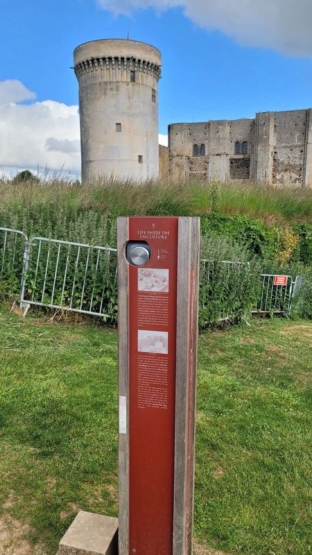
Photographed by James Hulse, June 2, 2025
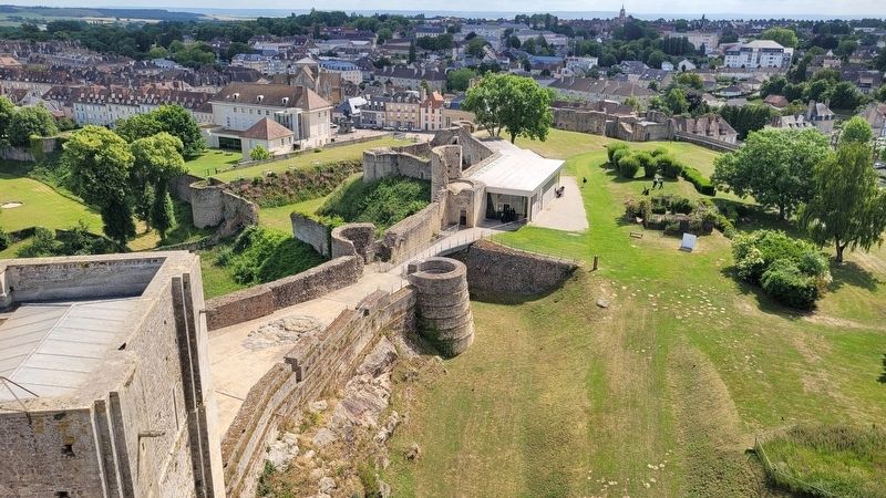
4. The view of inside the enclosure from the tower
Credits. This page was last revised on June 21, 2025. It was originally submitted on June 20, 2025, by James Hulse of Medina, Texas. This page has been viewed 67 times since then and 3 times this year. Photos: 1, 2, 3, 4. submitted on June 20, 2025, by James Hulse of Medina, Texas.
