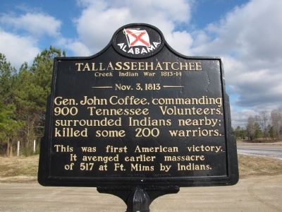
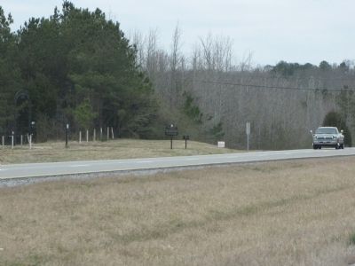
Near Alexandria in Calhoun County, Alabama — The American South (East South Central)
Tallasseehatchee
Creek Indian War 1813-14
— Nov. 3, 1813 —
Erected 1954 by Alabama Historical Association.
Topics and series. This historical marker is listed in these topic lists: Native Americans • Wars, US Indian. In addition, it is included in the Alabama Historical Association series list.
Location. 33° 48.617′ N, 85° 54.25′ W. Marker is near Alexandria, Alabama, in Calhoun County. Marker is on U.S. 431, 2 miles north of State Route 144, on the right when traveling south. located at the entrance to Tallasseehatchee Farm. Touch for map. Marker is in this post office area: Alexandria AL 36250, United States of America. Touch for directions.
Other nearby markers. At least 8 other markers are within 8 miles of this marker, measured as the crow flies. Lincoyer (approx. 2.2 miles away); The Tallasahatchie Battle Field (approx. 2.2 miles away); Crook Cemetery (approx. 2½ miles away); Major John Pelham (approx. 5.7 miles away); The Birthplace of the “Gallant Pelham” (approx. 5.7 miles away); Janney Furnace (approx. 6.8 miles away); Jacksonville, Alabama (approx. 7½ miles away); The Depot (approx. 7½ miles away). Touch for a list and map of all markers in Alexandria.
Credits. This page was last revised on June 16, 2016. It was originally submitted on February 17, 2010, by Lee Hattabaugh of Capshaw, Alabama. This page has been viewed 2,923 times since then and 99 times this year. Photos: 1, 2. submitted on February 17, 2010, by Lee Hattabaugh of Capshaw, Alabama. • Craig Swain was the editor who published this page.

