Marker Logo
THE HISTORICAL
MARKER DATABASE
“Bite-Size Bits of Local, National, and Global History”
Northwest in Virginia Beach, Virginia — The American South (Mid-Atlantic)
 

Thoroughgood House


Thoroughgood House Marker image. Click for full size.
Photographed by Devry Becker Jones (CC0), June 11, 2025
1. Thoroughgood House Marker
Inscription. This dwelling illustrates the transition from Virginia's temporary frontier structures of the early 17th century to the more permanent, gentry houses of the 18th century. Adam Thorowgood, who came to the colony as an indentured servant and gained prominence as a landowner and burgess, obtained land here in 1635. The house was likely built ca. 1719 for his great-grandson, Argall Thorowgood II, and his wife Susannah. It was restored by the Adam Thoroughgood House Foundation and opened as a museum in 1957. The building was designated a National Historic Landmark in 1960 and listed on the National Register of Historic Places in 1966.
 
Erected 2017 by Department of Historic Resources. (Marker Number KW-16.)
 
Topics and series. This historical marker is listed in these topic lists: Colonial EraNotable BuildingsSettlements & Settlers. In addition, it is included in the National Historic Landmarks, and the Virginia Department of Historic Resources (DHR) series lists. A significant historical year for this entry is 1635.
 
Location. 36° 53.624′ N, 76° 6.821′ W. Marker is in Virginia Beach, Virginia. It is in Northwest.
Paid Advertisement
Click or scan to see
this page online
It is at the intersection of Parish Road and Thoroughgood Lane, on the right when traveling north on Parish Road. Touch for map. Marker is at or near this postal address: 1636 Parish Rd, Virginia Beach VA 23455, United States of America. Touch for directions.

Regionally, this marker is in Virginia’s Hampton Roads, specifically in Coastal Virginia, and in the Hampton Roads Metropolitan Area. It is also in the American South, specifically in the Upper South, and in the Tidewater. Globally, it is in the North Atlantic Region, North America, the Western Hemisphere, the Western World, and the Anglosphere. Historically, it finds itself in what was once the territory of the Mississippian Culture, one of the original Thirteen Colonies, one of the Confederate States of America, and the Antebellum South.

Other nearby markers. At least 8 other markers are within 2 miles of this marker, measured as the crow flies: Adam Thoroughgood House (within shouting distance of this marker); Thorowgoods in the Revolution (within shouting distance of this marker); Church Point (within shouting distance of this marker); Adam Thorowgood
Thoroughgood House Marker image. Click for full size.
Photographed by Devry Becker Jones (CC0), June 11, 2025
2. Thoroughgood House Marker
(approx. 0.9 miles away); Colonizing “Carolana” (approx. 0.9 miles away); Protecting Our Waterways and Wildlife (approx. one mile away); The Oyster Barge (approx. 1.2 miles away); Fisheries / Blue Crab (approx. 1.2 miles away). Touch for a list and map of all markers in Virginia Beach.
 
The Thoroughgood House image. Click for full size.
Photographed by Devry Becker Jones (CC0), June 11, 2025
3. The Thoroughgood House
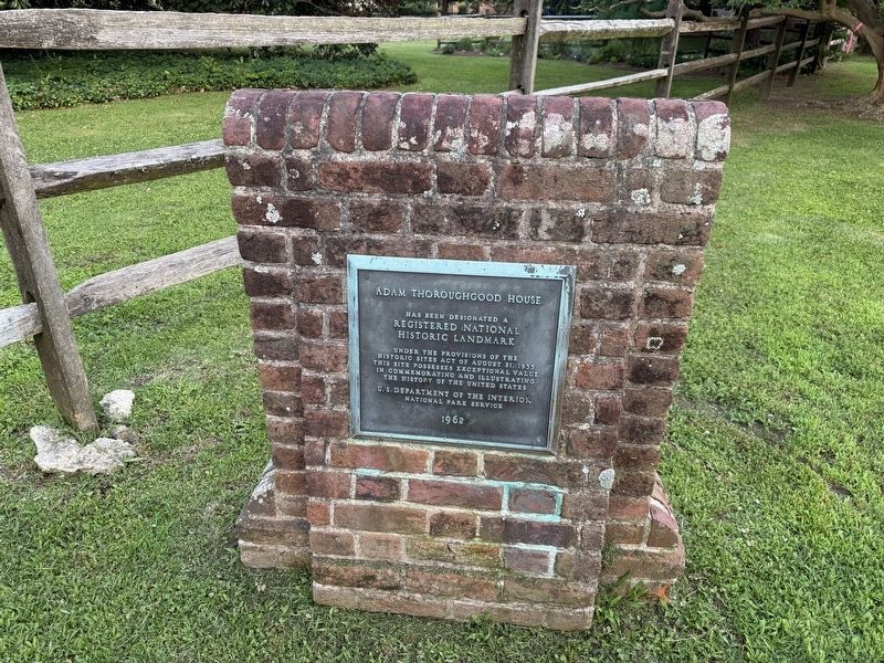
National Historic Landmark plaque for the house image. Click for full size.
Photographed by Devry Becker Jones (CC0), June 11, 2025
4. National Historic Landmark plaque for the house
 
 
Credits. This page was last revised on June 21, 2025. It was originally submitted on June 20, 2025, by Devry Becker Jones of Washington, District of Columbia. This page has been viewed 232 times since then and 38 times this year. Photos:   1, 2, 3, 4. submitted on June 20, 2025, by Devry Becker Jones of Washington, District of Columbia.

m=276136

CeraNet Cloud Computing sponsors the Historical Marker Database.
This website earns income from purchases you make after using our links to Amazon.com. We appreciate your support.
Paid Advertisement
Jul. 14, 2026