Moyock in Currituck County, North Carolina — The American South (South Atlantic)
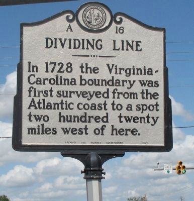
Dividing Line
Erected 1967 by Archives and Highway Departments. (Marker Number A-16.)
Topics and series. This historical marker is listed in these topic lists: Colonial Era • Political Subdivisions. In addition, it is included in the North Carolina Division of Archives and History series list. A significant historical year for this entry is 1728.
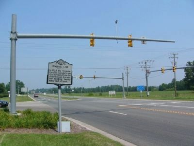
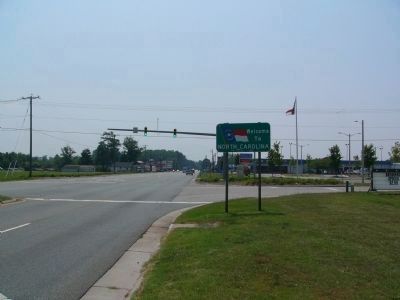
Location. 36° 33.011′ N, 76° 11.569′ W. Marker is in Moyock, North Carolina, in Currituck County. Marker is at the intersection of Caratoke Highway (Route 168) and North Point Road, on the right when traveling south on Caratoke Highway. Touch for map. Marker is in this post office area: Moyock NC 27958, United States of America. Touch for directions.
Other nearby markers. At least 8 other markers are within 11 miles of this marker, measured as the crow flies. Moyock (approx. 2.1 miles away); Seven Patriot Heroes (approx. 3.2 miles away in Virginia); St. Bride's Church (approx. 3.7 miles away in Virginia); The Cuffeytown Thirteen (approx. 5.7 miles away in Virginia); Pleasant Grove Baptist Church Cemetery (approx. 6.2 miles away in Virginia); Dismal Swamp Canal (approx. 9˝ miles away); Eastern North Carolina (approx. 9˝ miles away); McBride Colored School (approx. 10.1 miles away).
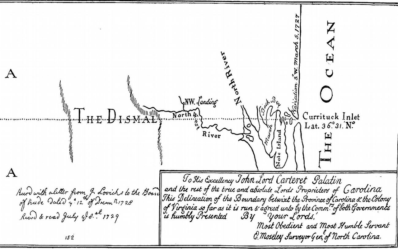
Regarding Dividing Line. Virginia and North Carolina’s early settlers intermingled beginning around 1650, particularly in North Carolina’s northeastern or Albemarle region, where colonists trickled down in search of good land to grow crops and establish homesteads. In the early 1700’s, explorer John Lawson began surveying a boundary between Carolina and Virginia at the behest of the Lord Proprietors, but was unable to complete the task. Because many colonists easily traveled back and forth between the two, the border between North Carolina and Virginia was vague until Virginian William Byrd first surveyed the line in 1728. Byrd and other surveyors defined the line from the coast as far westward as modern Stokes County, about 240 miles.
The survey of the boundary between the two colonies was completed in 1749 when Thomas Jefferson’s father, Peter, began in Stokes County and completed the survey to what is now Ashe County. The borders were often disputed and additional surveys were called to settle claims, the most notable in 1887, when the two states sponsored another joint boundary survey.
While Byrd’s adventure is
interesting in itself, the explorer and aristocratic planter published a journal of the expedition, The History of the Dividing Line Betwixt Virginia and North Carolina, where he wrote about places and people encountered while surveying the dividing line. In the alternate version, titled The Secret History of the Line, Byrd candidly described the attitudes and abilities of men from both Virginia and North Carolina, tending to place the former over the latter. The unofficial account was only recently published, as Byrd’s frank descriptions of raw colonial life in his secret history deterred many publishing companies. Both versions of Byrd’s account are entertaining, and offer a rare and humorous glimpse into life and travel in colonial America.
References:
William S. Powell, North Carolina Through Four Centuries (1989)
Louis B. Wright, ed., The Prose Works of William Byrd of Westover: Narratives of a Colonial Virginian (1966)
Allen Johnson, ed., Dictionary of American Biography, III, 383-384—sketch by Thomas Jefferson Wertenbaker
Kenneth A. Lockridge, The Diary and Life of William Byrd II of Virginia, 1674-1744 (1987)
William S. Powell, ed., Dictionary of North Carolina Biography, I, 663—sketch by Lindley S. Butler
Bill Sharpe, A New Geography of North Carolina (1954-1965)
Virginius Dabney, Virginia: The New Dominion (1992)
Virginia History: http://www.virginia.gov/cmsportal2/facts_and_history_4096/index.html
copied from the North Carolina Department of Cultural Resources
Photographed By Allen C. Browne, January 18, 2014
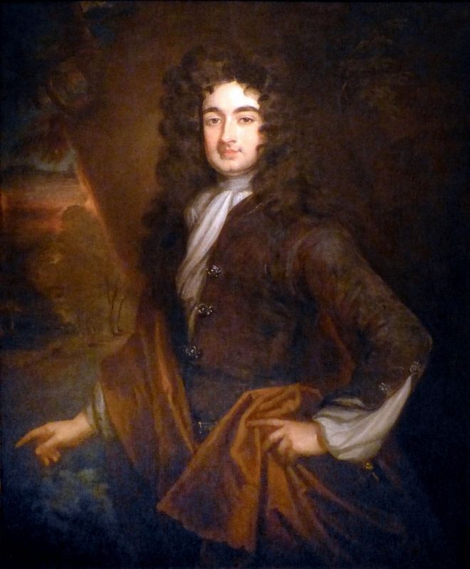
5. William Byrd II
This 1700-1704 portrait of William Byrd II (1674-1744) by Sir Godfrey Kneller hangs in the National Portrait Gallery in Washington, DC.
"William Byrd II inherited a great deal of property In Virginia that, together with the force of his personality and his own accomplishments, made him one of the most prominent and powerful men in the colony. He was educated and practiced law in England and traveled extensively there and on the Continent. Before returning to America, he commissioned this stylish portrait by Sir Godfrey Kneller, the principal painter to the British monarch. Byrd was a successful tobacco planter and served for many years on the Virginia Council. In 1728 he played a lead role in surveying the Virginia-North Carolina boundary line. One result of this work was Byrd's book, The History of the Dividing Line Run in the Year 1728, a colorful account of Virginia's history and its flora and fauna. Late in life he built Westover, a Georgian mansion on the James River, where he housed his collection of thirty portraits of family and other persons of note." -- National Portrait Gallery
Credits. This page was last revised on August 5, 2020. It was originally submitted on October 1, 2007, by Laura Troy of Burke, Virginia. This page has been viewed 3,442 times since then and 47 times this year. Photos: 1. submitted on October 1, 2007, by Laura Troy of Burke, Virginia. 2, 3. submitted on July 23, 2008, by Kevin W. of Stafford, Virginia. 4, 5. submitted on September 23, 2016, by Allen C. Browne of Silver Spring, Maryland. • J. J. Prats was the editor who published this page.
