Plymouth in Washington County, North Carolina — The American South (South Atlantic)
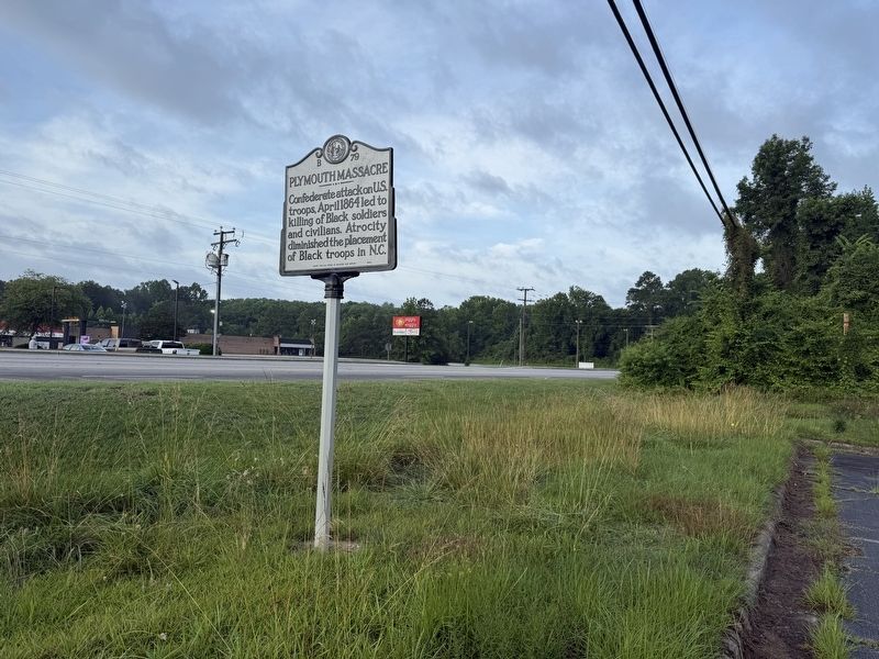
Plymouth Massacre

Erected 2024 by North Carolina Office of Archives and History. (Marker Number B-27.)
Topics and series. This historical marker is listed in these topic lists: African Americans • War, US Civil. In addition, it is included in the North Carolina Division of Archives and History series list. A significant historical month for this entry is April 1864.
Location. 35° 51.642′ N, 76° 44.295′ W. Marker is in Plymouth, North Carolina, in Washington County. It is at the intersection of U.S. 64 and Rankin Lane, on the right when traveling west on U.S. 64. Touch for map. Marker is at or near this postal address: 433 U.S Highway 64, Plymouth NC 27962, United States of America. Touch for directions.

Regionally, this marker is in the Coastal Plain. It is also in the American South, specifically in the Upper South, in the Tidewater, and on the Eastern Seaboard. Globally, it is in the North Atlantic Region, North America, the Western Hemisphere, the Western World, and the Anglosphere.
this page online
Other nearby markers. At least 8 other markers are within walking distance of this marker: Union Earthworks (approx. half a mile away); "To Free Our Race" (approx. 0.6 miles away); Carthagenia Lodge (approx. 0.6 miles away); Plymouth State Normal School (approx. 0.6 miles away); Naval Action (approx. 0.6 miles away); New Chapel Baptist Church (approx. 0.6 miles away); Siege of Plymouth, NC (approx. 0.6 miles away); Fort Compher Battlefield (approx. 0.6 miles away). Touch for a list and map of all markers in Plymouth.
Also see . . . Plymouth Massacre (B-79). Profile for the marker including an essay expanding on the text. (Submitted on June 22, 2025, by Devry Becker Jones of Washington, District of Columbia.)
Additional keywords. USCTs; U.S. Colored Troops
Credits. This page was last revised on June 22, 2025. It was originally submitted on June 22, 2025, by Devry Becker Jones of Washington, District of Columbia. This page has been viewed 185 times since then and 55 times this year. Photos: 1, 2. submitted on June 22, 2025, by Devry Becker Jones of Washington, District of Columbia.
