Saint Bees in Cumberland, England, United Kingdom — Northwestern Europe (the British Isles)
The Priory Church
| — | St Bees Heritage Trail | — |
Photographed by Ray Gurganus, April 11, 2025
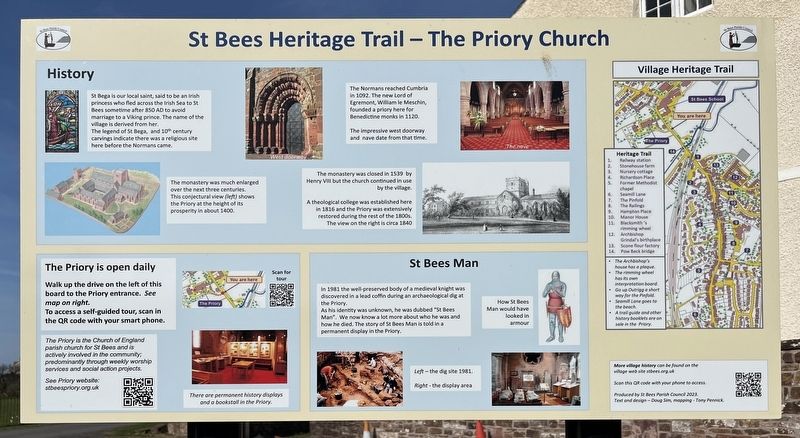
1. St Bees Heritage Trail - The Priory Church Marker
History
St Bega is our local saint, said to be an princess who fled across the Irish Sea to St Bees sometime after 850 AD to avoid marriage to a Viking prince. The name of the village is derived from her.
The legend of St Bega, and 10th century carvings indicate there was a religious site here before the Normans came.
The monastery was much enlarged over the next three centuries. This conjectural view (left) shows the Priory at the height of its prosperity in about 1400.
The Normans reached Cumbria in 1092. The new Lord of Egremont, William le Meschin founded a priory here for Benedictine monks in 1120.
The impressive west doorway and nave date from that time.
The monastery was closed in 1539 by Henry VIII but the church continued in use by the village.
A theological college was established here in 1836 and the Priory was extensively restored during the rest of the 1800s. The view on the right is circa 1840.
St Bees Man
In 1981 the well preserved body of a medieval knight was discovered in a lead coffin during an archaeological dig at the Priory.
As his identity was unknown, he was dubbed "St Bees
this page online
The Priory is open daily
Walk up the drive on the left of this board to the Priory entrance. See map on right.
To access a self-guided tour, scan in the QR code with your smart phone. The Priory is the Church of England parish church for St Bees and is actively involved in the community, predominantly through weekly worship services and social action projects.
Erected by St Bees Parish Council.
Topics. This historical marker is listed in these topic lists: Anthropology & Archaeology • Religion & Religious Structures.
Location. 54° 29.63′ N, 3° 35.527′ W. Marker is in Saint Bees, England, in Cumberland. It is on B5345. Touch for map. Marker is at or near this postal address: 4 B5345, Saint Bees, England CA27 0DS, United Kingdom. Touch for directions.

Regionally, this marker is in North West England. Globally, it is on the Atlantic Ocean, in the North Atlantic Region, in Europe, in Atlantic Europe, on one of the British Isles,
Photographed by Ray Gurganus, April 11, 2025
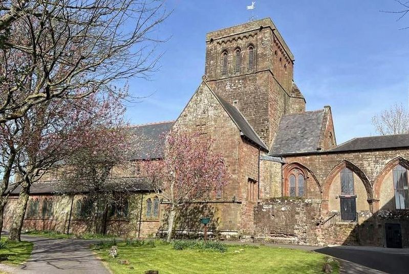
2. St Bees Priory
Other nearby markers. At least 8 other markers are within 18 kilometers of this marker, measured as the crow flies: St Bees Man (within shouting distance of this marker); Lost Railways of West Cumbria (approx. 16.9 kilometers away); Workington Station Timeline (approx. 16.9 kilometers away); Life in the Coal Mines (approx. 16.9 kilometers away); A Local History of Coal Mining (approx. 16.9 kilometers away); Decline of the Local Coal Industry (approx. 16.9 kilometers away); The Rail Making Process (approx. 16.9 kilometers away); The Steel Making Process (approx. 16.9 kilometers away).
Credits. This page was last revised on June 24, 2025. It was originally submitted on June 22, 2025, by Ray Gurganus of Washington, District of Columbia. This page has been viewed 119 times since then and 16 times this year. Photos: 1, 2. submitted on June 22, 2025, by Ray Gurganus of Washington, District of Columbia. • Andrew Ruppenstein was the editor who published this page.
