Near Voorheesville in Albany County, New York — The American Northeast (Mid-Atlantic)
Indian Ladder Farms
Photographed by Steve Stoessel, June 22, 2025
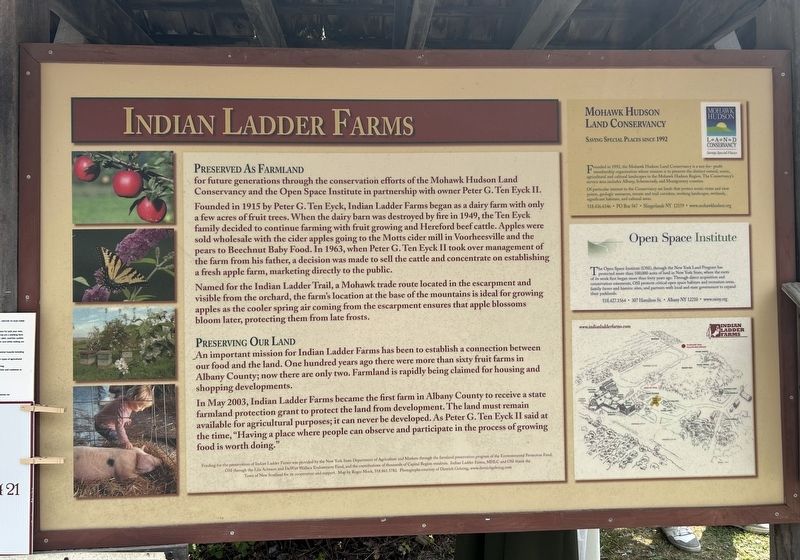
1. Indian Ladder Farms Marker
Preserved as Farmland for future generations through the conservation efforts of the Mohawk Hudson Land Conservancy and the Open Space Institute in partnership with owner Peter G. Ten Eyck II.
Founded in 1915 by Peter G. Ten Eyck, Indian Ladder Farms began as a dairy farm with only a few acres of fruit trees. When the dairy barn was destroyed by fire in 1949, the Ten Eyck family decided to continue farming with fruit growing and Hereford beef cattle. Apples were sold wholesale with the cider apples going to the Motts cider mill in Voorheesville and the pears to Beechnut Baby Food. In 1963, when Peter G. Ten Eyck II took over management of the farm from his father, a decision was made to sell the cattle and concentrate on establishing a fresh apple farm, marketing directly to the public.
Named for the Indian Ladder Trail, a Mohawk trade route located in the escarpment and visible from the orchard, the farm's location at the base of the mountains is ideal for growing apples as the cooler spring air coming from the escarpment ensures that apple blossoms bloom later, protecting them from late frosts.
Preserving Our Land
An
this page online
In May 2003, Indian Ladder Farms became the first farm in Albany County to receive a state farmland protection grant to protect the land from development. The land must remain available for agricultural purposes; it can never be developed. As Peter G. Ten Eyck II said at the time, "Having a place where people can observe and participate in the process of growing food is worth doing."
Mohawk Hudson Land Conservancy
Saving Special Places
Founded in 1992, the Mohawk Hudson Land Conservancy is a not-for-profit membership organization whose mission is to preserve the distinct natural, scenic, agricultural and cultural landscapes in the Mohawk Hudson Region. The Conservancy's service area includes Albany, Schenectady, and Montgomery counties.
Of particular interest to the Conservancy are lands that protect scenic vistas and view points, geologic resources,
Photographed by Steve Stoessel, June 22, 2025
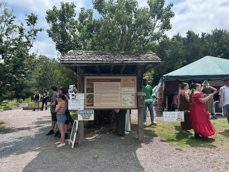
2. Indian Ladder Farms Marker
The farm was hosting the NY Capital District Renaissance Festival on this day.
518.436.6346 • PO Box 567 • Slingerlands NY 12159 • www.mohawkhudson.org
Open Space Institute
The Open Space Institute (OST), through the New York Land Program has protected more than 100,000 acres of land in New York State, where the roots of its work first began more than forty years ago. Through direct acquisition and conservation easements, OSI protects critical open space habitats and recreation areas, family farms and historic sites, and partners with local and state government to expand their parklands.
518.427.1564 • 307 Hamilton St. • Albany NY 12210 • www.osiny.org
Funding for the preservation of Indian Ladder Farms was provided by the New York State Department of Agriculture and Markets through the farmland preservation program of the Environmental Protection Fund, OSI through the Lila Acheson and DeWitt Wallace Endowment Fund, and the contributions of thousands of Capital Region residents. Indian Ladder Farms, MHLC and OSI thank the Town of New Scotland for its cooperation and support.
Erected by Mohawk Hudson Land Conservancy, Open Space Institute.
Topics. This historical marker is listed in these topic lists: Agriculture • Industry & Commerce. A significant historical year for this entry is 1915.
Location. 42° 39.315′ N, 73° 58.419′ W. Marker is near Voorheesville, New York, in Albany County. It can be reached from Altamont Road (New York State Route 156) 0.4 miles west of Tygert Road, on the left when traveling west. Marker is located behind the main store of Indian Ladder farms. Touch for map. Marker is at or near this postal address: 342 Altamont Rd, Voorheesville NY 12186, United States of America. Touch for directions.

Regionally, this marker is in Upstate New York, in the Capital District, and in the Albany Metropolitan Area. It is also in the American Northeast and in the Mid-Atlantic. Globally, it is in North America, the Western Hemisphere, the Western World, and the Anglosphere. Historically, it finds itself in what was once New Netherland and also one of the original Thirteen Colonies.
Other nearby markers. At least 8 other markers are within 2 miles of this marker, measured as the crow flies: A different marker also named Indian Ladder Farms (within shouting distance of this marker); Tory Robbery (approx. half a mile away); Locust Vale School (approx. 0.6 miles away); Henry Crounse (approx. ¾ mile away); Methodism (approx. 1.6 miles away); Helderbergs (approx. 1.7 miles away); First P.O. 1868 (approx. 1.9 miles away); The Indian Ladder Trail (approx. 2 miles away). Touch for a list and map of all markers in Voorheesville.
Credits. This page was last revised on June 23, 2025. It was originally submitted on June 22, 2025, by Steve Stoessel of Niskayuna, New York. This page has been viewed 273 times since then and 50 times this year. Photos: 1, 2. submitted on June 22, 2025, by Steve Stoessel of Niskayuna, New York.
