Near Central in Pickens County, South Carolina — The American South (South Atlantic)
Issaqueena Bombing Range

Photographed by J. J. Prats, May 18, 2025
1. Issaqueena Bombing Range Marker, Side One
USAAF crews dropped thousands of 100-lb. practice bombs on two target areas. Lake Issaqueena was used for skip-bombing runs, in which pilots “skipped” bombs across the water to the target. Northwest of the lake was land range used for medium-altitude bombing. Practice missions took place until the war’s end in 1945. Clemson later resumed control of the lake and returned it to recreational use.
Erected 2022 by Department of Archives and History. Sponsored by the Pickens County Historical Society. (Marker Number 39-31.)
Topics. This historical marker is listed in these topic lists: Parks & Recreational Areas • War, World II. A significant historical year for this entry is 1938.
Location. 34° 44.638′ N, 82° 50.086′ W.
this page online

Regionally, this marker is in andspecifically pstate, in the Foothills, in the Golden Corner. It is also in the American South, specifically in the Deep South, in Appalachia, and specifically in Southern Appalachia. Globally, it is in North America, the Western Hemisphere, the Western World, and the Anglosphere. Historically, it finds itself in what was once the original Cherokee Nation, the territory of the Mississippian Culture, one of the original Thirteen Colonies, one of the Confederate States of America, and the Antebellum South.
Other nearby markers. At least 8 other markers are within 4 miles of this marker, measured as the crow flies: Keowee / John Ewing Colhoun (approx. 2 miles away); The Central African-American Schoolhouse (approx. 3.2 miles away); Central Colored School (approx. 3.2 miles away); Central (approx. 3.3 miles away); Central, South Carolina

Photographed by J. J. Prats, May 18, 2025
2. Issaqueena Bombing Range Marker, Side Two
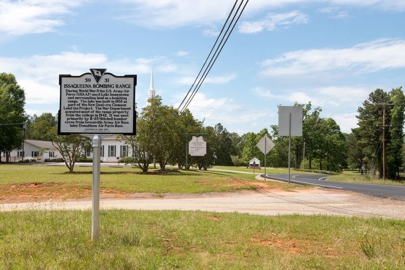
Photographed by J. J. Prats, May 18, 2025
3. Issaqueena Bombing Range Marker

United States Army Air Force photograph via Clemson University Libraries, January 3, 1942
4. Issaqueena Bombing Range Target
A B-25 Mitchell from Greenville Army Air Base practices skip-bombing at the Isaqueena bombing range near Clemson, South Carolina.
Credits. This page was last revised on June 22, 2025. It was originally submitted on June 22, 2025, by J. J. Prats of Powell, Ohio. This page has been viewed 295 times since then and 69 times this year. Photos: 1, 2, 3, 4. submitted on June 22, 2025, by J. J. Prats of Powell, Ohio.
