Mars in Butler County, Pennsylvania — The American Northeast (Mid-Atlantic)
Samuel Kennedy Memorial
Photographed by William Fischer, Jr., June 22, 2025
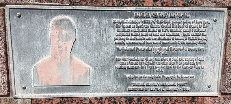
1. Samuel Kennedy Memorial Marker
SAMUEL ANDERSON KENNEDY, 1826-1896, pioneer settler of Mars Boro, first known as Overbrook Station, deeded this track of ground to the Reformed Presbyterian Church in 1877. Kennedy, being a religious prosperous farmer active in civic and community growth deeded this property to said church with the stipulation it remain a PSALM singing church, otherwise said track would revert back to the Kennedy Heirs.
The Reformed Presbyterian church used this parcel of ground from 1877-1983
The First Presbyterian Church was given a deed to a portion of said track of ground in 1902 with the stipulation it be used only for religious purposes. This Track reverted back to the Kennedy Heirs in 1988.
Herein, is the Kennedy Heirs Property to be known as:
"SAMUEL KENNEDY MEMORIAL PARK"
DEDICATED BY LESTER L KENNEDY 1990
Erected 1990 by the Kennedy Heirs.
Topics. This historical marker and memorial is listed in these topic lists: Charity & Public Work • Parks & Recreational Areas • Settlements & Settlers. A significant historical year for this entry is 1877.
Location. 40° 41.747′ N, 80° 0.673′ W. Marker is in Mars,
this page online

Regionally, this marker and memorial is in Northwestern Pennsylvania and in Greater Pittsburgh. It is also in the American Northeast, in the Mid-Atlantic, in Appalachia, and specifically in Northern Appalachia. Globally, it is in North America, the Western Hemisphere, the Western World, and the Anglosphere. Historically, it finds itself in what was once the Haudenosaunee (Iroquois) Confederacy and also one of the original Thirteen Colonies.
Other nearby markers. At least 8 other markers are within 4 miles of this marker, measured as the crow flies: USS Mars AFS-1 Ship's Bell (within shouting distance of this marker); B & O Caboose #C2235 (about 800 feet away, measured in a direct line); Aermotor Windmill (approx. 0.2 miles away); Mars (approx. 0.2 miles away); Welcome to Adams Station (approx. 0.2 miles away); The "BALL" Oilfield Engine (approx. 0.2
Photographed by William Fischer, Jr., June 22, 2025
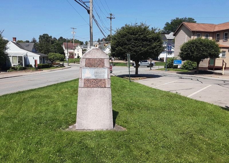
2. Samuel Kennedy Memorial
Also see . . . A Brief History of Mars Borough. (Submitted on June 23, 2025, by William Fischer, Jr. of Reynoldsburg, Ohio.)
Credits. This page was last revised on June 23, 2025. It was originally submitted on June 23, 2025, by William Fischer, Jr. of Reynoldsburg, Ohio. This page has been viewed 104 times since then and 14 times this year. Photos: 1, 2. submitted on June 23, 2025, by William Fischer, Jr. of Reynoldsburg, Ohio.
