San Juan Capistrano in Orange County, California — The American West (Pacific Coastal)
Riverstreet Trade
Photographed by Adam Margolis, June 15, 2025
1. Riverstreet Trade Marker
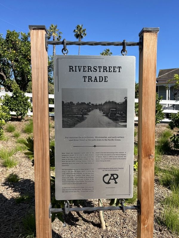
For centuries the Acjechemen, Missionaries, and early settlers used River Street as the path down to the Pacific Ocean.
River Street was originally a path used by the Indigenous people of the area to reach Trabuco Creek. The Creek was one of the main sources for water in the area. River Street is shown on maps from the late 1800's crossing Trabuco Creek and extending about four miles to the Ocean ending in Dana Point.
The thoroughfare was used by sheep herders to drive sheep to the area off Alipaz, which is across the creek, where shearing took place. At one time there was a bridge across Trabuco Creek where River Street ends today. It was known as the McKinley Bridge, named for the one time co-owner of the Mission along with Don Juan Forster. The bridge was washed away in a flood and never rebuilt.
In 1948 it was abandoned as a street. It is unknown when the street was first paved. Now the street is 25 feet wide and 600 feet long. It runs from Los Rios Street to the west terminating at Paseo Adelanto. It is part of the area placed on the National Registry of Historic Places in 1983 by local historian Ilse Byrnes.
this page online
Topics. This historical marker is listed in these topic lists: Bridges & Viaducts • Industry & Commerce • Roads & Vehicles • Settlements & Settlers.
Location. 33° 30.031′ N, 117° 39.882′ W. Marker is in San Juan Capistrano, California, in Orange County. It is on Los Rios Street. Touch for map. Marker is at or near this postal address: 31791 Los Rios St, San Juan Capistrano CA 92675, United States of America. Touch for directions.

Regionally, this marker is in Greater Los Angeles and in the Peninsular Ranges. It is also on the American Pacific Coast. Globally, it is in North America, on the Ring of Fire, on the Pacific Rim, in the Western Hemisphere, in the Western World, and in the Anglosphere. Historically, it finds itself in what was once New Spain and also Mexico’s Alta California.
Other nearby markers. At least 8 other markers are within walking distance of this marker: The Oyharzabal Family (here, next to this marker); The Ito Family (a few steps from this marker); O'Neill Museum
Photographed by Adam Margolis, June 15, 2025
2. Riverstreet Trade Marker
Also see . . . Los Rios Historic District (Wikipedia). Excerpt:
The Los Rios Historic District is an historic district and neighborhood in the city of San Juan Capistrano, California.The nearby Mission San Juan Capistrano was the first of the 21 California Missions to have Indians, soldiers and workers live outside the mission grounds, making it the oldest residential neighborhood in California.…(Submitted on June 23, 2025.)

Photographed by Adam Margolis, June 15, 2025
3. Riverstreet Trade Marker
Credits. This page was last revised on June 23, 2025. It was originally submitted on June 23, 2025, by Adam Margolis of Mission Viejo, California. This page has been viewed 106 times since then and 23 times this year. Photos: 1, 2, 3. submitted on June 23, 2025, by Adam Margolis of Mission Viejo, California. • Andrew Ruppenstein was the editor who published this page.
