Martinez in Contra Costa County, California — The American West (Pacific Coastal)
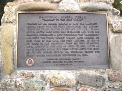
Martinez-Benicia Ferry
"Gateway to the Gold Fields"
Dedicated September 20, 1997
Joaquin Murrieta Chapter Thirteen
E Clampus Vitus
Erected 1997 by Joaquin Murrieta Chapter Thirteen of E Clampus Vitus.
Topics and series. This historical marker is listed in this topic list: Waterways & Vessels. In addition, it is included in the E Clampus Vitus, and the Pony Express National Historic Trail series lists. A significant historical month for this entry is April 1879.
Location. 38° 1.208′ N, 122° 8.226′ W. Marker is in Martinez, California, in Contra Costa County. Marker is at the intersection of Joe DiMaggio Jr., Drive and Ferry Street, on the left when traveling east on Joe DiMaggio Jr., Drive. Touch for map. Marker is in this post office area: Martinez CA 94553, United States of America. Touch for directions.
Other nearby markers. At least 8 other markers are within walking distance of this marker. Southern Pacific R.R. Depot (within shouting distance of this marker); Pony Express Ferry "Carquinez" (about 300 feet away, measured in a direct line); Martinez Troops-In-Transit Canteen (about 300 feet away); 815 Marina Vista (about 400 feet away); Martinez Train Depot (about 700 feet away); Borland Home (about 800 feet away); Contra Costa County Courthouse (approx. 0.2 miles away); Bergamini Building (approx. 0.2 miles away). Touch for a list and map of all markers in Martinez.
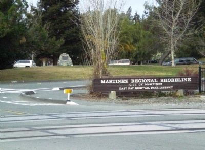
More about this marker. The marker is mounted on a stone monument very near the entrance of Martinez Regional Shoreline Park, right where Joe DiMaggio, Jr. Drive splits east off of Ferry Street.
Regarding Martinez-Benicia Ferry. J.P. Munro-Frasier's History of Contra Costa County notes that on August 19th, 1850, the county court granted license to Coffin for the Benicia-Martinez ferry route, but that his charges were limited to the following tariffs: $1 per man; $2 per horse, mule, or ox (or $2.50 for man with a horse); $5 per wagon; $4 for a carriage; and $0.50 per head of sheep or hogs.
Also see . . .
"Carquinez". The steam ferry boat "Carquinez" was used to transport the Pony Express rider and horse between Benicia and Martinez, California, when the mail was routed overland between Sacramento and Oakland due to missed boat connections in Sacramento.
In 1851 Oliver C. Coffin and Seth Swain were granted the exclusive franchise to operate a ferry across the Carquinez Strait on the Sacramento River between Martinez, the county seat of Contra Costa County, and Benicia. In 1854 Coffin placed into service the double end dual paddle wheeler "Carquinez", the first ferry vessel used on the west coast constructed specifically for that purpose. The ferry had been framed and fitted in an eastern shipyard and shipped around the Horn as ballast in the hold of a sailing vessel.
(Submitted on November 17, 2009.)
Credits. This page was last revised on June 16, 2016. It was originally submitted on November 17, 2009, by Andrew Ruppenstein of Lamorinda, California. This page has been viewed 3,982 times since then and 178 times this year. Last updated on February 18, 2010, by Andrew Ruppenstein of Lamorinda, California. Photos: 1, 2. submitted on November 17, 2009, by Andrew Ruppenstein of Lamorinda, California. • Syd Whittle was the editor who published this page.

