
Thorold in Niagara Region, Ontario — Central Canada (North America)
Beaver Dams
Photographed by Dale K. Benington, July 28, 2011
1. Beaver Dams Marker

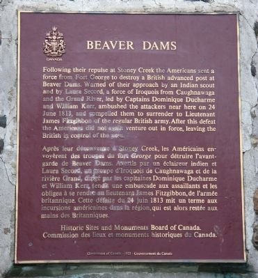
Following their repulse at Stoney Creek the Americans sent a force from Fort George to destroy a British advanced post at Beaver Dams. Warned of their approach by an Indian scout and by Laura Secord, a force of Indians from Caughnawaga and the Grand River, led by Captains Dominique Ducharme and William Kerr, ambushed the attackers near here on 24 June 1813, and compelled them to surrender to Lieutenant James Fitzgibbon of the regular British army. After this defeat the Americans did not again venture out in force, leaving the British in control of the area.
Erected by Historic
this page online
Topics and series. This historical marker is listed in these topic lists: Colonial Era • War of 1812. In addition, it is included in the Canada, Historic Sites and Monuments Board series list. A significant historical date for this entry is June 24, 1813.
Location. 43° 7.367′ N, 79° 12.091′ W. Marker is in Thorold, Ontario, in Niagara Region. It can be reached from Sullivan Avenue south of Towpath Road, on the right when traveling east. This historic marker is located in Battlefield Of Beaverdams Park, near the north entrance to the park, along a walking trail that runs north to south through the park, just southwest of the downtown business district. Touch for map. Marker is at or near this postal address: 64 Front St S, Thorold ON L2V L2V, Canada. Touch for directions.

Regionally, this marker is on Ontario’s Golden Horseshoe and in Niagara Canada. It is also in Central Canada. Globally, it is in North America, the Western Hemisphere, the Western World, and the Anglosphere. Historically, it finds itself in what was once a British colony, the Viceroyalty of New France, the Haudenosaunee
Photographed by Dale K. Benington, July 28, 2011
2. Beaver Dams Marker
Other nearby markers. At least 8 other markers are within walking distance of this marker: Battle of Beaverdams Park (here, next to this marker); Laura Ingersoll Secord (a few steps from this marker); a different marker also named Beaver Dams (within shouting distance of this marker); Arthur S. Whelan (within shouting distance of this marker); In Memory of Unknown American Soldiers (within shouting distance of this marker); City of Thorold Time Capsule (within shouting distance of this marker); In Memory of John Bean, Ph.D., M.D. (about 90 meters away, measured in a direct line); The JB Stone (about 90 meters away). Touch for a list and map of all markers in Thorold.
More about this marker. Some nearby monuments memorializing the same event, the Battle of Beaverdams:
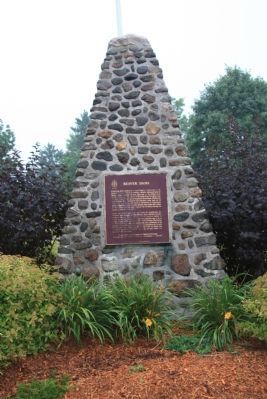
1. This stone cairn with a maroon plaque (cairn created 1976, although the marker is dated 1923) - HMDB #48909
2. A nearby shorter, simple concrete cairn (created in the 1920s, originally located at the original battle site, then moved here in 1976) - HMDB #271464
3. A boulder with plaques (created 2013) at the original
Photographed by Dale K. Benington, July 28, 2011
3. Beaver Dams Marker
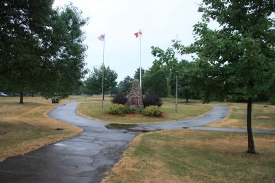
View looking south along the park trail, of the historic marker in Beaversdam Battlefield Park.
Related markers. Click here for a list of markers that are related to this marker. To better understand the relationship, study each marker in the order shown.
Also see . . .
1. Battle of Beaver Dams. This is a link to information provided by Wikipedia, the free encyclopedia. (Submitted on November 5, 2011, by Dale K. Benington of Toledo, Ohio.)
2. Battle of Beaver Dams, 24 June 1813. This is a link to information provided by the Military History Encyclopedia on the Web. (Submitted on November 5, 2011, by Dale K. Benington of Toledo, Ohio.)
3. Battle of Beaver Dams National Historic Site of Canada. This is a link to information from a website administered by Parks Canada. (Submitted on November 5, 2011, by Dale K. Benington of Toledo, Ohio.)
Additional commentary.
1. Battle at Bever Dams
My -g-grandfather NATHANIEL WHEELER NILES, was captured at this battlefield, on 24 June 1813. He was imprisoned in Toronto, Kingston, Montreal and on Mellville Island in Halifax (for 2 months). He and others, were then put on the frigate
Photographed by Dale K. Benington, July 28, 2011
4. Beaver Dams Marker
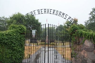
View looking through the gated north entrance to Beaversdam Battlefield Park, of the historic marker situated a short distance south from the park entrance.
— Submitted April 16, 2012, by Joan Watson Frederich of Lakeland, Florida.

Photographed by Kevin Westell, April 26, 2025
5. Beaver Dams - Marker in context
Photo faces south. This marker is at the centre of a concrete circle, close to the north end of Battle of Beaverdams Park. In the distant left, the Thorold Bandshell is visible.

Photographed by Kevin Westell, April 26, 2025
6. Beaver Dams - View from Sullivan Street
Photo faces south. The marker is visible from the street, at the centre of the concrete circle, reached via the concrete path from north gate.
Credits. This page was last revised on June 30, 2025. It was originally submitted on October 28, 2011, by Dale K. Benington of Toledo, Ohio. This page has been viewed 1,246 times since then and 53 times this year. Last updated on June 24, 2025, by Kevin Westell of St. Catharines, Ontario. Photos: 1, 2, 3, 4. submitted on November 1, 2011, by Dale K. Benington of Toledo, Ohio. 5, 6. submitted on June 24, 2025, by Kevin Westell of St. Catharines, Ontario. • Devry Becker Jones was the editor who published this page.
