Shawboro in Currituck County, North Carolina — The American South (South Atlantic)
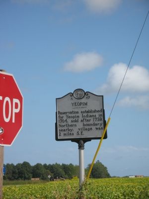
Yeopim
Erected 1992 by Division of Archives and History. (Marker Number A-47.)
Topics and series. This historical marker is listed in these topic lists: Native Americans • Settlements & Settlers. In addition, it is included in the North Carolina Division of Archives and History series list. A significant historical year for this entry is 1704.
Location. 36° 22.675′ N, 76° 5.161′ W. Marker is in Shawboro, North Carolina, in Currituck County. Marker is at the intersection of Indiantown Road and Shortcut Road (U.S. 158), on the left when traveling south on Indiantown Road. Touch for map. Marker is in this post office area: Shawboro NC 27973, United States of America. Touch for directions.
Other nearby markers. At least 8 other markers are within 6 miles of this marker, measured as the crow flies. McKnight’s Shipyard (within shouting distance of this marker); Henry M. Shaw (approx. 1.9 miles away); Indiantown (approx. 2.1 miles away); Former Site of Sawyer's Creek / Marian Anderson High School (approx. 5 miles away); Hijacking Maple Leaf (approx. 5.2 miles away); William Reed (approx. 5½ miles away); Isaac Gregory (approx. 5.8 miles away); Dempsey Burgess (approx. 5.9 miles away). Touch for a list and map of all markers in Shawboro.
Regarding Yeopim. The Yeopim Indians were small in number but played important roles in North Carolina history. Part of the Algonquian linguistic group, the Yeopim inhabited the present counties of Camden, Currituck, Perquimans, and Pasquotank. Their numbers in 1700 were estimated at 200 but by mid-century the tribe had ceased to exist in any significant numbers in North Carolina. Captain Philip Amadas in 1584 encountered Yeopim and other related Weapemeoc Indians while scouting for a suitable site for the first Roanoke colony. In 1660 Kiscutanewh, King of the Yeopim, granted a tract of land to Nathaniel Batts and in 1662 another tract to George Durant. These were the first deeds for land in North Carolina (Batts’s was recorded in Virginia.)
As early as 1697 the Yeopim complained to the colonial government about encroachment by white settlers. In 1704 the Executive Council created for the tribe a reservation of 10,240 acres (sixteen square miles) on the North River. The transfer was among the largest during the proprietary period. The tract was the same size as that granted to the Mattamuskeet Indians in 1727 but smaller than the tracts granted to the Tuscaroras and the Chowan Indians. The 1704 deed to the Yeopim granted the King and his nation all hunting and fishing rights but reserved one-half of any gold and silver if found. The quitrent was one ear of corn per year. In 1723 the Indians sold 640 acres of their holdings and in 1739 sought and received permission to sell any land as they wished. The village of “Yawpim” was clearly marked on the Moseley map of 1733. That site, today known as Indiantown, was investigated by East Carolina archaeologists in 1984.
References:
Camden, Currituck, and Pasquotank Deed Books
William L. Saunders, ed., Colonial Records of North Carolina, I, ix, 19, 657; II, 140
Robert J. Cain, ed., Colonial Records of North Carolina (2nd series), Records of Executive Council, 1735-1754, introduction
Jesse Forbes Pugh, 300 Years Along the Pasquotank: A Biographical History of Camden County (1957)
David S. Phelps, “Archaeology of the Native Americans: The Carolina Algonkians” (report available in Office of State Archaeology, 1984)
Jerry L. Cross, “Indiantown” (typescript research report available in Research Branch, Office of Archives and History, 1983)
copied from the North Carolina Department of Cultural Resources
Credits. This page was last revised on June 25, 2021. It was originally submitted on October 1, 2007, by Laura Troy of Burke, Virginia. This page has been viewed 3,415 times since then and 58 times this year. Photo 1. submitted on October 1, 2007, by Laura Troy of Burke, Virginia. • J. J. Prats was the editor who published this page.
