Marker Logo HMdb.org THE HISTORICAL
MARKER DATABASE
“Bite-Size Bits of Local, National, and Global History”
Peak in Newberry County, South Carolina — The American South (South Atlantic)
 

Peak


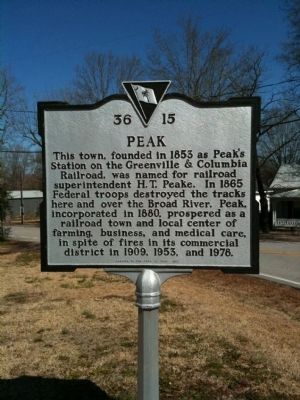
Peak Marker image. Click for full size.
Photographed By Cindy Bullard, February 16, 2010
1. Peak Marker
Inscription. This town, founded in 1853 as Peak's Station on the Greenville & Columbia Railroad, was named for railroad superintendent H.T. Peake. In 1865 Federal troops destroyed the tracks here and over the Broad River. Peak, incorporated in 1880, prospered as a railroad town and local center of farming, business, and medical care, in spite of fires in its commercial district in 1909, 1953, and 1978.
 
Erected 1999 by the Town of Peak. (Marker Number 36-15.)
 
Topics. This historical marker is listed in these topic lists: Railroads & StreetcarsWar, US Civil. A significant historical year for this entry is 1853.
 
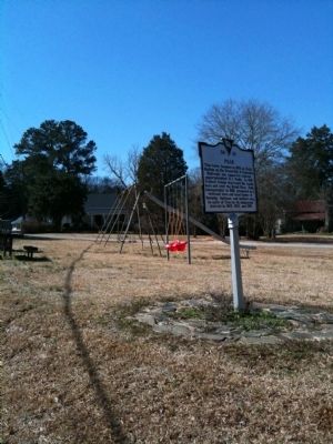
Location. 34° 14.474′ N, 81° 19.35′ W. Marker is in Peak, South Carolina, in Newberry County. Marker is beside a small park, behind the commercial area. Touch for map. Marker is in this post office area: Peak SC 29122, United States of America. Touch for directions.
 
Other nearby markers. At least 8 other markers are within 7 miles of this marker, measured as the crow flies. Nuclear Power (approx. 1.9 miles away); St. John's Church (approx. 2.9 miles away); Hope Rosenwald School (approx. 3.1 miles away); Spring Hill (approx. 5.2 miles away); Pomaria (approx. 5˝ miles away); Folk-Holloway House (approx. 5.9 miles away); Lutheran Theological Southern Seminary
Paid Advertisement
Click on the ad for more information.
Please report objectionable advertising to the Editor.
Click or scan to see
this page online
(approx. 6.3 miles away); Industry Evolution on the Broad River (approx. 6.3 miles away).
 
Peak Marker and Park image. Click for full size.
Photographed By Cindy Bullard, February 16, 2010
2. Peak Marker and Park
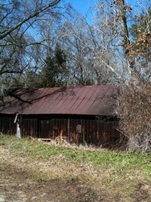
Old Building image. Click for full size.
Photographed By Cindy Bullard, February 16, 2010
3. Old Building
This building is beside an old railroad bed, probably a spur line.
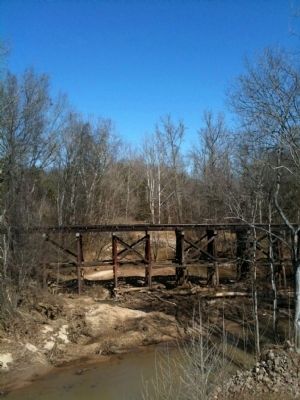
Old Railroad Trestle image. Click for full size.
Photographed By Cindy Bullard, February 16, 2010
4. Old Railroad Trestle
This Trestle is on the spur line, not the tracks over the Broad River.
 
 
Credits. This page was last revised on June 16, 2016. It was originally submitted on February 18, 2010, by David Bullard of Seneca, South Carolina. This page has been viewed 1,413 times since then and 39 times this year. Photos:   1, 2, 3, 4. submitted on February 18, 2010, by David Bullard of Seneca, South Carolina. • Craig Swain was the editor who published this page.
Share this page.  
Share on Tumblr
m=27661

CeraNet Cloud Computing sponsors the Historical Marker Database.
This website earns income from purchases you make after using our links to Amazon.com. We appreciate your support.
Paid Advertisement
Apr. 19, 2024