Echo in Summit County, Utah — The American Mountains (Southwest)
The Battle of the Signs
Photographed by Jeremy Snow, June 20, 2025
1. The Battle of the Signs Marker
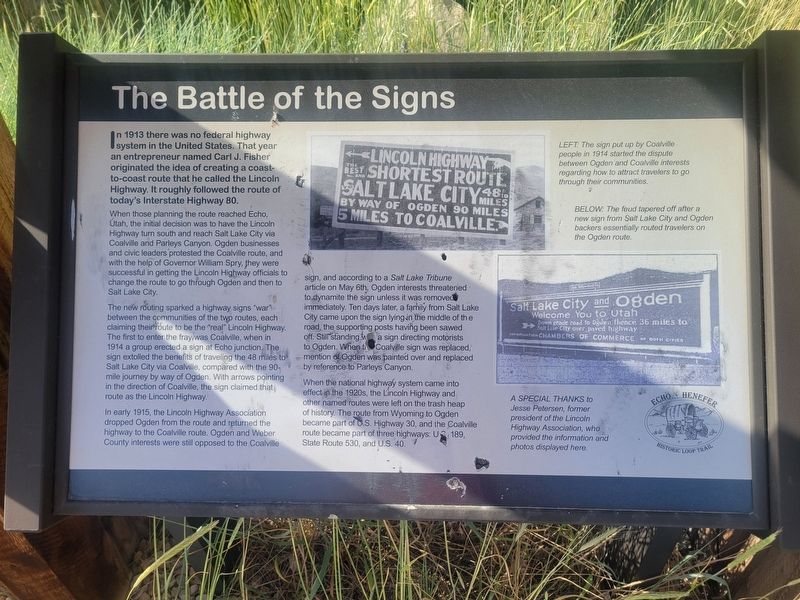
When those planning the route reached Echo, Utah, the initial decision was to have the Lincoln Highway turn south and reach Salt Lake City via Coalville and Parleys Canyon. Ogden businesses and civic leaders protested the Coalville route, and with the help of Governor William Spry, they were successful in getting the Lincoln Highway officials to change the route to go through Ogden and then to Salt Lake City.
The new routing sparked a highway signs "war" between the communities of the two routes, each claiming their foute to be the "real" Lincoln Highway. The first to enter the fray/was Coalville, when in 1914 a group erected a sign at Echo junction. The sign extolled the benefits of traveling the 48 mies to Salt Lake City via Coalville, compared with the 90- mile journey by way of Ogden. With arrows pointing in the direction of Coalville, the sign
this page online
In early 1915, the Lincoln Highway Association dropped Ogden from the route and returned the highway to the Coalville route. Ogden and Weber County interests were still opposed to the Coalville sign, and according to a Salt Lake Tribune article on May 6th, Ogden interests threatened to dynamite the sign unless it was removed immediately. Ten days later, a family from Salt Lake City came upon the sign lying in the middle of the road, the supporting posts having been sawed off: Still standing was a sign directing motorists to Ogden. When the Coalvile sign was replaced, mention of Ogden was painted over and replaced. by reference to Parleys Canyon.
When the national highway system came into effect in the 1920s, the Lincoln Highway and other named routes were left on the trash heap of history. The route from Wyoming to Ogden became part of U.S. Highway 30, and the Coalville route became part of three highways: U.S. 189, State Route 530, and U.S. 40.
(captions) LEFT The sign put up by Coalville people in 1914 started the dispute between Ogden and Coalville interests regarding how to
Photographed by Jeremy Snow, June 20, 2025
2. The Battle of the Signs Marker
BELOW: The feud tapered off after a new sign from Salt Lake City and Ogden backers essentially routed travelers on the Ogden route.
Topics and series. This historical marker is listed in this topic list: Roads & Vehicles. In addition, it is included in the Lincoln Highway series list. A significant historical year for this entry is 1913.
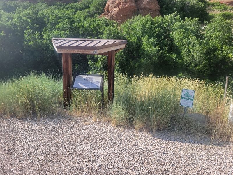
Location. 40° 58.36′ N, 111° 26.312′ W. Marker is in Echo, Utah, in Summit County. It is on South Echo Road, on the right when traveling west. Touch for map. Marker is at or near this postal address: S Echo Road, Coalville UT 84017, United States of America. Touch for directions.

Regionally, this marker is in the Uinta Mountains, in the Wasatch Front, and in Greater Provo. It is also in the American Mountain West and on the Colorado Plateau. Globally, it is in North America, the Rocky Mountains, the Western Hemisphere, the Western World, and the Anglosphere. Historically, it finds itself in what was once New Spain and also Mexico’s Alta California.
Other nearby markers. At least 8 other markers are within 2 miles of this marker, measured as the crow flies: Weber Pony Express Station (a few steps from this marker); Pulpit Rock (approx. ¼ mile away); Iron Rails and Silver Dreams (approx. ¼ mile away); Control of Influence (approx. ¼ mile away); Echo School and Church (approx. 0.4 miles away); Echo Church and School (approx. 0.4 miles away); Temple Camp and Supplication Hills (approx. 1.1 miles away); Witch Rocks (approx. 1.8 miles away). Touch for a list and map of all markers in Echo.
Credits. This page was last revised on June 26, 2025. It was originally submitted on June 25, 2025, by Jeremy Snow of Cedar City, Utah. This page has been viewed 206 times since then and 40 times this year. Photos: 1, 2. submitted on June 25, 2025, by Jeremy Snow of Cedar City, Utah. • Andrew Ruppenstein was the editor who published this page.
