
Rapid City in Pennington County, South Dakota — The American Midwest (Upper Plains)
A Massive Surge
Remembrance and Renewal
| — | Rapid City Flood of 1972 | — |

Photographed by Daniel Barriball, June 10, 2025
1. A Massive Surge Marker
On June 9, 1972 a storm system approximately 80 miles long and 12 miles wide stalled on the eastern slope of the Black Hills with rainfall from 12 to 14 inches at its center. This system produced total rainfall of more than 800,000 acre feet of water—enough to fill Pactola Dam 15 times over. More than 10 inches of rain fell in the 60 square miles of the Rapid Creek basin. The crest of this water hit Canyon Lake around 10 p.m. carrying with it all kinds of debris from the canyon environment above Rapid City.
A summary of the destruction from that storm and flood:
•238 deaths with five missing persons, 3,057 injured including 118 hospitalized
•770 homes and 565 mobile homes destroyed
•2,035 homes and 785 mobile homes damaged
•36 businesses destroyed and 236 damaged
•5,000 vehicles destroyed
•financial loss $165 million (in 2011 dollars this would be $888 million)
This flood took such a terrible toll because the floodplain was filled with homes, businesses (including a shopping center and mobile homes sales), public facilities, a nursing home, a hospital, mobile home parks and car lots.
Did You Know?
Flood-frequency
this page online
Graphic U.S. Geological Survey flood chronology for the basin
The drainage area between Pactola Reservoir and Canyon Lake consists of about 51 square miles with a drop in elevation of more than 1,000 feet. Several large sub-basins and numerous smaller sub-basins are within this reach. During intense thunderstorms, these basins can contribute substantial runoff to Rapid Creek.
Captions
Graphic depicting rainfall
Total storm rainfall for June 9-10, 1972 (from U.S. Geological Survey)
Graphic Rapid Creek basin areas (United States Geological Survey)
Aerial view of Canyon Lake (Black Hills Council of Local Governments)
Bridge at Chapel Lane (Rapid City Journal)
Empty Canyon Lake (Rapid City

Photographed by Daniel Barriball, June 10, 2025
2. A Massive Surge Marker and USGS Flood Benchmark in context
Erected by Warner and De De Ghere, De De served on the Rapid City Council 1972. (Marker Number 2 of 14.)
Topics. This historical marker is listed in these topic lists: Disasters • Waterways & Vessels. A significant historical date for this entry is June 9, 1972.
Location. 44° 3.619′ N, 103° 17.541′ W. Marker is in Rapid City, South Dakota, in Pennington County. It can be reached from Jackson Boulevard. This marker is located in Canyon Lake Park. It is on the mainland end of the bridge to the island in Canyon Lake. Touch for map. Marker is at or near this postal address: 4181 Jackson Blvd, Rapid City SD 57702, United States of America. Touch for directions.

Regionally, this marker is in West River and in the Badlands. It is also in the American Black Hills, in the Lewis & Clark Corridor, on the prairies, and on the Northern Plains. Globally, it is in North America, the Western Hemisphere, the Western World, and the Anglosphere. Historically, it finds itself in what was once Rupert’s Land and also the Louisiana Purchase.
Other nearby markers. At least 8 other markers are within 3 miles of this marker, measured
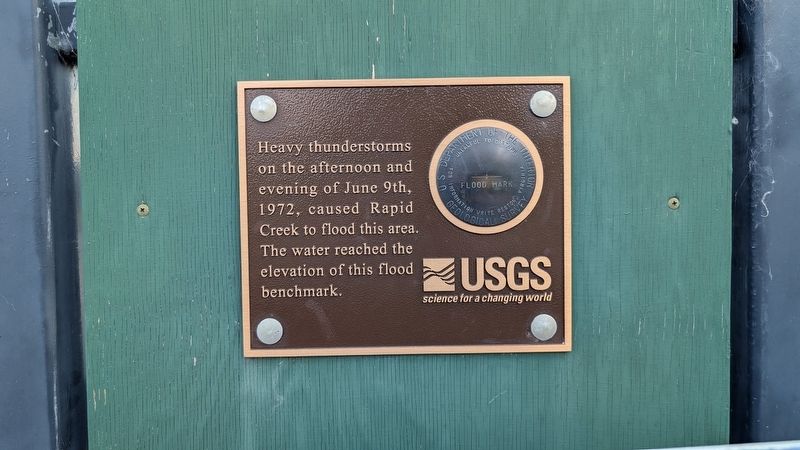
Photographed by Daniel Barriball, June 10, 2025
3. USGS Flood Benchmark
Also see . . . Flood of 1972. Rapid City Public Library
The 1972 Black Hills Flood project was created by the Rapid City Public Library because we believe that preserving the shared history of a life-altering local event will benefit our community. To help preserve the community’s memory of the lives that were lost and the remarkable heroism of the time, the Library presents a virtual archive that digitizes and publishes a variety of historical resources related to the flood.(Submitted on June 27, 2025, by Daniel Barriball of Chesterton, Indiana.)
Credits. This page was last revised on June 28, 2025. It was originally submitted on June 27, 2025, by Daniel Barriball of Chesterton, Indiana. This page has been viewed 182 times since then and 57 times this year. Photos: 1, 2, 3. submitted on June 27, 2025, by Daniel Barriball of Chesterton, Indiana. • J. Makali Bruton was the editor who published this page.
