
Ephraim in Sanpete County, Utah — The American Mountains (Southwest)
Fort Ephraim Peace Treaty

Photographed by Bill Kirchner, June 14, 2014
1. Fort Ephraim Peace Treaty Marker
Erected 1982 by Fort Ephraim Camp, Daughters of Utah Pioneers. (Marker Number 423.)
Topics and series. This historical marker is listed in this topic list: Wars, US Indian. In addition, it is included in the Daughters of Utah Pioneers
this page online
Location. 39° 21.666′ N, 111° 35.285′ W. Marker is in Ephraim, Utah, in Sanpete County. It can be reached from West 100 North Street west of North Main Street, on the left when traveling west. The marker is in Ephraim Pioneer Park. Touch for map. Marker is in this post office area: Ephraim UT 84627, United States of America. Touch for directions.

Regionally, this marker is in the Central Utah Valleys. It is also in the American Mountain West and on the Colorado Plateau. Globally, it is in North America, the Western Hemisphere, the Western World, and the Anglosphere. Historically, it finds itself in what was once New Spain and also Mexico’s Alta California.
Other nearby markers. At least 8 other markers are within walking distance of this marker: Hansen-Sparks Home (within shouting distance of this marker); John Dorius, Jr., House and Barn (about 300 feet away, measured in a direct line); Ephraim Relief Society Granary (about 300 feet away); Ephraim Co-op Building (about 300 feet away); Canute Peterson House (about 500 feet away); The Old Fort (about 600 feet away);
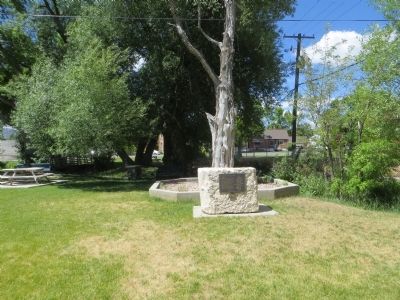
Photographed by Bill Kirchner, June 14, 2014
2. Fort Ephraim Peace Treaty Marker
Photographed by Bill Kirchner, June 14, 2014
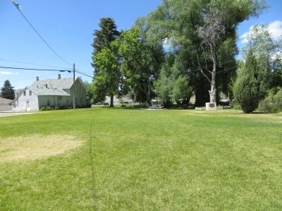
3. Fort Ephraim Peace Treaty Marker
Marker is at center-right in photo.
Credits. This page was last revised on June 27, 2025. It was originally submitted on July 2, 2014, by Bill Kirchner of Tucson, Arizona. This page has been viewed 1,196 times since then and 23 times this year. Last updated on June 27, 2025, by Lajos Juhasz of Corona, California. Photos: 1, 2, 3. submitted on July 2, 2014, by Bill Kirchner of Tucson, Arizona. • Devry Becker Jones was the editor who published this page.
